
Bissezeele
Bissezeele
Bissezele | |
|---|---|
 The church in Bissezeele | |
_Nord-France.svg) Coat of arms | |
Location of Bissezeele  | |
 Bissezeele  Bissezeele | |
| Coordinates: 50°54′44″N 2°24′39″E / 50.9122°N 2.4108°E | |
| Country | France |
| Region | Hauts-de-France |
| Department | Nord |
| Arrondissement | Dunkerque |
| Canton | Wormhout |
| Intercommunality | CC Hauts de Flandre |
| Government | |
| • Mayor (2020–2026) | Claudine Delassus[1] |
| Area 1 | 3.57 km2 (1.38 sq mi) |
| Population (2021)[2] | 246 |
| • Density | 69/km2 (180/sq mi) |
| Time zone | UTC+01:00 (CET) |
| • Summer (DST) | UTC+02:00 (CEST) |
| INSEE/Postal code | 59083 /59380 |
| Elevation | 14–31 m (46–102 ft) (avg. 24 m or 79 ft) |
| 1 French Land Register data, which excludes lakes, ponds, glaciers > 1 km2 (0.386 sq mi or 247 acres) and river estuaries. | |
Bissezeele (French pronunciation: [bisəzɛl]; from Dutch; Bissezele in modern Dutch spelling) is a commune in the Nord department in northern France.[3]
Population[edit]
| Year | Pop. | ±% p.a. |
|---|---|---|
| 1968 | 199 | — |
| 1975 | 166 | −2.56% |
| 1982 | 161 | −0.44% |
| 1990 | 178 | +1.26% |
| 1999 | 174 | −0.25% |
| 2009 | 202 | +1.50% |
| 2014 | 238 | +3.33% |
| 2020 | 250 | +0.82% |
| Source: INSEE[4] | ||
Images[edit]
-
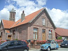 Town hall

Heraldry[edit]
|
The arms of Bissezeele are blazoned : Or, a lion sable langued gules, crowned Or, wearing a collar with a pendant cross Or.
|
See also[edit]
References[edit]
- ^ "Répertoire national des élus: les maires" (in French). data.gouv.fr, Plateforme ouverte des données publiques françaises. 13 September 2022.
- ^ "Populations légales 2021". The National Institute of Statistics and Economic Studies. 28 December 2023.
- ^ INSEE commune file
- ^ Population en historique depuis 1968, INSEE
Wikimedia Commons has media related to Bissezeele.
| Authority control databases: National |
|---|
This Nord geographical article is a stub. You can help Wikipedia by expanding it. |