
File:2013 Hama Offensive.svg

Size of this PNG preview of this SVG file: 800 × 402 pixels. Other resolutions: 320 × 161 pixels | 640 × 322 pixels | 1,024 × 514 pixels | 1,280 × 643 pixels | 2,560 × 1,286 pixels | 3,493 × 1,755 pixels.
Original file (SVG file, nominally 3,493 × 1,755 pixels, file size: 4.43 MB)
| This is a file from the Wikimedia Commons. Information from its description page there is shown below. Commons is a freely licensed media file repository. You can help. |
Summary
| Description |
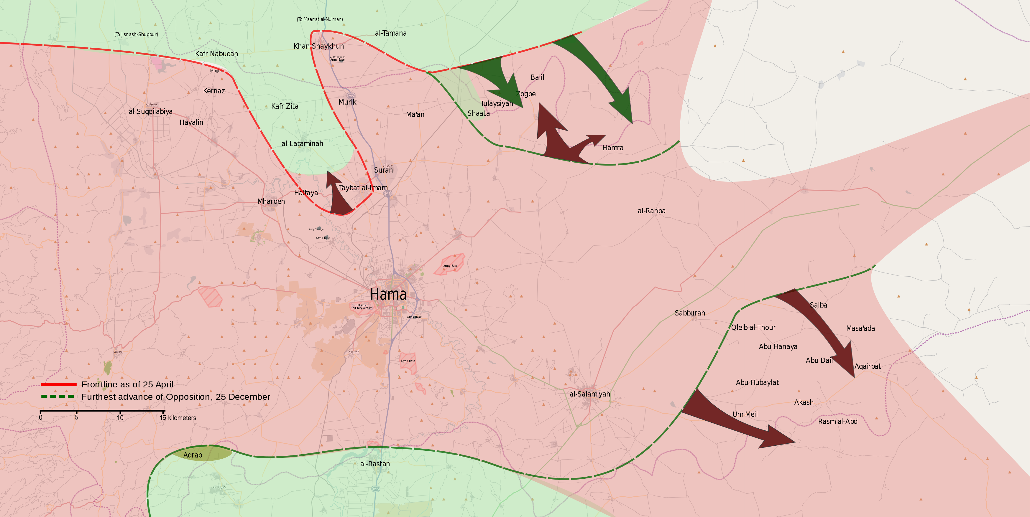
English: Map showing the course of the 2013 Hama Offensive.
Syrian Government control post-offensive
Opposition control post-offensive
Contested العربية: خريطة تظه مجرى هجوم حماة 2013. |
||||
| Date | |||||
| Source | Own work | ||||
| Author | MrPenguin20 | ||||
| Other versions |
|


.svg)

.png)


.svg)


.svg)


_Territory_Change_2014-2016.gif)

_(within_Northern_Syria).svg)


.png)
.svg)


_map.png)
.svg)


.svg)


Licensing
| This work contains information from OpenStreetMap, which is made available under the Open Database License (ODbL).
The ODbL does not require any particular license for maps produced from ODbL data. Prior to 1 August 2020, map tiles produced by the OpenStreetMap Foundation were licensed under the CC-BY-SA-2.0 license. Maps produced by other people may be subject to other licences. |
I, the copyright holder of this work, hereby publish it under the following license:
This file is licensed under the Creative Commons Attribution-Share Alike 3.0 Unported license.
- You are free:
- to share – to copy, distribute and transmit the work
- to remix – to adapt the work
- Under the following conditions:
- attribution – You must give appropriate credit, provide a link to the license, and indicate if changes were made. You may do so in any reasonable manner, but not in any way that suggests the licensor endorses you or your use.
- share alike – If you remix, transform, or build upon the material, you must distribute your contributions under the same or compatible license as the original.
File history
Click on a date/time to view the file as it appeared at that time.
| Date/Time | Thumbnail | Dimensions | User | Comment | |
|---|---|---|---|---|---|
| current | 00:45, 28 September 2013 | | 3,493 × 1,755 (4.43 MB) | MrPenguin20 | Added names of towns in South East. SAA in control of Taybat al-Imam. |
| 15:16, 27 September 2013 |  | 3,493 × 1,755 (4.42 MB) | MrPenguin20 | User created page with UploadWizard |
File usage
The following pages on the English Wikipedia use this file (pages on other projects are not listed):
Global file usage
The following other wikis use this file:
- Usage on ar.wikipedia.org
- Usage on fa.wikipedia.org
- Usage on pl.wikipedia.org
- Usage on www.wikidata.org
- Usage on zh.wikipedia.org