
File:Aerial view Louisiana flooding August 2016 USGS.jpg

Size of this preview: 800 × 254 pixels. Other resolutions: 320 × 101 pixels | 1,180 × 374 pixels.
Original file (1,180 × 374 pixels, file size: 169 KB, MIME type: image/jpeg)
| This is a file from the Wikimedia Commons. Information from its description page there is shown below. Commons is a freely licensed media file repository. You can help. |
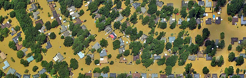
Summary
| Description |
English: Aerial imagery of flooding in Louisiana. |
| Date | |
| Source | https://www.usgs.gov/media/images/ngs-aerial-imagery-louisiana-flooding |
| Author | Jason Burton, USGS, using aerial imagery taken by NOAA aviators on behalf of the National Geodetic Survey |
Licensing
This image is in the public domain in the United States because it only contains materials that originally came from the United States Geological Survey, an agency of the United States Department of the Interior. For more information, see the official USGS copyright policy.
|
File history
Click on a date/time to view the file as it appeared at that time.
| Date/Time | Thumbnail | Dimensions | User | Comment | |
|---|---|---|---|---|---|
| current | 01:56, 9 February 2019 | 1,180 × 374 (169 KB) | 42Squire | Aerial imagery of flooding in Louisiana. Image created by Jason Burton, USGS, using aerial imagery taken by NOAA aviators on behalf of the National Geodetic Survey. Available at https://www.usgs.gov/media/images/ngs-aerial-imagery-louisiana-flooding Date Taken: Thursday, August 18, 2016 In the public domain as a work of the U.S. Geological Survey. |
File usage
The following pages on the English Wikipedia use this file (pages on other projects are not listed):