
File:Aerial view of Kolberg in the eastern town of Brussels and the upper Forestville Millpond in the western town of Forestville in Door County, Wisconsin 2020.png

Size of this preview: 443 × 600 pixels. Other resolutions: 177 × 240 pixels | 355 × 480 pixels | 567 × 768 pixels | 756 × 1,024 pixels | 1,513 × 2,048 pixels | 9,259 × 12,532 pixels.
Original file (9,259 × 12,532 pixels, file size: 211.06 MB, MIME type: image/png)
| This is a file from the Wikimedia Commons. Information from its description page there is shown below. Commons is a freely licensed media file repository. You can help. |
| Warning | The original file is very high-resolution. It might not load properly or could cause your browser to freeze when opened at full size. |
|---|
| Description |
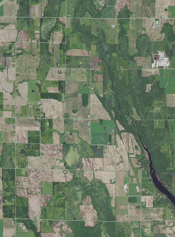
English: Aerial view of Kolberg in the eastern town of Brussels and the upper Forestville Millpond in the western town of Forestville. Photo includes part of the Ahnapee River (right), part of the Forestville Millpond (lower right), and part of one of two Silver Creeks which are tributaries to the Ahnapee (upper left), in Door County, Wisconsin, taken June 27, 2020. The Ahnapee State Trail is at the center left.
|
|||
| Date | ||||
| Source | converted to .png by Epiphyllumlover from the original .tif available as item M_4408720_NE_16_060_20200627 on EarthExplorer | |||
| Author | Aerial Photography Field Office (APFO) for NAIP, USGS; in contract with the Surdex Corporation | |||
| Permission (Reusing this file) |
|
File history
Click on a date/time to view the file as it appeared at that time.
| Date/Time | Thumbnail | Dimensions | User | Comment | |
|---|---|---|---|---|---|
| current | 14:22, 5 March 2022 | | 9,259 × 12,532 (211.06 MB) | Epiphyllumlover | c:User:Rillke/bigChunkedUpload.js: {{Information | Description = {{en|Aerial view of Kolberg in the eastern town of Brussels and the upper Forestville Millpond in the western town of Forestville. Photo includes part of the Ahnapee River (right), part of the Forestville Millpond (lower right), and part of one of two Silver Creeks which are tributaries to the Ahnapee (upper left... |
File usage
The following pages on the English Wikipedia use this file (pages on other projects are not listed):