
File:Aerial view of southeastern Gardner, southwestern Nasewaupee, northeastern Brussels, and northwestern Forestville, all four towns in Door County, Wisconsin 2020.png

Size of this preview: 436 × 599 pixels. Other resolutions: 174 × 240 pixels | 349 × 480 pixels | 559 × 768 pixels | 745 × 1,024 pixels | 1,490 × 2,048 pixels | 9,252 × 12,717 pixels.
Original file (9,252 × 12,717 pixels, file size: 213.38 MB, MIME type: image/png)
| This is a file from the Wikimedia Commons. Information from its description page there is shown below. Commons is a freely licensed media file repository. You can help. |
| Warning | The original file is very high-resolution. It might not load properly or could cause your browser to freeze when opened at full size. |
|---|
| Description |
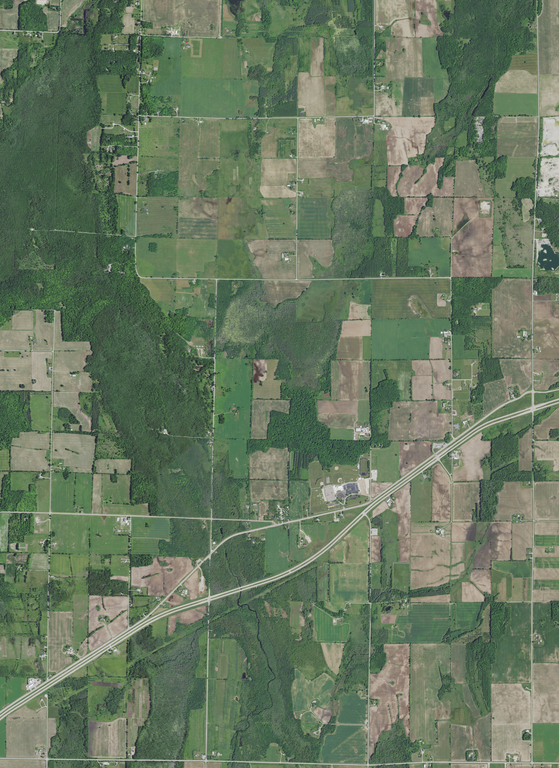
English: Aerial view of part of four towns in Door County, Wisconsin, taken June 27, 2020. The four towns: Gardner is at the top left, Nasewaupee is at the top right, Brussels is at the bottom left, and Forestville is at the bottom right. More of Gardner is shown than any other particular town and the village of Forestville is not pictured. The divided highway running southwest through northeast is Wisconsin Highway 57. The Ahnapee River flows south somewhat left of the center in the lower part of the photograph.
Tornado Memorial County Park (lower left) and the Eagle Walking Trail (center) are recreational areas. Southern Door School is near the center of the photograph. Coordinates:
|
|||
| Date | ||||
| Source | converted to .png by Epiphyllumlover from the original .tif available as item M_4408712_SE_16_060_20200627 on EarthExplorer | |||
| Author | Aerial Photography Field Office (APFO) for NAIP, USGS; in contract with the Surdex Corporation | |||
| Permission (Reusing this file) |
|
File history
Click on a date/time to view the file as it appeared at that time.
| Date/Time | Thumbnail | Dimensions | User | Comment | |
|---|---|---|---|---|---|
| current | 13:07, 17 March 2022 | | 9,252 × 12,717 (213.38 MB) | Epiphyllumlover | c:User:Rillke/bigChunkedUpload.js: {{Information | Description = {{en|1=Aerial view of part of four towns in w:Door County, Wisconsin, Wisconsin, taken June 27, 2020. The four towns: Gardner is at the top left, Nasewaupee is at the top right, Brussels is at the bottom left, and Forestville is at the bottom right. More of Gardner is shown than any other particular town and the... |
File usage
The following pages on the English Wikipedia use this file (pages on other projects are not listed):