
File:AgrihanNASA.jpg

Size of this preview: 800 × 535 pixels. Other resolutions: 320 × 214 pixels | 640 × 428 pixels | 1,000 × 669 pixels.
Original file (1,000 × 669 pixels, file size: 144 KB, MIME type: image/jpeg)
| This is a file from the Wikimedia Commons. Information from its description page there is shown below. Commons is a freely licensed media file repository. You can help. |
Summary
| Description |
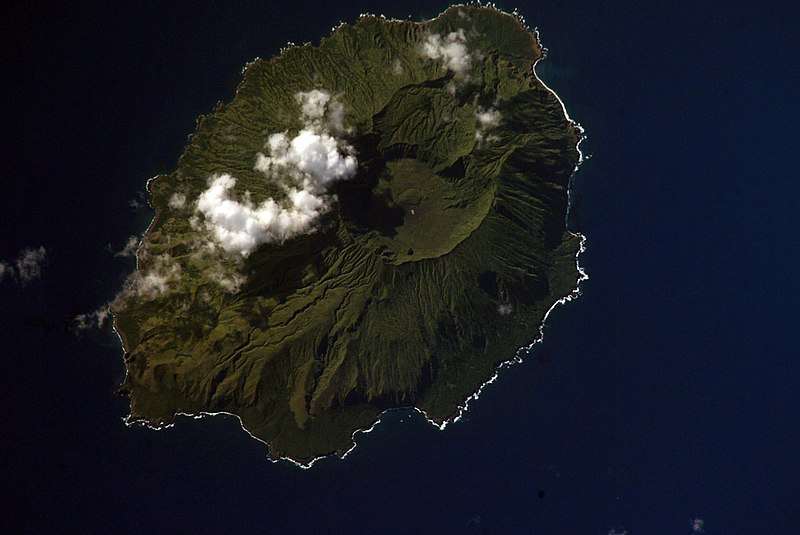
English: NASA Space Shuttle image of Agrihan island in the Northern Mariana Islands.
|
||||||||||||||||||||||||||||||||||||||||||||||||||
| Location | Northern Mariana Islands | ||||||||||||||||||||||||||||||||||||||||||||||||||
| Date | |||||||||||||||||||||||||||||||||||||||||||||||||||
| Source |
|
||||||||||||||||||||||||||||||||||||||||||||||||||
| Author | NASA | ||||||||||||||||||||||||||||||||||||||||||||||||||
| Object location | | View this and other nearby images on: OpenStreetMap |
|---|
This image or video was catalogued by one of the centers of the United States National Aeronautics and Space Administration (NASA) under Photo ID: ISS006-E-42419. This tag does not indicate the copyright status of the attached work. A normal copyright tag is still required. See Commons:Licensing. Other languages:
|
Licensing
This file is in the public domain in the United States because it was created by the Image Science & Analysis Laboratory, of the NASA Johnson Space Center. NASA copyright policy states that "NASA material is not protected by copyright unless noted". (NASA media use guidelines or Conditions of Use of Astronaut Photographs).
Photo source: ISS006-E-42419.
|
File history
Click on a date/time to view the file as it appeared at that time.
| Date/Time | Thumbnail | Dimensions | User | Comment | |
|---|---|---|---|---|---|
| current | 04:54, 22 April 2007 | | 1,000 × 669 (144 KB) | Seattle Skier | == Summary == {{Information |Description= NASA Space Shuttle image of Agrihan island in the Northern Mariana Islands. |Source= http://www.oceandots.com/pacific/mariana/agrihan.htm |Date= 01 April 2003 |Location = [[Northern Mariana Islands |
File usage
The following pages on the English Wikipedia use this file (pages on other projects are not listed):
Global file usage
The following other wikis use this file:
- Usage on arz.wikipedia.org
- Usage on ast.wikipedia.org
- Usage on ceb.wikipedia.org
- Usage on de.wikipedia.org
- Usage on en.wiktionary.org
- Usage on eo.wikipedia.org
- Usage on es.wikipedia.org
- Usage on et.wikipedia.org
- Usage on fa.wikipedia.org
- Usage on fi.wikipedia.org
- Usage on fr.wikipedia.org
- Usage on fr.wikiquote.org
- Usage on gcr.wikipedia.org
- Usage on gl.wikipedia.org
- Usage on it.wikipedia.org
- Usage on ja.wikipedia.org
- Usage on ka.wikipedia.org
- Usage on ko.wikipedia.org
- Usage on lld.wikipedia.org
- Usage on ms.wikipedia.org
- Usage on mzn.wikipedia.org
- Usage on nl.wikipedia.org
- Usage on pl.wikipedia.org
- Usage on pt.wiktionary.org
- Usage on ru.wikipedia.org
- Usage on ru.wiktionary.org
- Usage on sk.wikipedia.org
- Usage on sv.wikipedia.org
- Usage on ur.wikipedia.org
- Usage on vi.wikipedia.org
- Usage on www.wikidata.org
- Usage on zh.wikipedia.org