
File:Alberta Highway 017.png

Size of this preview: 682 × 599 pixels. Other resolutions: 273 × 240 pixels | 546 × 480 pixels | 874 × 768 pixels | 1,114 × 979 pixels.
Original file (1,114 × 979 pixels, file size: 107 KB, MIME type: image/png)
| This is a file from the Wikimedia Commons. Information from its description page there is shown below. Commons is a freely licensed media file repository. You can help. |
Summary
| Description |
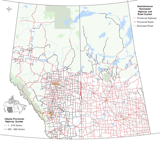
English: The alignment of Highway 17 within Alberta and Saskatchewan in relation to the balance of the Alberta's provincial highway system and Saskatchewan's numbered highway/road system with other base features including hydrography, national parks, provincial parks (Alberta only as Saskatchewan open data boundary equivalents are not available), provincial green and white zones (Alberta) and the Northern Saskatchewan Administration District (Saskatchewan) |
| Date | |
| Source | Own work |
| Author | Hwy43 |
Licensing
I, the copyright holder of this work, hereby publish it under the following license:
This file is licensed under the Creative Commons Attribution 4.0 International license.
- You are free:
- to share – to copy, distribute and transmit the work
- to remix – to adapt the work
- Under the following conditions:
- attribution – You must give appropriate credit, provide a link to the license, and indicate if changes were made. You may do so in any reasonable manner, but not in any way that suggests the licensor endorses you or your use.
File history
Click on a date/time to view the file as it appeared at that time.
| Date/Time | Thumbnail | Dimensions | User | Comment | |
|---|---|---|---|---|---|
| current | 20:51, 12 November 2016 | | 1,114 × 979 (107 KB) | Hwy43 | Add Grasslands National Park and SK's numbered municipal roads (legend title for SK changed to be inclusive of numbered municipal roads). |
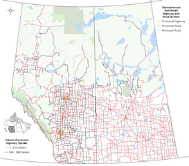
| 06:27, 11 November 2016 |  | 1,114 × 979 (100 KB) | Hwy43 | Expand map to include Saskatchewan since the highway is biprovincial, shared between both Alberta and Saskatchewan, forming the boundary between the two provinces in some locations | |
| 04:00, 28 October 2016 |  | 557 × 941 (64 KB) | Hwy43 | User created page with UploadWizard |
File usage
The following pages on the English Wikipedia use this file (pages on other projects are not listed):
Global file usage
The following other wikis use this file:
- Usage on www.wikidata.org