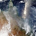
File:Ash distribution from Hunga Tonga over Australia.jpg

Size of this preview: 600 × 600 pixels. Other resolutions: 240 × 240 pixels | 480 × 480 pixels | 768 × 768 pixels | 1,024 × 1,024 pixels | 2,048 × 2,048 pixels | 8,000 × 8,000 pixels.
Original file (8,000 × 8,000 pixels, file size: 15.19 MB, MIME type: image/jpeg)
File history
Click on a date/time to view the file as it appeared at that time.
| Date/Time | Thumbnail | Dimensions | User | Comment | |
|---|---|---|---|---|---|
| current | 13:08, 17 January 2022 |  | 8,000 × 8,000 (15.19 MB) | TheWxResearcher | Uploaded a work by NASA/Terra-MODIS from https://worldview.earthdata.nasa.gov/ with UploadWizard |
File usage
The following pages on the English Wikipedia use this file (pages on other projects are not listed):
Global file usage
The following other wikis use this file:
- Usage on es.wikipedia.org
- Usage on fr.wikipedia.org
- Usage on id.wikipedia.org


