
File:Badwater Basin - Flickr - Joe Parks.jpg
Size of this preview: 800 × 533 pixels. Other resolutions: 320 × 213 pixels | 640 × 427 pixels | 1,024 × 683 pixels | 1,280 × 853 pixels | 2,560 × 1,707 pixels | 4,272 × 2,848 pixels.
Original file (4,272 × 2,848 pixels, file size: 10.56 MB, MIME type: image/jpeg)
| This is a file from the Wikimedia Commons. Information from its description page there is shown below. Commons is a freely licensed media file repository. You can help. |
Summary
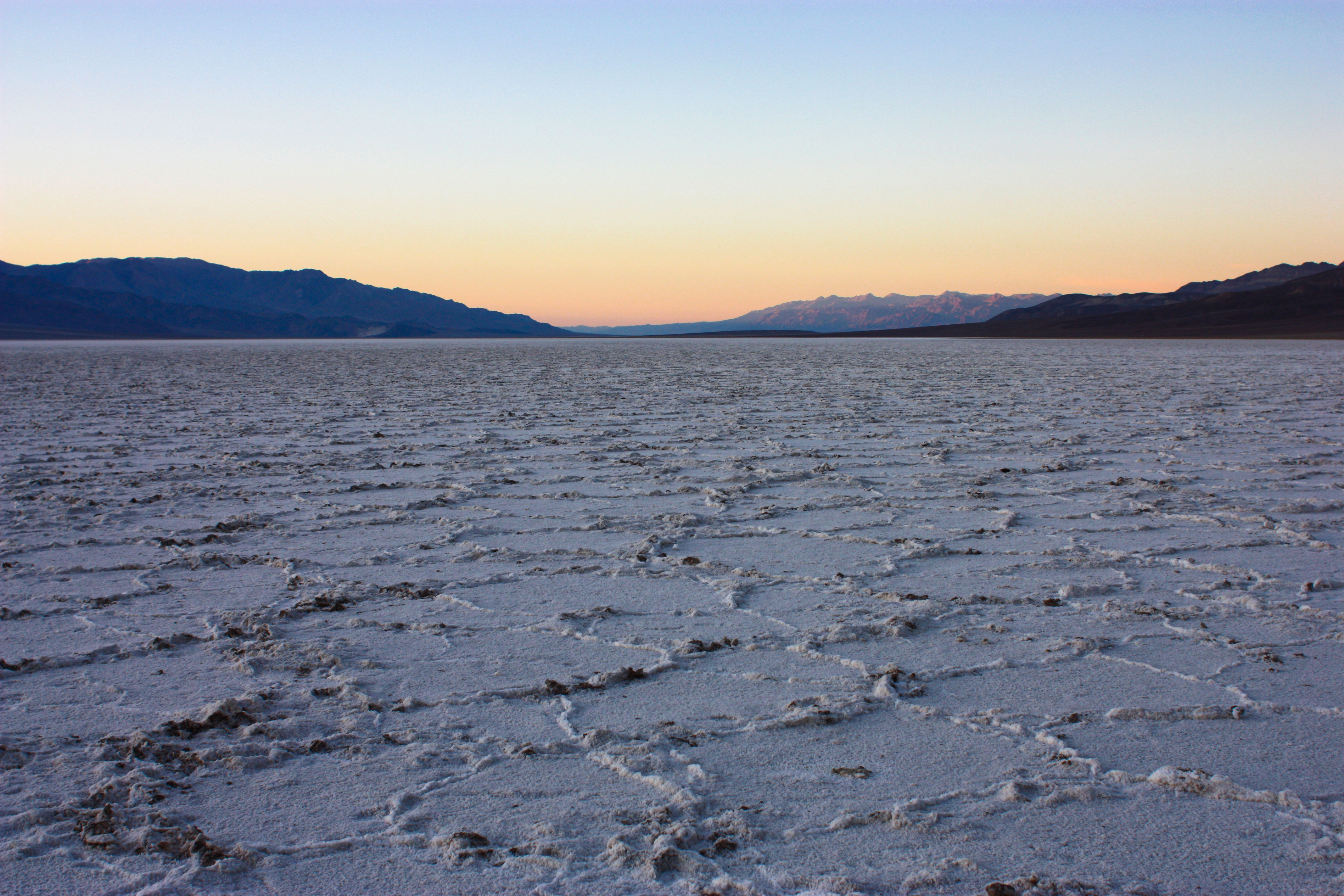
| Description | The salt flats at Badwater defend Lake Manly's legacy. As the ancient lake evaporated, the minerals in the water remained, creating the massive salt pan seen stretching to the horizon. Occasionally dampened by rainfall (~1.9 inches/year), the hexagonal patterns on the surface are formed when the moisture evaporates, and the salt crystals expand during the drying process. At 282 feet below sea level, Badwater Basin is the lowest point in North America. |
| Date | |
| Source | Badwater Basin |
| Author | Joe Parks from Berkeley, CA |
| Camera location | | View this and other nearby images on: OpenStreetMap |
|---|
Licensing
This file is licensed under the Creative Commons Attribution 2.0 Generic license.
- You are free:
- to share – to copy, distribute and transmit the work
- to remix – to adapt the work
- Under the following conditions:
- attribution – You must give appropriate credit, provide a link to the license, and indicate if changes were made. You may do so in any reasonable manner, but not in any way that suggests the licensor endorses you or your use.
| This image was originally posted to Flickr by Joe Parks at https://www.flickr.com/photos/34450190@N08/6660593465. It was reviewed on 9 June 2013 by FlickreviewR and was confirmed to be licensed under the terms of the cc-by-2.0. |
File history
Click on a date/time to view the file as it appeared at that time.
| Date/Time | Thumbnail | Dimensions | User | Comment | |
|---|---|---|---|---|---|
| current | 05:11, 9 June 2013 | | 4,272 × 2,848 (10.56 MB) | Matanya | == {{int:filedesc}} == {{Information |Description=The salt flats at Badwater defend Lake Manly's legacy. As the ancient lake evaporated, the minerals in the water remained, creating the massive salt pan seen stretching to the horizon. Occasionally damp... |
File usage
The following pages on the English Wikipedia use this file (pages on other projects are not listed):