
File:Blackhall Rocks Station site of 1814212 25d76923.jpg
Size of this preview: 800 × 435 pixels. Other resolutions: 320 × 174 pixels | 640 × 348 pixels | 1,024 × 557 pixels | 1,280 × 696 pixels | 3,500 × 1,903 pixels.
Original file (3,500 × 1,903 pixels, file size: 2.91 MB, MIME type: image/jpeg)
| This is a file from the Wikimedia Commons. Information from its description page there is shown below. Commons is a freely licensed media file repository. You can help. |
Summary
| Description |
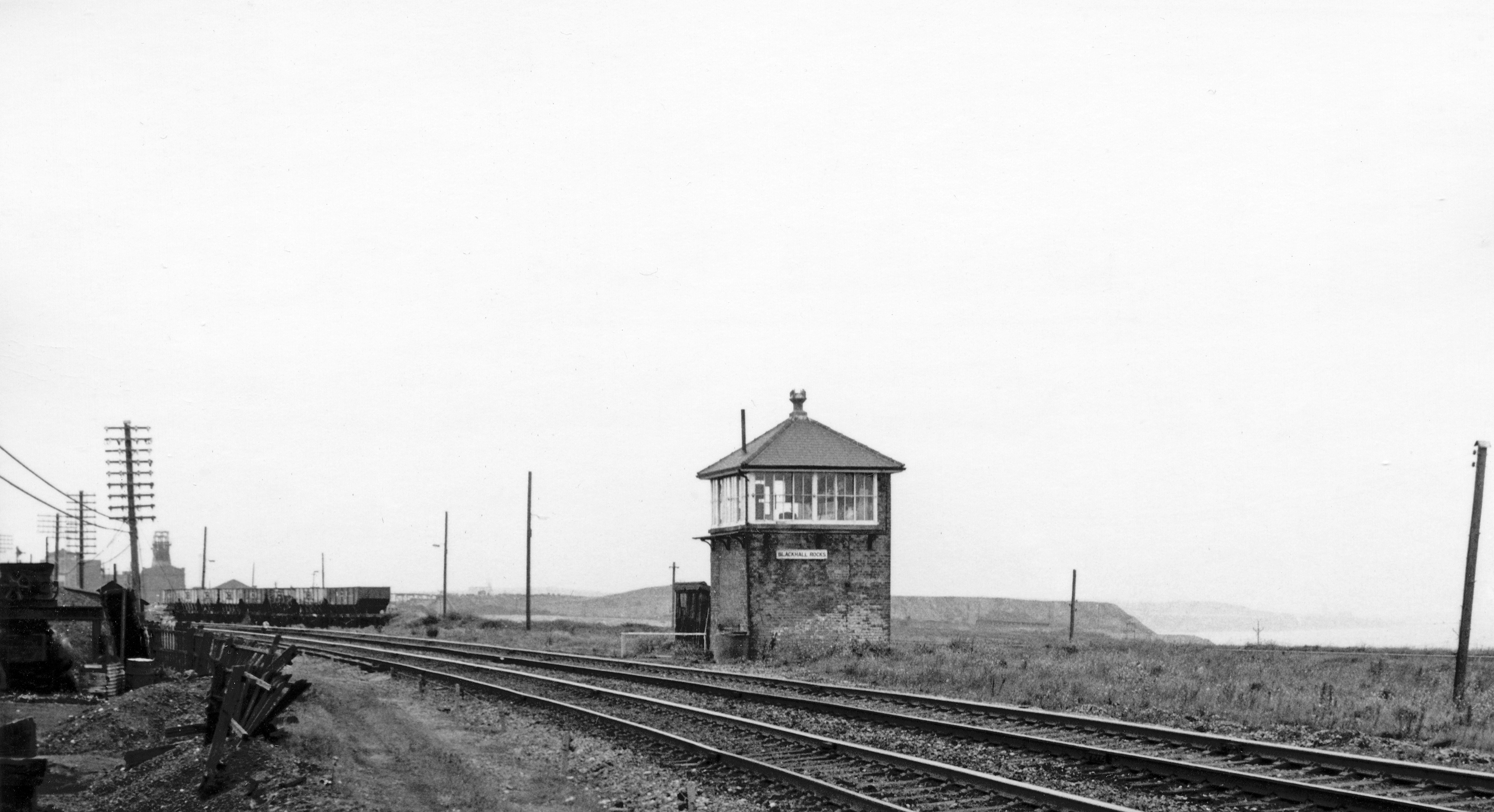
English: Site of Blackhall Rocks Station. View NW, towards Sunderland; Northallereton/Middlesbrough - Stockton - Sunderland - Newcastle secondary main line. Station closed to passengers 4/1/60, goods 7/12/64. |
| Date | |
| Source | From geograph.org.uk |
| Author | Ben Brooksbank |
| Permission (Reusing this file) |
Creative Commons Attribution Share-alike license 2.0 |
| Camera location | | View this and other nearby images on: OpenStreetMap |
|---|
Licensing

|
This image was taken from the Geograph project collection. See this photograph's page on the Geograph website for the photographer's contact details. The copyright on this image is owned by Ben Brooksbank and is licensed for reuse under the Creative Commons Attribution-ShareAlike 2.0 license.
|
This file is licensed under the Creative Commons Attribution-Share Alike 2.0 Generic license.
Attribution: Ben Brooksbank
- You are free:
- to share – to copy, distribute and transmit the work
- to remix – to adapt the work
- Under the following conditions:
- attribution – You must give appropriate credit, provide a link to the license, and indicate if changes were made. You may do so in any reasonable manner, but not in any way that suggests the licensor endorses you or your use.
- share alike – If you remix, transform, or build upon the material, you must distribute your contributions under the same or compatible license as the original.
File history
Click on a date/time to view the file as it appeared at that time.
| Date/Time | Thumbnail | Dimensions | User | Comment | |
|---|---|---|---|---|---|
| current | 22:19, 9 September 2017 | | 3,500 × 1,903 (2.91 MB) | Geograph Update Bot | Higher-resolution version from Geograph. |
| 16:42, 26 January 2011 |  | 640 × 345 (82 KB) | Belaro | == {{int:filedesc}} == {{Information |Description={{en|1=Site of Blackhall Rocks Station View NW, towards Sunderland; Northallereton/Middlesbrough - Stockton - Sunderland - Newcastle secondary main line. Station closed to passengers 4/1/60, goods 7/12/64. |
File usage
The following pages on the English Wikipedia use this file (pages on other projects are not listed):