
File:BlankMap-Europe-v5.png

Size of this preview: 800 × 488 pixels. Other resolutions: 320 × 195 pixels | 640 × 391 pixels | 1,024 × 625 pixels | 1,280 × 781 pixels | 2,079 × 1,269 pixels.
Original file (2,079 × 1,269 pixels, file size: 79 KB, MIME type: image/png)
| This is a file from the Wikimedia Commons. Information from its description page there is shown below. Commons is a freely licensed media file repository. You can help. |
Summary
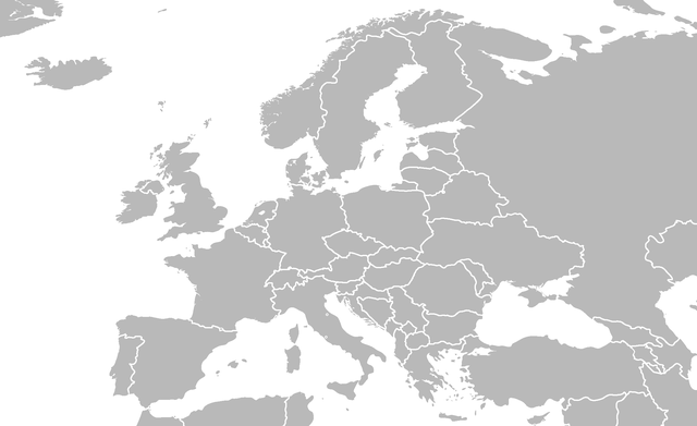
| Description | blank political map of europe |
| Date | |
| Source | derived from Image:BlankMap-World6.svg |
| Author | Zaparojdik |
| Permission (Reusing this file) |
self made |
| Other versions |
Derivative works of this file: Handelszahlen DE mit Europa.png version 6, version 4, version 3, version 2, original blank europe |
Licensing
I, the copyright holder of this work, hereby publish it under the following licenses:

|
Permission is granted to copy, distribute and/or modify this document under the terms of the GNU Free Documentation License, Version 1.2 or any later version published by the Free Software Foundation; with no Invariant Sections, no Front-Cover Texts, and no Back-Cover Texts. A copy of the license is included in the section entitled GNU Free Documentation License. |
| This file is licensed under the Creative Commons Attribution-Share Alike 3.0 Unported license. | ||
| ||
| This licensing tag was added to this file as part of the GFDL licensing update. |
You may select the license of your choice.
File history
Click on a date/time to view the file as it appeared at that time.
| Date/Time | Thumbnail | Dimensions | User | Comment | |
|---|---|---|---|---|---|
| current | 16:12, 16 February 2014 | | 2,079 × 1,269 (79 KB) | Maps & Lucy | Better proportioned Monaco, Vatican City, and San Marino; added Liechtenstein; and redrew the border between Kosovo and Serbia to properly reflect reality there. |
| 15:39, 2 December 2013 |  | 2,079 × 1,269 (106 KB) | Bobrayner | Back to the consensus version. Welcome to 2013! | |
| 15:11, 2 December 2013 |  | 2,079 × 1,269 (106 KB) | Nikola Smolenski | Reverted to version as of 14:51, 31 July 2008 | |
| 16:19, 29 November 2013 |  | 2,079 × 1,269 (106 KB) | No More Cats | updated borders | |
| 14:51, 31 July 2008 |  | 2,079 × 1,269 (106 KB) | Avala | ||
| 16:34, 13 March 2008 |  | 2,079 × 1,269 (106 KB) | Nightstallion | upload a variant if you wish, but the majority in Europe recognises or will recognise. | |
| 18:16, 11 March 2008 |  | 2,079 × 1,269 (106 KB) | Avala | there is no consensus in Europe | |
| 02:42, 24 February 2008 |  | 2,079 × 1,269 (106 KB) | Hoshie | Added Kosovo since it has been internationally recognized | |
| 12:56, 7 August 2007 |  | 2,079 × 1,269 (106 KB) | Zaparojdik~commonswiki | == Summary == {{Information |Description= blank map of europe |Source= derived from Image:BlankMap-World6.svg |Date= June 2006 |Author= Zaparojdik |Permission= self made |other_versions= [[:Image:BlankMap |
File usage
No pages on the English Wikipedia use this file (pages on other projects are not listed).
Global file usage
The following other wikis use this file:
- Usage on pt.wikipedia.org
- Wikipédia:Projetos/Países/Europa
- Sildávia
- Rockall
- Wikipédia:Projetos/Países/Europa/Mapa político
- Bordúria
- Predefinição:Mapa de localização/Europa
- Lista de finais da Copa do Mundo FIFA
- Predefinição:Mapa Cidades Europa
- Cimeira da Organização do Tratado do Atlântico Norte
- Golfo de Antália
- Confederação das Associações Independentes de Futebol
- EuroBasket de 2015
- EuroBasket de 1965
- Copa Europeia CONIFA
- EuroBasket de 2017
- International Champions Cup de 2016
- Liga dos Campeões da EHF de 2016–17
- Eurocopa de Basquetebol de 2016–17
- Predefinição:Info/Instituição europeia
- Predefinição:Info/Instituição europeia/doc
- Jogos Insulares
- Taça EHF de 2017–18
- Final Four da Euroliga de 2018
- International Champions Cup de 2018
- Liga dos Campeões da EHF de 2018–19
- Liga dos Campeões da UEFA de 2019–20
- Festival Eurovisão da Canção Júnior 2007
- Festival Eurovisão da Canção Júnior 2004
- International Champions Cup de 2019
- Liga dos Campeões da UEFA de 2020–21
- Liga Conferência Europa da UEFA de 2021–22
- Liga dos Campeões da UEFA de 2021–22
- Liga Europa da UEFA de 2021–22
- Grandes cidades termais da Europa
- Liga dos Campeões da UEFA de 2022–23
- Liga Conferência Europa da UEFA de 2022–23
- Liga Europa da UEFA de 2022–23
- Liga dos Campeões da UEFA de 2023–24
- Liga Europa da UEFA de 2023–24
- Liga Conferência Europa da UEFA de 2023–24
- Final Four de 2023 da Euroliga
- Final Four de 2023 da Liga dos Campeões da FIBA
- BlueCo
- Usage on pt.wikibooks.org