
File:Bosham Waterfront and Church - geograph.org.uk - 25199.jpg
No higher resolution available.
Bosham_Waterfront_and_Church_-_geograph.org.uk_-_25199.jpg (640 × 463 pixels, file size: 79 KB, MIME type: image/jpeg)
| This is a file from the Wikimedia Commons. Information from its description page there is shown below. Commons is a freely licensed media file repository. You can help. |
Summary
| Description |
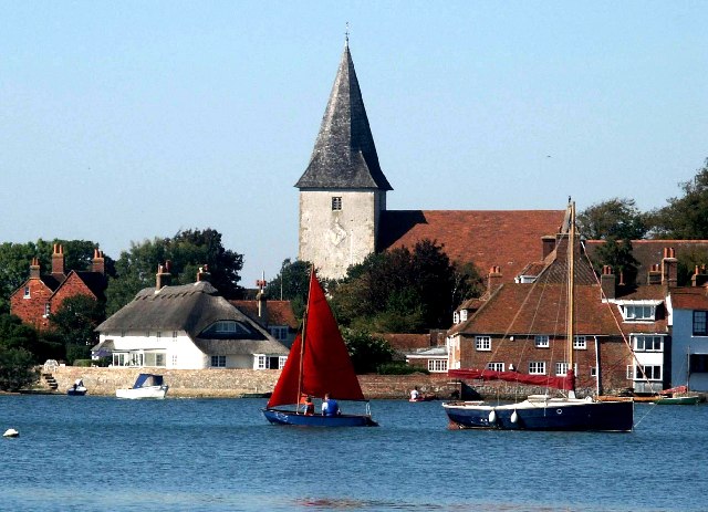
English: Bosham Waterfront and Church. The waterfront shown hear is actually a road (Shore Road) which floods every tide - often engulfing the parked cars of tourists who fail to read the signs! The Church is the burial place of King Canute's daughter and is featured in the Bayeux tapestry - depicting King Harold praying there before setting sail to Normandy where he will make a promise that when broken will lead to William's invasion of 1066. |
| Date | |
| Source | From geograph.org.uk |
| Author | Phil Gullen |
| Attribution (required by the license) | Phil Gullen / Bosham Waterfront and Church / |
| Object location | | View this and other nearby images on: OpenStreetMap |
|---|
_&language=en)
Licensing

|
This image was taken from the Geograph project collection. See this photograph's page on the Geograph website for the photographer's contact details. The copyright on this image is owned by Phil Gullen and is licensed for reuse under the Creative Commons Attribution-ShareAlike 2.0 license.
|
This file is licensed under the Creative Commons Attribution-Share Alike 2.0 Generic license.
Attribution: Phil Gullen
- You are free:
- to share – to copy, distribute and transmit the work
- to remix – to adapt the work
- Under the following conditions:
- attribution – You must give appropriate credit, provide a link to the license, and indicate if changes were made. You may do so in any reasonable manner, but not in any way that suggests the licensor endorses you or your use.
- share alike – If you remix, transform, or build upon the material, you must distribute your contributions under the same or compatible license as the original.
File history
Click on a date/time to view the file as it appeared at that time.
| Date/Time | Thumbnail | Dimensions | User | Comment | |
|---|---|---|---|---|---|
| current | 01:45, 30 January 2010 | | 640 × 463 (79 KB) | GeographBot | == {{int:filedesc}} == {{Information |description={{en|1=Bosham Waterfront and Church. The waterfront shown hear is actually a road (Shore Road) which floods every tide - often engulfing the parked cars of tourists who fail to read the signs! The Church |
File usage
The following pages on the English Wikipedia use this file (pages on other projects are not listed):
Global file usage
The following other wikis use this file:
- Usage on ceb.wikipedia.org
- Usage on cy.wikipedia.org
- Usage on en.wikivoyage.org
- Usage on es.wikipedia.org
- Usage on fr.wikivoyage.org
- Usage on it.wikipedia.org
- Usage on lld.wikipedia.org
- Usage on www.wikidata.org