
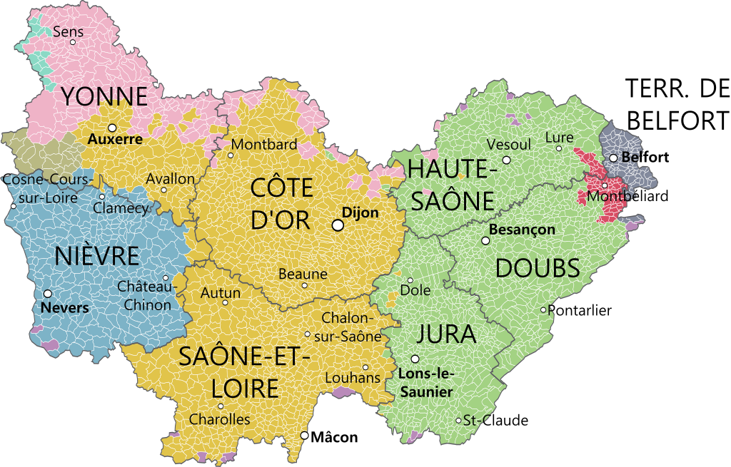
File:Bourgogne-Franche-Comté et provinces.svg

Original file (SVG file, nominally 1,574 × 1,007 pixels, file size: 1.88 MB)
| This is a file from the Wikimedia Commons. Information from its description page there is shown below. Commons is a freely licensed media file repository. You can help. |
Summary
| Description |
|
|||
| Date | ||||
| Source |
Gouvernemens généraux de la Marche, du Limousin, et de l'Auvergne et Gouvernements généraux du Berry, du Nivernois, et du Bourbonois, Robert de Vaugondy, 1753. ; Partie méridionale du gouvernement général de Bourgogne où se trouvent les bailliages d'Autun, et de Challon, le Mâconois, la Bressedivisés en leurs mandemens. Gouvernement general du Lyonois divisé en Lyonois, Forez et Beaujolois, Gouvernements généraux du Berry, du Nivernois, et du Bourbonois, Robert de Vaugondy, 1753 ; Partie méridionale du gouvernement général de Champagne qui comprend la Champagne propre, la Vallage, le Bassigny, le Senonois, et une partie de la Brie et du Perthois, Robert de Vaugondy. Derivative works of this file: Blank map of France, with communes and departments.svg by Poulpy |
|||
| Author | Oie blanche |
Licensing
- You are free:
- to share – to copy, distribute and transmit the work
- to remix – to adapt the work
- Under the following conditions:
- attribution – You must give appropriate credit, provide a link to the license, and indicate if changes were made. You may do so in any reasonable manner, but not in any way that suggests the licensor endorses you or your use.
- share alike – If you remix, transform, or build upon the material, you must distribute your contributions under the same or compatible license as the original.
File history
Click on a date/time to view the file as it appeared at that time.
| Date/Time | Thumbnail | Dimensions | User | Comment | |
|---|---|---|---|---|---|
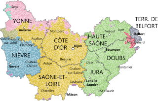
| current | 23:14, 21 March 2017 | | 1,574 × 1,007 (1.88 MB) | Oie blanche | Orain en Bourgogne |
| 18:44, 26 February 2016 |  | 1,574 × 1,007 (1.8 MB) | Chabe01 | Fusion des communes qui le sont depuis 2013 et petites améliorations. | |
| 18:44, 26 February 2016 |  | 1,574 × 1,007 (1.8 MB) | Chabe01 | Fusion des communes qui le sont depuis 2013 et petites améliorations. | |
| 15:15, 5 September 2015 |  | 1,574 × 1,007 (1.78 MB) | Oie blanche | Corrections Montbéliard | |
| 14:19, 5 September 2015 |  | 1,574 × 1,007 (1.98 MB) | A.BourgeoisP | Correction | |
| 17:14, 4 September 2015 |  | 1,574 × 1,007 (1.98 MB) | Oie blanche | User created page with UploadWizard |
File usage
Global file usage
The following other wikis use this file:
- Usage on als.wikipedia.org
- Usage on de.wikipedia.org
- Usage on de.wikivoyage.org
- Usage on el.wikipedia.org
- Usage on es.wikipedia.org
- Usage on fr.wikipedia.org
- Bourgogne (ancienne région administrative)
- Franche-Comté
- Utilisateur:Oie blanche
- Bourgogne-Franche-Comté
- Discussion:Bourgogne-Franche-Comté
- Wikipédia:Statistiques des anecdotes de la page d'accueil/Visibilité des anecdotes (2016)
- Wikipédia:Statistiques des anecdotes de la page d'accueil/Visibilité des anecdotes (2016)/2016 04
- Wikipédia:Le saviez-vous ?/Archives/2016
- Usage on fy.wikipedia.org
- Usage on hr.wikipedia.org
- Usage on it.wikipedia.org
- Usage on ja.wikipedia.org
- Usage on ko.wikipedia.org
- Usage on la.wikipedia.org
- Usage on nl.wikipedia.org
- Usage on pcd.wikipedia.org
- Usage on ro.wikipedia.org
- Usage on sh.wikipedia.org
- Usage on sl.wikipedia.org
- Usage on vi.wikipedia.org
- Usage on zh.wikipedia.org