
File:Bristol Channel map.svg

Size of this PNG preview of this SVG file: 585 × 414 pixels. Other resolutions: 320 × 226 pixels | 640 × 453 pixels | 1,024 × 725 pixels | 1,280 × 906 pixels | 2,560 × 1,812 pixels.
Original file (SVG file, nominally 585 × 414 pixels, file size: 52 KB)
| This is a file from the Wikimedia Commons. Information from its description page there is shown below. Commons is a freely licensed media file repository. You can help. |
Summary
| Description |
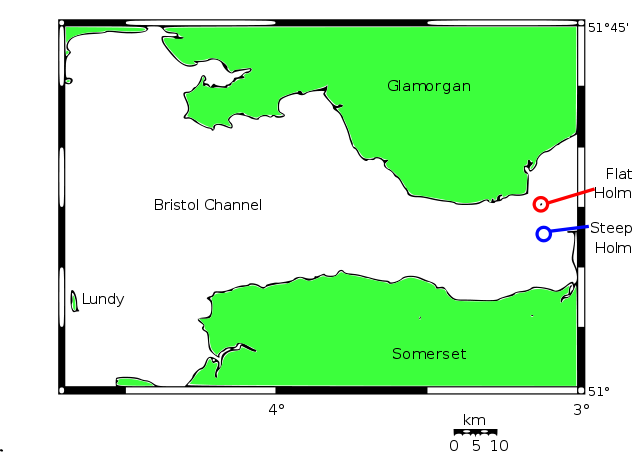
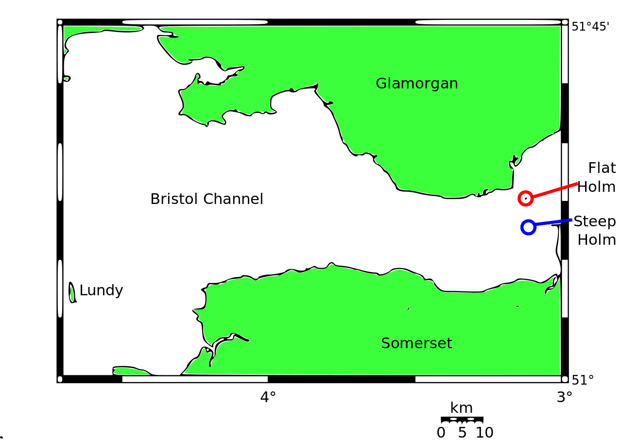
English: Map of the Bristol Channel with islands. GFDL. Made by Marnanel based on data at www.aquarius.geomar.de/omc/ . See also: File:Map Môr Hafren.svg (in Welsh)
Cymraeg: Map Môr Hafren gyda ynysoedd. GFDL. Gwler hefyd: File:Map Môr Hafren.svg (yn Gymraeg) |
| Date | |
| Source | File:Bristol Channel map.png |
| Author | User:Marnanel, User:Wapcaplet |
| Other versions | File:Bristol_Channel_map.png |
Original uploader was Marnanel at en.wikipedia Later versions were uploaded by Wapcaplet at en.wikipedia.
Licensing
I, the copyright holder of this work, hereby publish it under the following licenses:

|
Permission is granted to copy, distribute and/or modify this document under the terms of the GNU Free Documentation License, Version 1.2 or any later version published by the Free Software Foundation; with no Invariant Sections, no Front-Cover Texts, and no Back-Cover Texts. A copy of the license is included in the section entitled GNU Free Documentation License. |
This file is licensed under the Creative Commons Attribution-Share Alike 3.0 Unported license.
- You are free:
- to share – to copy, distribute and transmit the work
- to remix – to adapt the work
- Under the following conditions:
- attribution – You must give appropriate credit, provide a link to the license, and indicate if changes were made. You may do so in any reasonable manner, but not in any way that suggests the licensor endorses you or your use.
- share alike – If you remix, transform, or build upon the material, you must distribute your contributions under the same or compatible license as the original.
You may select the license of your choice.
File history
Click on a date/time to view the file as it appeared at that time.
| Date/Time | Thumbnail | Dimensions | User | Comment | |
|---|---|---|---|---|---|
| current | 15:52, 29 May 2010 | | 585 × 414 (52 KB) | Marnanel | Moved misaligned text. |
| 15:51, 29 May 2010 |  | 585 × 414 (52 KB) | Marnanel | Fixed text. | |
| 15:42, 29 May 2010 |  | 585 × 414 (52 KB) | Marnanel | {{Information |Description={{en|1=Map of the Bristol Channel with islands. GFDL. Made by Marnanel based on data at www.aquarius.geomar.de/omc/ .}} |Source=File:Bristol Channel map.png |Author=User:Marnanel, User:Wapcaplet |Date=2004-05-05 |Permission= |ot |
File usage
The following pages on the English Wikipedia use this file (pages on other projects are not listed):
Global file usage
The following other wikis use this file:
- Usage on br.wikipedia.org
- Usage on ha.wikipedia.org
- Usage on id.wikipedia.org
- Usage on it.wikipedia.org
- Usage on www.wikidata.org