
File:California Topography-MEDIUM.png
Size of this preview: 558 × 599 pixels. Other resolutions: 223 × 240 pixels | 447 × 480 pixels | 715 × 768 pixels | 953 × 1,024 pixels | 1,862 × 2,000 pixels.
Original file (1,862 × 2,000 pixels, file size: 2.25 MB, MIME type: image/png)
| This is a file from the Wikimedia Commons. Information from its description page there is shown below. Commons is a freely licensed media file repository. You can help. |
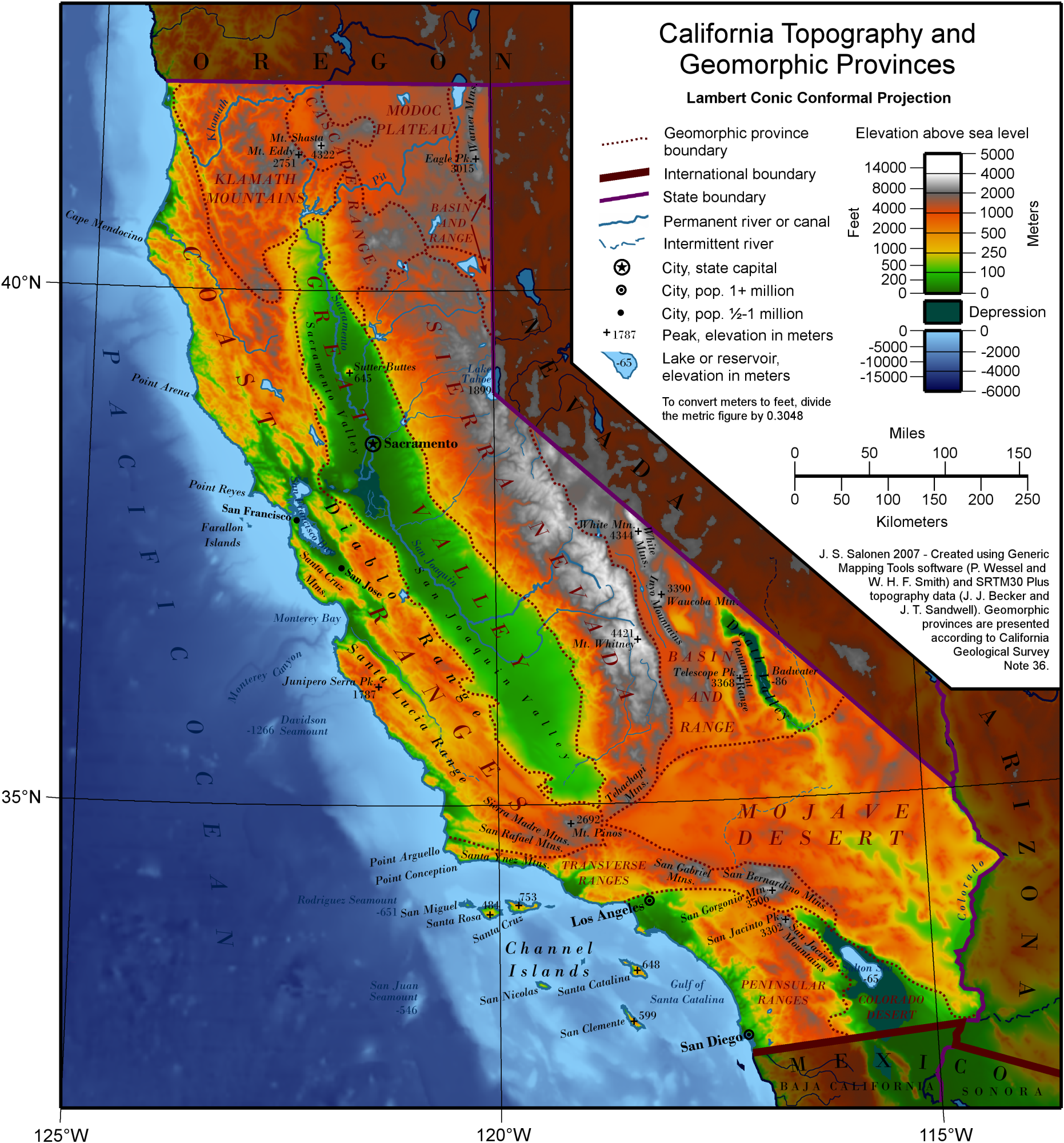
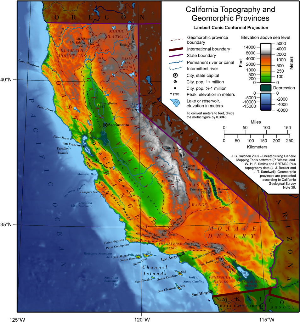
| Description | A map of California showing topography and geomorphic provinces. | ||||||||
| Date | |||||||||
| Source | Own work by the original uploader, using The Generic Mapping Tools | ||||||||
| Author | J.S. Salonen (talk · contribs) | ||||||||
| Permission (Reusing this file) |
Ssalonen at the English Wikipedia, the copyright holder of this work, hereby publishes it under the following license:
|
||||||||
| Other versions |
|


File history
Click on a date/time to view the file as it appeared at that time.
| Date/Time | Thumbnail | Dimensions | User | Comment | |
|---|---|---|---|---|---|
| current | 09:46, 31 July 2009 | | 1,862 × 2,000 (2.25 MB) | Urban~commonswiki | {{Information |Description=A map of California showing topography and geomorphic provinces. |Source=http://en.wikipedia.org/wiki/File:California_Topography-MEDIUM.png |Date= |Author=User:Ssalonen |Permission= |other_versions= }} {{GFDL-self-no-disclaimers |
File usage
No pages on the English Wikipedia use this file (pages on other projects are not listed).
Global file usage
The following other wikis use this file:
- Usage on am.wikipedia.org
- Usage on ar.wikipedia.org
- Usage on bn.wikipedia.org
- Usage on bo.wikipedia.org
- Usage on en.wikiversity.org
- Usage on eo.wikipedia.org
- Usage on es.wikipedia.org
- Usage on fr.wikipedia.org
- Usage on he.wikipedia.org
- Usage on incubator.wikimedia.org
- Usage on it.wikipedia.org
- Usage on ja.wikipedia.org
- Usage on krc.wikipedia.org
- Usage on lv.wikipedia.org
- Usage on mk.wikipedia.org
- Usage on my.wikipedia.org
- Usage on oc.wikipedia.org
- Usage on pt.wikipedia.org
- Usage on ro.wikipedia.org
- Usage on sr.wikipedia.org
- Usage on tr.wikipedia.org
- Usage on www.wikidata.org