
File:California map showing Glenn County.png
No higher resolution available.
California_map_showing_Glenn_County.png (200 × 231 pixels, file size: 22 KB, MIME type: image/png)
| This is a file from the Wikimedia Commons. Information from its description page there is shown below. Commons is a freely licensed media file repository. You can help. |
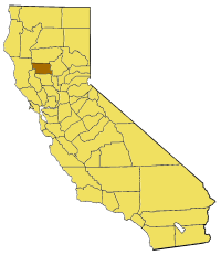
Map of Glenn county in California. From en:

|
Permission is granted to copy, distribute and/or modify this document under the terms of the GNU Free Documentation License, Version 1.2 or any later version published by the Free Software Foundation; with no Invariant Sections, no Front-Cover Texts, and no Back-Cover Texts. A copy of the license is included in the section entitled GNU Free Documentation License. |
| This file is licensed under the Creative Commons Attribution-Share Alike 3.0 Unported license. | ||
| ||
| This licensing tag was added to this file as part of the GFDL licensing update. |
File history
Click on a date/time to view the file as it appeared at that time.
| Date/Time | Thumbnail | Dimensions | User | Comment | |
|---|---|---|---|---|---|
| current | 17:00, 1 July 2005 | | 200 × 231 (22 KB) | Pyramide~commonswiki | Map of Glenn county in California. From en: {{GFDL}} Category:Maps of counties in California |
File usage
The following pages on the English Wikipedia use this file (pages on other projects are not listed):
- Afton, Glenn County, California
- Alder Springs, Glenn County, California
- Bayliss, California
- Butte City, Amador County, California
- Butte City, Glenn County, California
- Capay, Glenn County, California
- Chrome, California
- Codora, California
- Fruto, California
- Glenn County Superior Court
- Hoodoo Hills
- Inner North Coast Ranges
- Jacinto, California
- Meadowood Estates, California
- Mendocino Pass
- Monroeville, California
- Newville, California
- Ordbend, California
- Orland Buttes
- Saint John Mountain (California)
- Template:GlennCountyCA-geo-stub
Global file usage
The following other wikis use this file:
- Usage on bg.wikipedia.org
- Usage on li.wikipedia.org
- Usage on pam.wikipedia.org
- Usage on www.wikidata.org