
File:Canada Central Quebec location map.png
No higher resolution available.
Canada_Central_Quebec_location_map.png (750 × 520 pixels, file size: 177 KB, MIME type: image/png)
| This is a file from the Wikimedia Commons. Information from its description page there is shown below. Commons is a freely licensed media file repository. You can help. |
Summary
| Description |
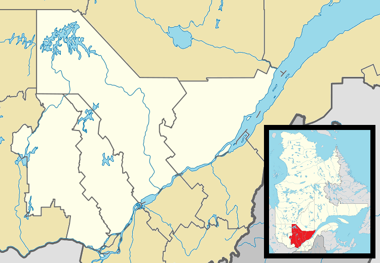
English: Map of central Québec Province for use in location map templates. |
| Date | |
| Source |
This file was derived from: Canada Quebec location map 2.svg:  |
| Author |
|
Licensing
This file is licensed under the Creative Commons Attribution-Share Alike 3.0 Unported license.
- You are free:
- to share – to copy, distribute and transmit the work
- to remix – to adapt the work
- Under the following conditions:
- attribution – You must give appropriate credit, provide a link to the license, and indicate if changes were made. You may do so in any reasonable manner, but not in any way that suggests the licensor endorses you or your use.
- share alike – If you remix, transform, or build upon the material, you must distribute your contributions under the same or compatible license as the original.
File history
Click on a date/time to view the file as it appeared at that time.
| Date/Time | Thumbnail | Dimensions | User | Comment | |
|---|---|---|---|---|---|
| current | 02:31, 20 April 2013 | | 750 × 520 (177 KB) | Gordalmighty | User created page with UploadWizard |
File usage
More than 100 pages use this file. The following list shows the first 100 pages that use this file only. A full list is available.
- Arundel, Quebec
- Baie-Saint-Paul
- Baie-Sainte-Catherine
- Basilica of Sainte-Anne-de-Beaupré
- Batiscan, Quebec
- Berthierville
- Blainville, Quebec
- Bois-des-Filion
- Boisbriand
- Boischatel
- Brownsburg-Chatham
- Brébeuf, Quebec
- Cap-Santé
- Champlain, Quebec
- Charette, Quebec
- Charlemagne, Quebec
- Château-Richer
- Communauté métropolitaine de Québec
- Deschambault-Grondines
- Deux-Montagnes
- Domaine Forget
- Donnacona, Quebec
- Forges du Saint-Maurice
- Grenville-sur-la-Rouge
- Hérouxville
- Joliette
- L'Ancienne-Lorette
- L'Assomption
- L'Isle-aux-Coudres
- L'Épiphanie
- La Malbaie
- La Tuque, Quebec
- Lac-Beauport, Quebec
- Lachute
- Lorraine, Quebec
- Louiseville
- Mascouche
- Maskinongé, Quebec
- Mirabel, Quebec
- Mont-Laurier
- Mont-Tremblant
- Morin-Heights
- Nominingue
- Notre-Dame-des-Anges, Quebec
- Notre-Dame-du-Mont-Carmel, Quebec
- Oka, Quebec
- Piedmont, Quebec
- Prévost, Quebec
- Rawdon, Quebec
- Repentigny, Quebec
- Rosemère
- Saint-Adelphe
- Saint-Adolphe-d'Howard
- Saint-Alexis-des-Monts, Quebec
- Saint-Augustin-de-Desmaures
- Saint-Barnabé, Quebec
- Saint-Boniface, Quebec
- Saint-Casimir, Quebec
- Saint-Donat, Lanaudière, Quebec
- Saint-Eustache, Quebec
- Saint-Hippolyte, Quebec
- Saint-Justin, Quebec
- Saint-Jérôme
- Saint-Liguori
- Saint-Lin–Laurentides
- Saint-Louis-de-Gonzague-du-Cap-Tourmente
- Saint-Luc-de-Vincennes, Quebec
- Saint-Léon-le-Grand, Mauricie
- Saint-Mathieu-du-Parc, Quebec
- Saint-Maurice, Quebec
- Saint-Narcisse
- Saint-Paulin, Quebec
- Saint-Prosper-de-Champlain, Quebec
- Saint-Raymond, Quebec
- Saint-Sauveur, Quebec
- Saint-Stanislas, Mauricie, Quebec
- Saint-Séverin, Mauricie, Quebec
- Saint-Sévère, Quebec
- Saint-Tite
- Saint-Ubalde
- Saint-Élie-de-Caxton
- Saint-Étienne-des-Grès, Quebec
- Sainte-Adèle
- Sainte-Agathe-des-Monts
- Sainte-Angèle-de-Prémont
- Sainte-Anne-de-Beaupré
- Sainte-Anne-de-la-Pérade
- Sainte-Anne-des-Lacs
- Sainte-Anne-des-Plaines
- Sainte-Christine-d'Auvergne, Quebec
- Sainte-Famille-de-l'Île-d'Orléans
- Sainte-Geneviève-de-Batiscan
- Sainte-Marie-Salomé
- Sainte-Thècle
- Sainte-Thérèse, Quebec
- Sainte-Ursule, Quebec
- Stoneham-et-Tewkesbury
- Terrebonne, Quebec
- Val-David
- Wendake
View more links to this file.
Global file usage
The following other wikis use this file:
- Usage on ar.wikipedia.org
- Usage on ceb.wikipedia.org
- Usage on fa.wikipedia.org
- لاتوک
- سن-فرانسوا-دو-لیل-دورلئان، کبک
- سن-ژان-دو-لیل-دورلئان، کبک
- سن-لوران-دو-لیل-دورلئان، کبک
- سن-پیر-دو-لیل-دورلئان، کبک
- لا ویزیتاسیون-دو-لیل-دوپاس، کبک
- ژولیت (استان کبک)
- سن-شارل-بورومه، کبک
- مون-لوریه
- سنت-آگات-ده-مون
- مورن-هایتز، کبک
- سن-ادوارد-دو-ماسکینونژه، کبک
- اروویل، کبک
- بوستونه، کبک
- لاک-ادوارد، کبک
- الگو:Location map Canada Central Quebec
- بازیلیکای سانت آن-دو-بوپره
- Usage on fr.wikipedia.org
- Usage on id.wikipedia.org
- Usage on it.wikipedia.org
- Usage on kn.wikipedia.org
- Usage on pa.wikipedia.org
- Usage on si.wikipedia.org
- Usage on tr.wikipedia.org
- Usage on ur.wikipedia.org
- Usage on uz.wikipedia.org
- Usage on war.wikipedia.org
- Usage on www.wikidata.org
- Usage on zh.wikipedia.org