
File:Central Europemap Pannonia Dacia and others.jpg
Size of this preview: 778 × 600 pixels. Other resolutions: 311 × 240 pixels | 623 × 480 pixels | 996 × 768 pixels | 1,280 × 987 pixels | 2,560 × 1,974 pixels | 3,717 × 2,866 pixels.
Original file (3,717 × 2,866 pixels, file size: 1.11 MB, MIME type: image/jpeg)
| This is a file from the Wikimedia Commons. Information from its description page there is shown below. Commons is a freely licensed media file repository. You can help. |
Summary
| Description |
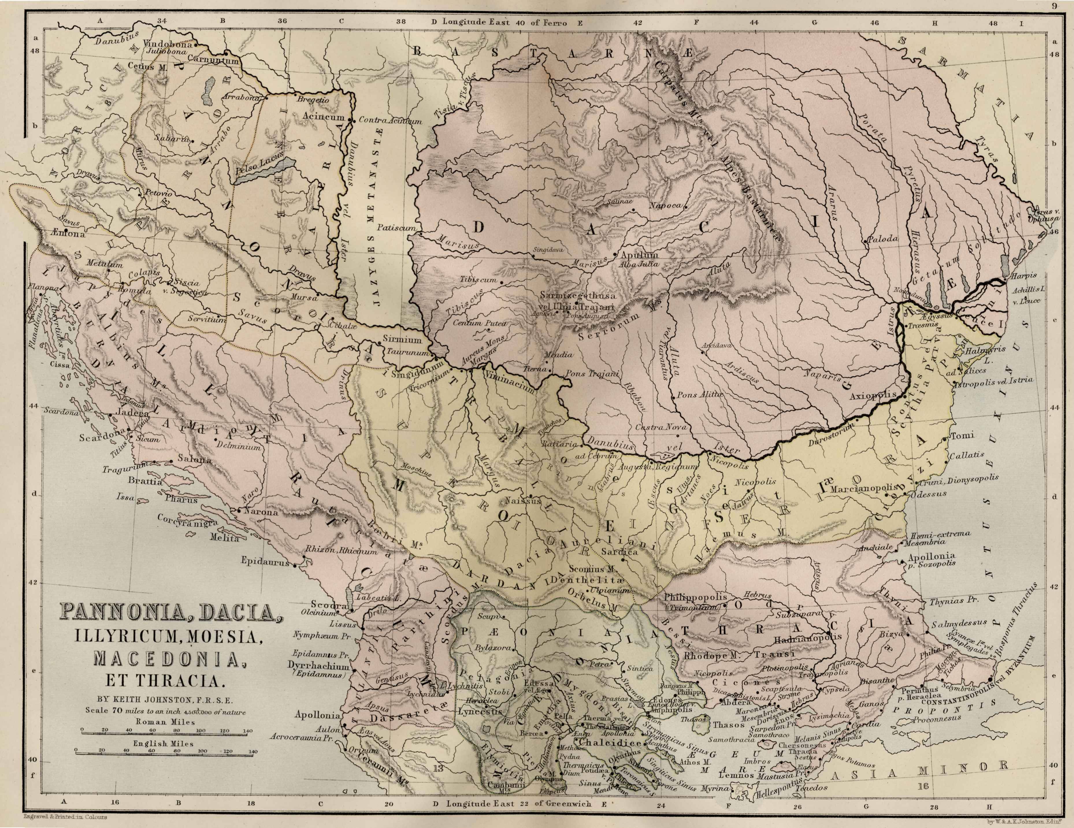
English: Map of Central Europe: Pannonia, Dacia, Illyricum, Thrace, Moesia, Macedonia and Thrace |
|||||||||||||||||||
| Date | ||||||||||||||||||||
| Source | http://ancienthistory.about.com/od/maps/ig/Ancient-World--Maps/Central-Europe-Map.htm | |||||||||||||||||||
| Author |
|
|||||||||||||||||||
| Permission (Reusing this file) |
|
|||||||||||||||||||
This map is in public domain and it comes from the 1886 Ginn & Company Classical Atlas by Keith Johnston (Map of Central Europe: Pannonia, Dacia, Illyricum, Thrace, Moesia, Macedonia and Thrace)
Licensing
|
This work is in the public domain in its country of origin and other countries and areas where the copyright term is the author's life plus 100 years or fewer. | |
| This file has been identified as being free of known restrictions under copyright law, including all related and neighboring rights. | |
File history
Click on a date/time to view the file as it appeared at that time.
| Date/Time | Thumbnail | Dimensions | User | Comment | |
|---|---|---|---|---|---|
| current | 15:46, 24 April 2011 | | 3,717 × 2,866 (1.11 MB) | Boldwin | {{Information |Description ={{en|1=Map of Central Europe: Pannonia, Dacia, Illyricum, Thrace, Moesia, Macedonia and Thrace}} |Source =http://ancienthistory.about.com/od/maps/ig/Ancient-World--Maps/Central-Europe-Map.htm |Author =Alexa |
File usage
The following pages on the English Wikipedia use this file (pages on other projects are not listed):
Global file usage
The following other wikis use this file:
- Usage on zh.wikipedia.org