
File:Ceps, Roquebrun, Hérault 04.jpg

Size of this preview: 800 × 500 pixels. Other resolutions: 320 × 200 pixels | 640 × 400 pixels | 1,024 × 640 pixels | 1,280 × 800 pixels | 2,560 × 1,600 pixels | 5,658 × 3,536 pixels.
Original file (5,658 × 3,536 pixels, file size: 14.71 MB, MIME type: image/jpeg)
| This is a file from the Wikimedia Commons. Information from its description page there is shown below. Commons is a freely licensed media file repository. You can help. |
Summary
| Description |
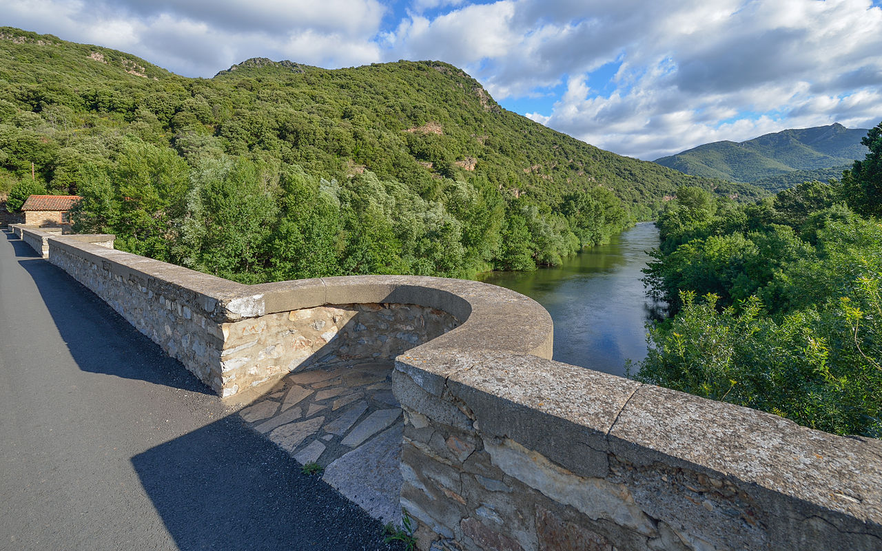
Français : La rivière et vallée de l'Orb depuis le pont de Ceps (XIXe siècle), en aval des Gorges de l'Orb. Sur la gauche le mont Cayre (451m) et sur la droite dans le fond (dans la commune de Vieussan), le mont de la Tour du Pin (666m). Hameau de Ceps, Roquebrun, Hérault, France. Parc naturel régional du Haut-Languedoc. English: Orb River and Valley from the bridge of Ceps (XIXe century), downstream of the Gorges de l'Orb. On the left the Mount Cayre (451m) and in the right in the background (in the commune of Vieussan), the Mount of La Tour du Pin (666m). Hamlet of Ceps, Roquebrun, Hérault, France. Haut-Languedoc Regional Natural Park. |
| Date | Taken on 23 June 2013, 08:43:47 |
| Source | Own work |
| Author | Christian Ferrer |
| Permission (Reusing this file) |
I, the copyright holder of this work, hereby publish it under the following license: This file is licensed under the Creative Commons Attribution-Share Alike 3.0 Unported license.
|
| Camera location | | View this and other nearby images on: OpenStreetMap |
|---|
|
This image was selected as picture of the day on Wikimedia Commons for 14 July 2014. It was captioned as follows:
|
| Annotations | This image is annotated: View the annotations at Commons |

|
This image has been assessed under the valued image criteria and is considered the most valued image on Commons within the scope: Orb River and Valley in the Hamlet of Ceps, Roquebrun, Hérault, France. From South (downstream) in 2013.. You can see its nomination here. |
File history
Click on a date/time to view the file as it appeared at that time.
| Date/Time | Thumbnail | Dimensions | User | Comment | |
|---|---|---|---|---|---|
| current | 11:12, 22 August 2013 | | 5,658 × 3,536 (14.71 MB) | Christian Ferrer | reworked |
| 04:51, 22 August 2013 |  | 5,658 × 3,536 (13.71 MB) | Christian Ferrer | sharpened | |
| 11:57, 20 August 2013 |  | 5,658 × 3,536 (12.4 MB) | Christian Ferrer | reworked | |
| 11:29, 24 June 2013 |  | 5,667 × 3,783 (11.42 MB) | Christian Ferrer | User created page with UploadWizard |
File usage
The following pages on the English Wikipedia use this file (pages on other projects are not listed):
Global file usage
The following other wikis use this file:
- Usage on be-tarask.wikipedia.org
- Usage on bn.wikipedia.org
- Usage on ca.wikipedia.org
- Usage on ceb.wikipedia.org
- Usage on crh.wikipedia.org
- Usage on cv.wikipedia.org
- Usage on eu.wikipedia.org
- Usage on fr.wikipedia.org
- Usage on hu.wikipedia.org
- Usage on it.wikipedia.org
- Usage on ka.wikipedia.org
- Usage on kk.wikipedia.org
- Usage on ko.wikipedia.org
- Usage on krc.wikipedia.org
- Usage on lbe.wikipedia.org
- Usage on mg.wikipedia.org
- Usage on ms.wikipedia.org
- Usage on nl.wikipedia.org
- Usage on oc.wikipedia.org
- Usage on os.wikipedia.org
- Usage on pt.wikipedia.org
- Usage on ru.wikipedia.org
- Usage on ru.wikinews.org
- Usage on sah.wikipedia.org
- Usage on sk.wikipedia.org
- Usage on sv.wikipedia.org
- Usage on tt.wikipedia.org
- Usage on uk.wikipedia.org
- Usage on vi.wikipedia.org
- Usage on vo.wikipedia.org
- Usage on war.wikipedia.org
- Usage on www.wikidata.org
- Usage on xal.wikipedia.org
- Usage on zh.wikipedia.org