
File:Château d'Aïre.jpg
Original file (3,008 × 2,000 pixels, file size: 2.9 MB, MIME type: image/jpeg)
| This is a file from the Wikimedia Commons. Information from its description page there is shown below. Commons is a freely licensed media file repository. You can help. |
Summary
| Description | |
| Date | |
| Source | Own work |
| Author | Calimo |
| Camera location | | View this and other nearby images on: OpenStreetMap |
|---|
Licensing

|
Permission is granted to copy, distribute and/or modify this document under the terms of the GNU Free Documentation License, Version 1.2 or any later version published by the Free Software Foundation; with no Invariant Sections, no Front-Cover Texts, and no Back-Cover Texts. A copy of the license is included in the section entitled GNU Free Documentation License. |
- You are free:
- to share – to copy, distribute and transmit the work
- to remix – to adapt the work
- Under the following conditions:
- attribution – You must give appropriate credit, provide a link to the license, and indicate if changes were made. You may do so in any reasonable manner, but not in any way that suggests the licensor endorses you or your use.
- share alike – If you remix, transform, or build upon the material, you must distribute your contributions under the same or compatible license as the original.
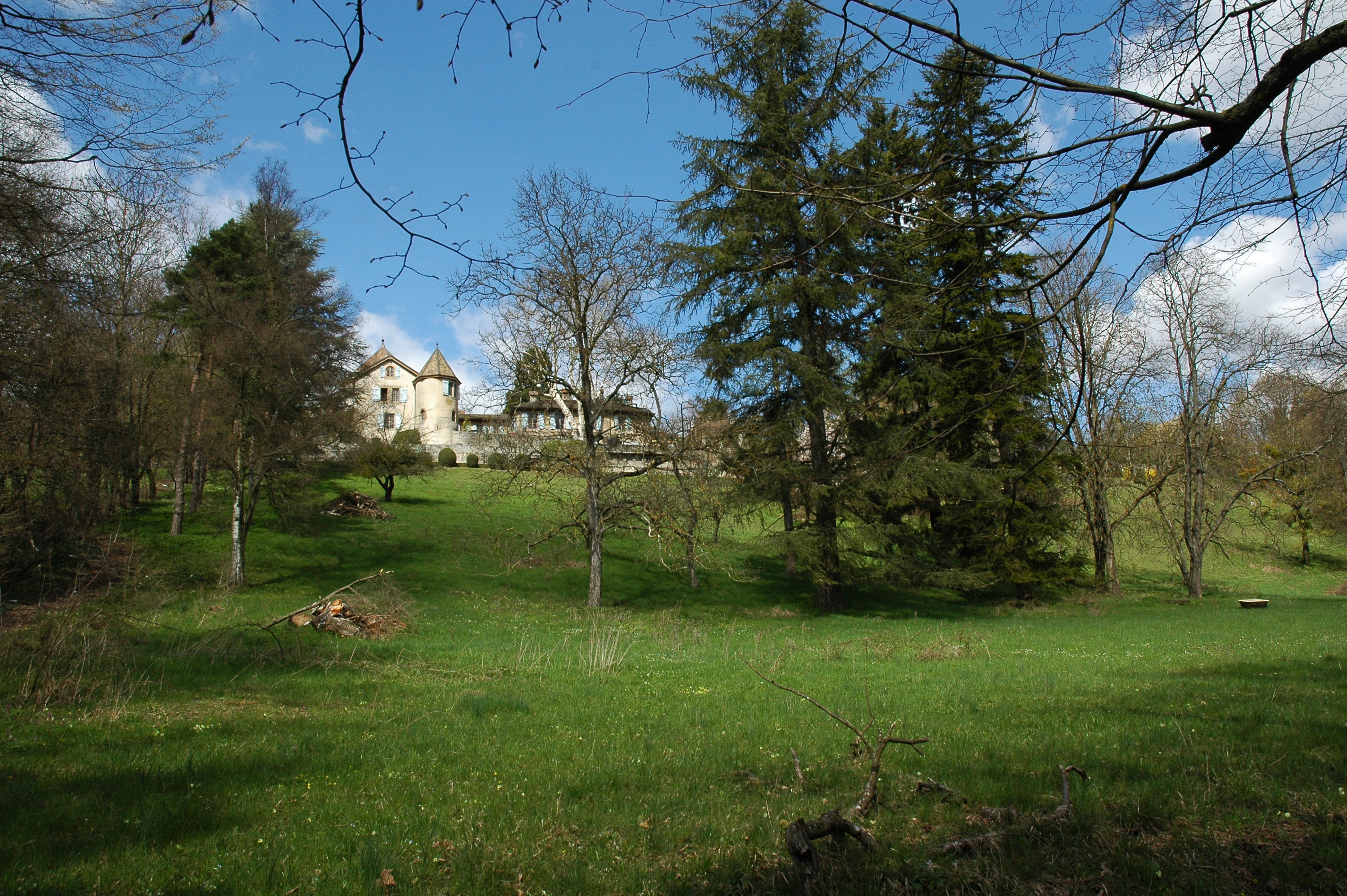
Château d'Aïre dates back to the 15th century. It is a classified monument, which was restored in 1917 and is constantly maintained in perfect order.
The Château covers an area of 18,400 sq. m. It is a magnificent environment with a view of the Rhône River and the iconic Salève Mountain. In this environment, students will be able to concentrate on their studies and be involved in the research.
The Château is easily accessible from the Geneva train station (Gare Cornavin), being only 3.4 km away and 10 minutes by car. A bus service (N° 7) from near the Cornavin Train station (bus stop Isaac-Mercier) also drops you off in front of the main door of the Château.
The Château is being used by SWISS UMEF University's students who enjoy the privilege of using this unique environment both during their studies and their free time. They are also free to invite their friends over.
File history
Click on a date/time to view the file as it appeared at that time.
| Date/Time | Thumbnail | Dimensions | User | Comment | |
|---|---|---|---|---|---|
| current | 12:31, 5 April 2010 | | 3,008 × 2,000 (2.9 MB) | Calimo | {{Information |Description={{en|1=Castle of Aïre seen from the path near the Rhône River.}} {{fr|1=Château d'Aïre vu depuis le chemin du bord du Rhône.}} |Source={{own}} |Author=Calimo |D |
File usage
Global file usage
The following other wikis use this file: