
File:Cleomenes War detail 1.svg

Size of this PNG preview of this SVG file: 343 × 360 pixels. Other resolutions: 229 × 240 pixels | 457 × 480 pixels | 732 × 768 pixels | 976 × 1,024 pixels | 1,951 × 2,048 pixels.
Original file (SVG file, nominally 343 × 360 pixels, file size: 931 KB)
| This is a file from the Wikimedia Commons. Information from its description page there is shown below. Commons is a freely licensed media file repository. You can help. |
Summary
| Description |
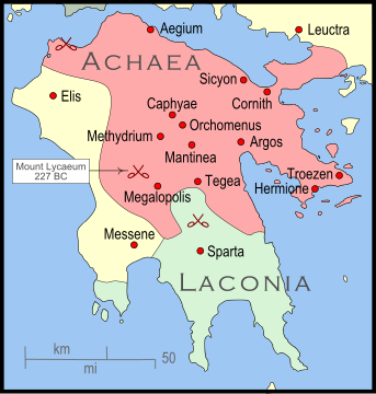
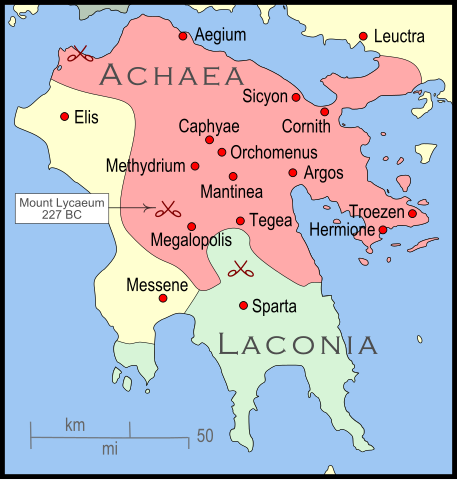
English: The Peleponnese (southernmost Greece) showing the larger powers and leagues at the time of the Cleomenean War (ca. 227 BC). The area in red shows the Achaean League. |
| Date | |
| Source | Own work |
| Author | MapMaster |
| Other versions |
[]
|


References
The map itself was built using a section of File:Greece map blank.svg. Towns were placed using geographic coordinates. There is some question where the ancient city of Messene was located. Maps (see "Greece under Theban Headship") place it well inland while the modern day Messene is close to the coast.
The borders of the various political entities were taken from several sources:
- Chamoux, François (2002) Hellenistic civilization, Wiley-Blackwell, ISBN 9780631222422, p. 206, for the Achaean League.
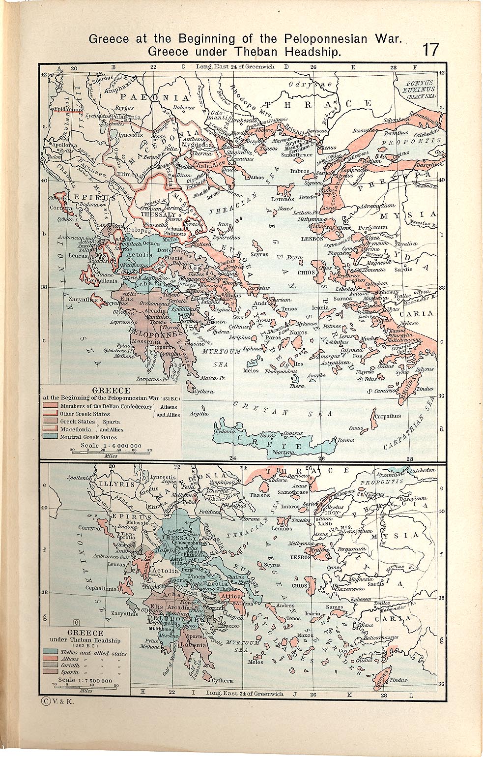
- Shepherd, William (1911) "Greece under Theban Headship", Historical Atlas, Henry Holt and Company. p. 17, was used as the primary reference for the Spartan borders. When there was a conflict with the Chamoux map, I used the Chamoux map.
Any additional information on borders and areas under control would be very welcome.
Similar maps

Licensing
I, the copyright holder of this work, hereby publish it under the following license:
This file is licensed under the Creative Commons Attribution-Share Alike 3.0 Unported license.
- You are free:
- to share – to copy, distribute and transmit the work
- to remix – to adapt the work
- Under the following conditions:
- attribution – You must give appropriate credit, provide a link to the license, and indicate if changes were made. You may do so in any reasonable manner, but not in any way that suggests the licensor endorses you or your use.
- share alike – If you remix, transform, or build upon the material, you must distribute your contributions under the same or compatible license as the original.
File history
Click on a date/time to view the file as it appeared at that time.
| Date/Time | Thumbnail | Dimensions | User | Comment | |
|---|---|---|---|---|---|
| current | 04:35, 12 January 2010 | | 343 × 360 (931 KB) | MapMaster | Added a few more cities and some clean-up |
| 05:46, 11 January 2010 |  | 343 × 360 (911 KB) | MapMaster | Changed town names to paths to properly render them | |
| 05:38, 11 January 2010 |  | 343 × 360 (825 KB) | MapMaster | {{Information |Description={{en|1=The Peleponnese (southernmost Greece) showing the larger powers and leagues at the time of the Cleomenean War (ca. 227 BC). The area in red shows the Achaean League.}} |Source={{own}} |Author=MapMaster |
File usage
The following pages on the English Wikipedia use this file (pages on other projects are not listed):
Global file usage
The following other wikis use this file:
- Usage on bg.wikipedia.org
- Usage on fr.wikipedia.org
- Usage on id.wikipedia.org
- Usage on ja.wikipedia.org
- Usage on nl.wikipedia.org
- Usage on vi.wikipedia.org