
File:Col du Galibier 090919.jpg
Size of this preview: 800 × 533 pixels. Other resolutions: 320 × 213 pixels | 640 × 427 pixels | 1,024 × 682 pixels | 1,280 × 853 pixels.
Original file (1,280 × 853 pixels, file size: 330 KB, MIME type: image/jpeg)
| This is a file from the Wikimedia Commons. Information from its description page there is shown below. Commons is a freely licensed media file repository. You can help. |
Summary
| Description |
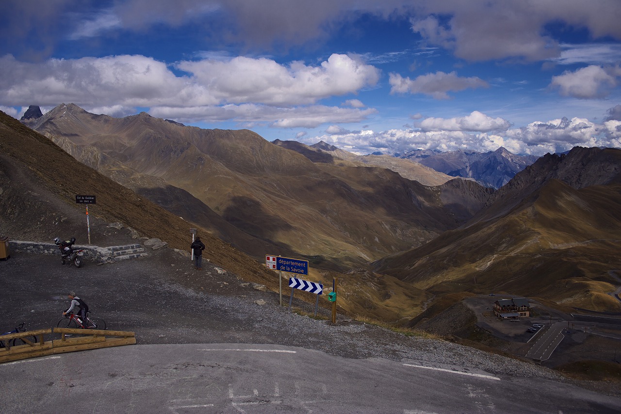
English: Col du Galibier (el. 2645 m.) is a mountain pass in the southern region of the French Dauphiné Alps near Grenoble. It is often the highest point of the Tour de France.
日本語: ガリビエ峠(ガリビエとうげ フランス語: Col du Galibier)とは、フランス・グルノーブル近郊にあるドーフィネ・アルプス南域に位置する、標高2645m地点の峠。 |
| Date | |
| Source | https://www.flickr.com/photos/43302713@N04/3992606626/ |
| Author | muneaki |
Licensing
I, the copyright holder of this work, hereby publish it under the following licenses:

|
Permission is granted to copy, distribute and/or modify this document under the terms of the GNU Free Documentation License, Version 1.2 or any later version published by the Free Software Foundation; with no Invariant Sections, no Front-Cover Texts, and no Back-Cover Texts. A copy of the license is included in the section entitled GNU Free Documentation License. |
This file is licensed under the Creative Commons Attribution-Share Alike 3.0 Unported, 2.5 Generic, 2.0 Generic and 1.0 Generic license.
- You are free:
- to share – to copy, distribute and transmit the work
- to remix – to adapt the work
- Under the following conditions:
- attribution – You must give appropriate credit, provide a link to the license, and indicate if changes were made. You may do so in any reasonable manner, but not in any way that suggests the licensor endorses you or your use.
- share alike – If you remix, transform, or build upon the material, you must distribute your contributions under the same or compatible license as the original.
You may select the license of your choice.
File history
Click on a date/time to view the file as it appeared at that time.
| Date/Time | Thumbnail | Dimensions | User | Comment | |
|---|---|---|---|---|---|
| current | 09:58, 24 October 2009 | | 1,280 × 853 (330 KB) | Muneaki | {{Information |Description={{en|1=Col du Galibier (el. 2645 m.) is a mountain pass in the southern region of the French Dauphiné Alps near Grenoble. It is often the highest point of the Tour de France. http://www.flickr.com/photos/43302713@N04/3997405874 |
File usage
The following pages on the English Wikipedia use this file (pages on other projects are not listed):
Global file usage
The following other wikis use this file:
- Usage on de.wikipedia.org
- Usage on fr.wikipedia.org
- Usage on ja.wikipedia.org