
File:Colorado.png
Size of this preview: 779 × 600 pixels. Other resolutions: 312 × 240 pixels | 623 × 480 pixels | 997 × 768 pixels | 1,066 × 821 pixels.
Original file (1,066 × 821 pixels, file size: 426 KB, MIME type: image/png)
| This is a file from the Wikimedia Commons. Information from its description page there is shown below. Commons is a freely licensed media file repository. You can help. |
Summary
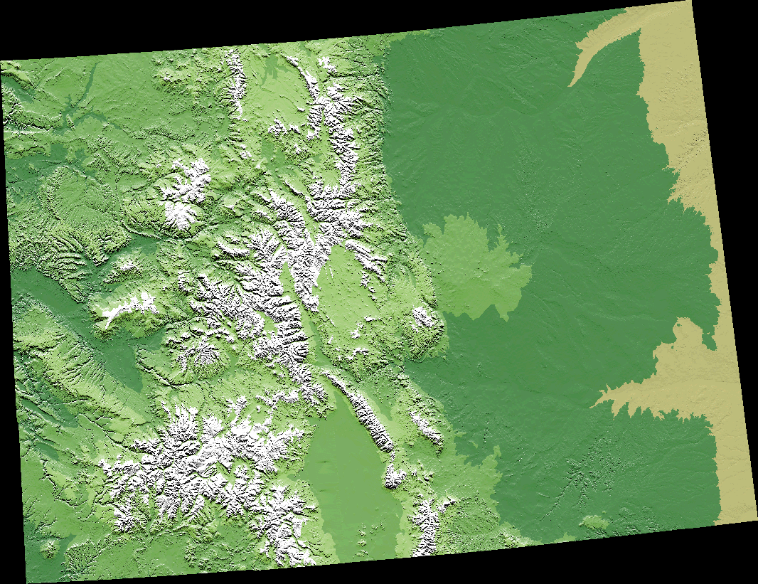
A digital elevation model (DEM) map of Colorado.
The map is from [1] archive copy at the Wayback Machine, specifically Colorado.gif archive copy at the Wayback Machine.
Licensing
This image is in the public domain in the United States because it only contains materials that originally came from the United States Geological Survey, an agency of the United States Department of the Interior. For more information, see the official USGS copyright policy.
|
File history
Click on a date/time to view the file as it appeared at that time.
| Date/Time | Thumbnail | Dimensions | User | Comment | |
|---|---|---|---|---|---|
| current | 00:02, 11 September 2005 | | 1,066 × 821 (426 KB) | Dbenbenn | from http://wwwflag.wr.usgs.gov/USGSFlag/Data/maps/ColoradoDEM.html, PD |
File usage
The following pages on the English Wikipedia use this file (pages on other projects are not listed):
Global file usage
The following other wikis use this file:
- Usage on de.wikipedia.org
- Usage on es.wikipedia.org
- Usage on fo.wikipedia.org
- Usage on fr.wikipedia.org
- Usage on he.wikipedia.org
- Usage on it.wikipedia.org
- Usage on ja.wikipedia.org
- Usage on la.wikipedia.org
- Usage on new.wikipedia.org
- एकर्स ग्रीन, कोलोर्याडो
- अगुलियार, कोलोर्याडो
- एअर फोर्स एकेडेमी, कोलोर्याडो
- एक्रोन, कोलोर्याडो
- एलामोजा, कोलोर्याडो
- एलामोजा इस्ट, कोलोर्याडो
- एलेनस्पार्क, कोलोर्याडो
- एल्मा, कोलोर्याडो
- एन्टोनियो, कोलोर्याडो
- एप्पलवूड, कोलोर्याडो
- आर्बोलेस, कोलोर्याडो
- एरिस्टोक्र्याट र्र्यान्चेट्स, कोलोर्याडो
- अरिबा, कोलोर्याडो
- अर्भादा, कोलोर्याडो
- एस्पेन, कोलोर्याडो
- एस्पेन पार्क, कोलोर्याडो
- एट्वूड, कोलोर्याडो
- औल्ट, कोलोर्याडो
- औरोरा, कोलोर्याडो
- एभोन, कोलोर्याडो
- एभोनडेल, कोलोर्याडो
- बसाल्ट, कोलोर्याडो
- ब्याटलमेन्ट मेसा, कोलोर्याडो
- बेफिल्ड, कोलोर्याडो
- बेनेट, कोलोर्याडो
- बर्क्ली, कोलोर्याडो
- बर्थोड, कोलोर्याडो
- बेथुएन, कोलोर्याडो
- बेउलाः भ्याली, कोलोर्याडो
- ब्ल्याक फरेस्ट, कोलोर्याडो
- ब्ल्याक हक, कोलोर्याडो
- ब्लांका, कोलोर्याडो
- ब्लु रिभर, कोलोर्याडो
- बोन्यांजा, कोलोर्याडो
- बून, कोलोर्याडो
- बाउल्डर, कोलोर्याडो
- बो मार, कोलोर्याडो
- ब्र्यान्सन, कोलोर्याडो
- ब्रेकेनरिज, कोलोर्याडो
- ब्राइटन, कोलोर्याडो
- ब्रूकसाइड, कोलोर्याडो
- ब्रूमफिल्ड, कोलोर्याडो
View more global usage of this file.