
File:Corbin Bridge.jpg
Size of this preview: 800 × 550 pixels. Other resolutions: 320 × 220 pixels | 640 × 440 pixels | 1,024 × 704 pixels | 1,280 × 880 pixels | 2,560 × 1,759 pixels | 4,673 × 3,211 pixels.
Original file (4,673 × 3,211 pixels, file size: 2.62 MB, MIME type: image/jpeg)
| This is a file from the Wikimedia Commons. Information from its description page there is shown below. Commons is a freely licensed media file repository. You can help. |
|
This is an image of a place or building that is listed on the National Register of Historic Places in the United States of America. Its reference number is 90000402. |
| Camera location | | View this and other nearby images on: OpenStreetMap |
|---|
| Description |
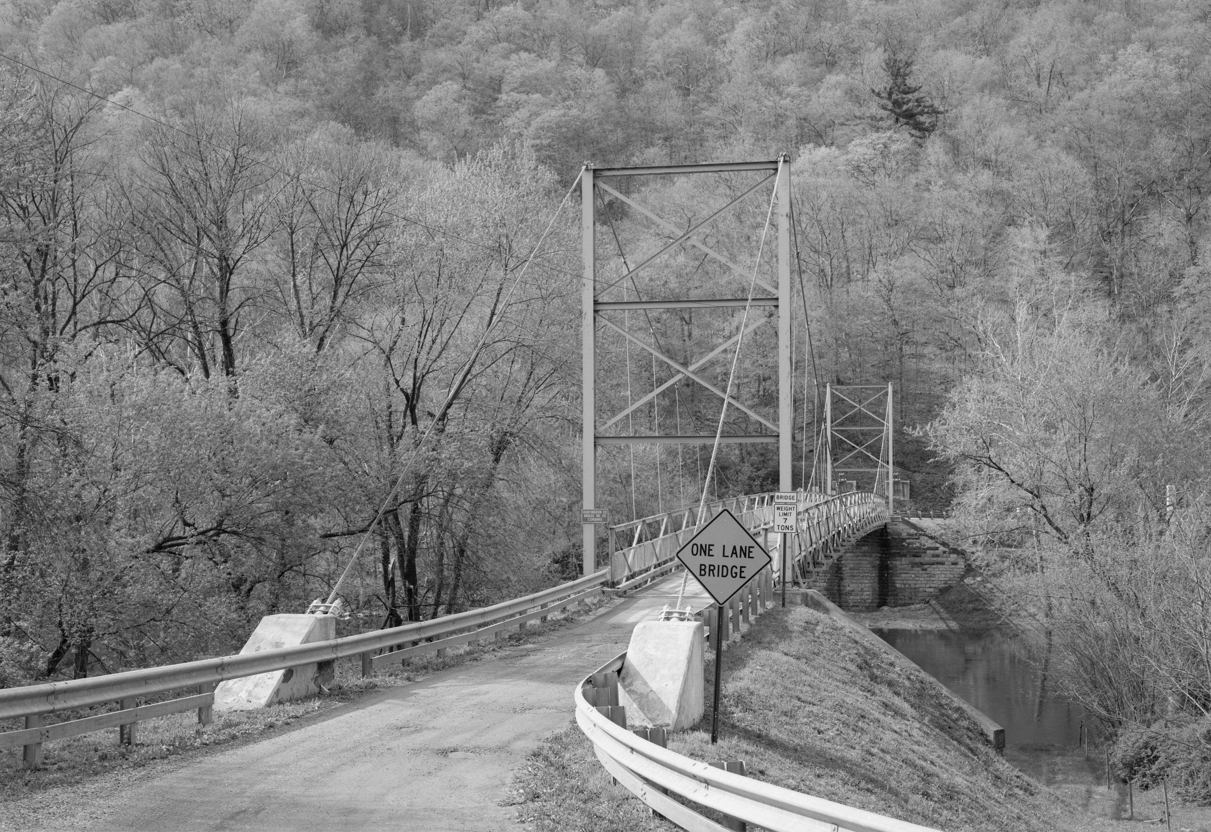
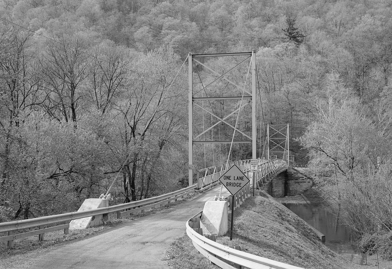
English: Eastern end of the Corbin Bridge, which carries Township Road 428 over the Raystown Branch Juniata River southwest of Huntingdon in Juniata Township, Huntingdon County, Pennsylvania, United States. Built in 1937, this suspension bridge is listed on the National Register of Historic Places. |
|||||||||||||||||||||||
| Date | ||||||||||||||||||||||||
| Source | Library of Congress, Prints and Photograph Division HAER: PA,31-HUDO.V,1-1 | |||||||||||||||||||||||
| Author |
|
|||||||||||||||||||||||
| Permission (Reusing this file) |
|
|||||||||||||||||||||||
.jpg)

|
This image is available from the United States Library of Congress's Prints and Photographs division
under the digital ID hhh.pa2739. This tag does not indicate the copyright status of the attached work. A normal copyright tag is still required. See Commons:Licensing.
|
File history
Click on a date/time to view the file as it appeared at that time.
| Date/Time | Thumbnail | Dimensions | User | Comment | |
|---|---|---|---|---|---|
| current | 15:26, 20 December 2009 | | 4,673 × 3,211 (2.62 MB) | Nyttend | {{Location|40|27|16|N|77|59|0|W}} {{Information |Description={{en|Eastern end of the {{w|Corbin Bridge}}, which carries Township Road 428 over the {{w|Raystown Branch Juniata River}} southwest of {{w|Huntingdon, Pennsylvania|Huntingdon}} in {{w|Juniata To |
File usage
The following pages on the English Wikipedia use this file (pages on other projects are not listed):
Global file usage
The following other wikis use this file:
- Usage on tl.wikipedia.org
- Usage on www.wikidata.org