
File:CotatiCensusMap76485024.png
No higher resolution available.
CotatiCensusMap76485024.png (575 × 425 pixels, file size: 49 KB, MIME type: image/png)
| This is a file from the Wikimedia Commons. Information from its description page there is shown below. Commons is a freely licensed media file repository. You can help. |
Summary
| Description | |
| Date | |
| Source | http://factfinder.census.gov/ using geography search with parameters: program=Census 2000, restrict=all, name=Cotati. |
| Author | United States Census Bureau |
| Permission (Reusing this file) |
Public domain |
Licensing
This image or file is a work of a United States Census Bureau employee, taken or made as part of that person's official duties. As a work of the U.S. federal government, the image is in the public domain.
|
 |
Original upload log
The original description page was here. All following user names refer to en.wikipedia.
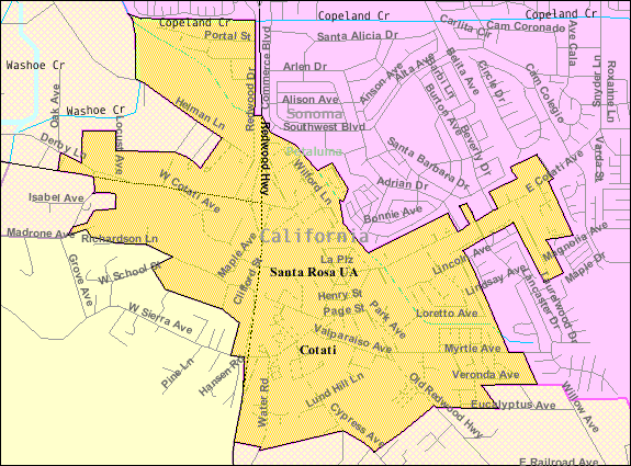
- 2007-12-04 00:04 Stepheng3 575×425× (53758 bytes) Census 2000 map of [[Cotati, California]] showing boundaries and major streets. Downloaded from http://factfinder.census.gov/leg2/24/76485024.gif on December 3, 2007. Found on factfinder.census.gov using geography search with parameters: program=Census 20
Original upload log
| Date/Time | Dimensions | User | Comment |
|---|---|---|---|
| 8 September 2009, 20:39:25 | 575 × 425 (53758 bytes) | Optigan13 (talk · contribs) | {{Information |Description={{en|[[:en:U.S. Census 2000|]] reference map for [[:en:Cotati, California|]]}} |Source=Transferred from [http://en.wikipedia.org en.wikipedia]<br/> (Original text : ''http://factfinder.census.gov/ using geography search with par |
File history
Click on a date/time to view the file as it appeared at that time.
| Date/Time | Thumbnail | Dimensions | User | Comment | |
|---|---|---|---|---|---|
| current | 12:45, 3 December 2014 | | 575 × 425 (49 KB) | GifTagger | Bot: Converting file to superior PNG file. (Source: CotatiCensusMap76485024.gif). This GIF was problematic due to non-greyscale color table. |
File usage
The following pages on the English Wikipedia use this file (pages on other projects are not listed):
Global file usage
The following other wikis use this file:
- Usage on fa.wikipedia.org
- Usage on ml.wikipedia.org
- Usage on ur.wikipedia.org