
File:Coxhoe railway station (site), County Durham (geograph 6853187).jpg
Size of this preview: 800 × 600 pixels. Other resolutions: 320 × 240 pixels | 640 × 480 pixels | 1,024 × 767 pixels | 1,280 × 959 pixels | 1,600 × 1,199 pixels.
Original file (1,600 × 1,199 pixels, file size: 633 KB, MIME type: image/jpeg)
| This is a file from the Wikimedia Commons. Information from its description page there is shown below. Commons is a freely licensed media file repository. You can help. |
,_County_Durham_(geograph_6853187).jpg)
Summary
| Description |
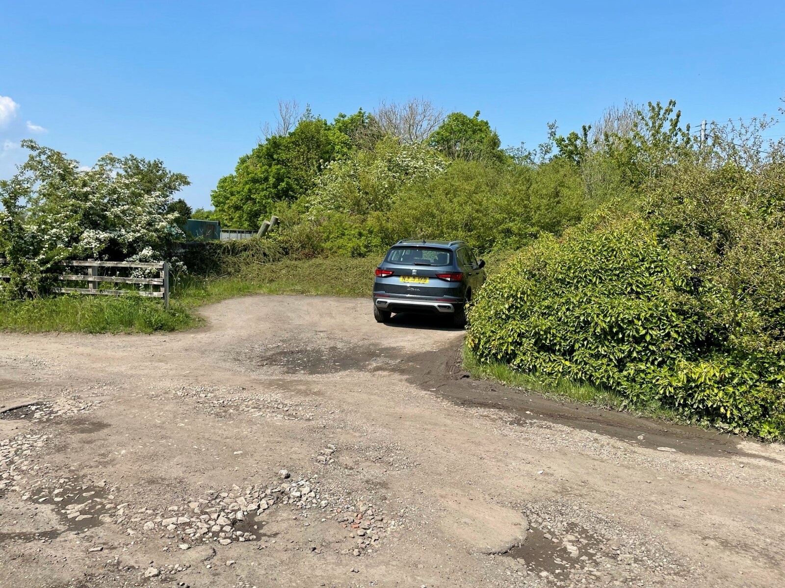
English: Coxhoe railway station (site), County Durham Opened in 1838 by the Clarence Railway, later part of the North Eastern Railway, as the terminus of its line from Stockton, this tiny station closed to passengers in 1902 and completely in 1966. View north, towards a level crossing, the gates of which were still there when this image was taken but were hidden by shrubs. The wall at the back of (what was a very low) single platform is still there, beyond the fence on the left. The former goods shed, behind the camera position, was also still extant. |
| Date | |
| Source | From geograph.org.uk |
| Author | Nigel Thompson |
| Permission (Reusing this file) |
Creative Commons Attribution Share-alike license 2.0 |
| Attribution (required by the license) | Nigel Thompson / Coxhoe railway station (site), County Durham / |
| Camera location | | View this and other nearby images on: OpenStreetMap |
|---|
,_County_Durham_(geograph_6853187).jpg¶ms=054.719801_N_-001.508159_E_globe:Earth_type:camera_source:geograph-osgb36(NZ31783620)_heading:0.00&language=en)
| Object location | | View this and other nearby images on: OpenStreetMap |
|---|
,_County_Durham_(geograph_6853187).jpg¶ms=054.720070_N_-001.508160_E_globe:Earth_class:object_type:object_source:geograph-osgb36(NZ31783623)_heading:0.00&language=en)
Licensing

|
This image was taken from the Geograph project collection. See this photograph's page on the Geograph website for the photographer's contact details. The copyright on this image is owned by Nigel Thompson and is licensed for reuse under the Creative Commons Attribution-ShareAlike 2.0 license.
|
This file is licensed under the Creative Commons Attribution-Share Alike 2.0 Generic license.
Attribution: Nigel Thompson
- You are free:
- to share – to copy, distribute and transmit the work
- to remix – to adapt the work
- Under the following conditions:
- attribution – You must give appropriate credit, provide a link to the license, and indicate if changes were made. You may do so in any reasonable manner, but not in any way that suggests the licensor endorses you or your use.
- share alike – If you remix, transform, or build upon the material, you must distribute your contributions under the same or compatible license as the original.
File history
Click on a date/time to view the file as it appeared at that time.
| Date/Time | Thumbnail | Dimensions | User | Comment | |
|---|---|---|---|---|---|
| current | 11:52, 16 November 2021 | | 1,600 × 1,199 (633 KB) | Lamberhurst | == {{int:filedesc}} == {{Information |Description={{en|1=<b>Coxhoe railway station (site), County Durham</b><br>Opened in 1838 by the Clarence Railway, later part of the North Eastern Railway, as the terminus of its line from Stockton, this tiny station closed to passengers in 1902 and completely in 1966. View north, towards a level crossing, the gates of which were still there when this image was taken but were hidden by shrubs. The wall at the back of (what was a very low) single platform i... |
File usage
The following pages on the English Wikipedia use this file (pages on other projects are not listed):
,_County_Durham_(geograph_6853187).jpg)