
File:DIOMEDE BRIDGE MAP.jpg
Size of this preview: 800 × 566 pixels. Other resolutions: 320 × 226 pixels | 640 × 452 pixels | 1,024 × 724 pixels | 1,280 × 905 pixels | 2,560 × 1,810 pixels | 3,508 × 2,480 pixels.
Original file (3,508 × 2,480 pixels, file size: 1.43 MB, MIME type: image/jpeg)
| This is a file from the Wikimedia Commons. Information from its description page there is shown below. Commons is a freely licensed media file repository. You can help. |
Summary
| Description |
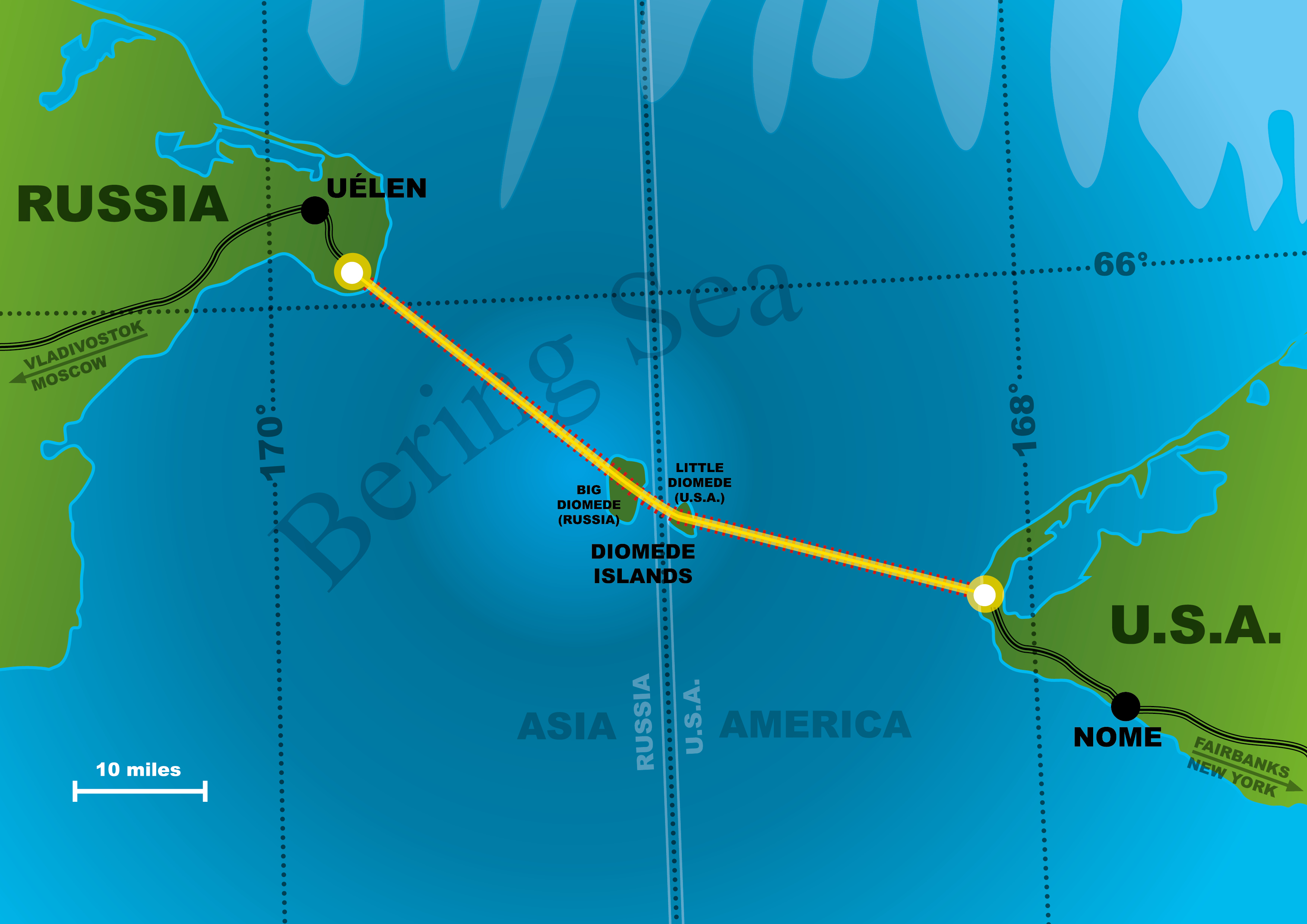
Italiano: Possibile tracciato del ponte sullo stretto di Bering |
| Date | |
| Source | Own work |
| Author | Enryonthecloud |
Licensing
| I, the copyright holder of this work, release this work into the public domain. This applies worldwide. In some countries this may not be legally possible; if so: I grant anyone the right to use this work for any purpose, without any conditions, unless such conditions are required by law. |
File history
Click on a date/time to view the file as it appeared at that time.
| Date/Time | Thumbnail | Dimensions | User | Comment | |
|---|---|---|---|---|---|
| current | 14:05, 28 July 2017 | | 3,508 × 2,480 (1.43 MB) | Enryonthecloud | {{Informazioni file |Descrizione = Possibile tracciato del ponte sullo stretto di Bering |Fonte = opera propria |Data = luglio 2017 |Autore = Enryonthecloud |Licenza = vedi sotto |Detentore copyright = vedi sotto |EDP = |Altre versioni = }} |
File usage
No pages on the English Wikipedia use this file (pages on other projects are not listed).
Global file usage
The following other wikis use this file:
- Usage on de.wikipedia.org
- Usage on frr.wikipedia.org
- Usage on it.wikipedia.org