
File:DR Congo-Rwanda bilateral map.png

Size of this preview: 800 × 406 pixels. Other resolutions: 320 × 162 pixels | 640 × 325 pixels | 1,024 × 520 pixels | 1,280 × 649 pixels | 2,560 × 1,299 pixels | 4,845 × 2,458 pixels.
Original file (4,845 × 2,458 pixels, file size: 418 KB, MIME type: image/png)
| This is a file from the Wikimedia Commons. Information from its description page there is shown below. Commons is a freely licensed media file repository. You can help. |
Summary
| Description |
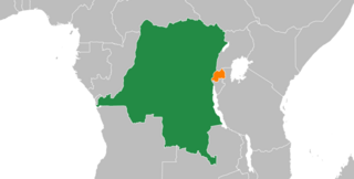
English: Democratic Republic of the Congo–Rwanda relations |
| Date | |
| Source | https://www.mapchart.net/ |
| Author | MapChart |
Licensing
| This map was created for free at MapChart.net. All maps created there are licensed under the Creative Commons Attribution-ShareAlike 4.0 International License. See the "Licensing" link on the home page, or the MapChart.net feedback page for the image license info, and this MapChart.net Commons discussion. Use {{Mapchart.net}} to provide attribution for maps created with that service.
See also: Other maps on Commons created with Mapchart.net: Category:Mapchart.net and this search query; other map and chart resources. |
I, the copyright holder of this work, hereby publish it under the following license:
This file is licensed under the Creative Commons Attribution-Share Alike 4.0 International license.
- You are free:
- to share – to copy, distribute and transmit the work
- to remix – to adapt the work
- Under the following conditions:
- attribution – You must give appropriate credit, provide a link to the license, and indicate if changes were made. You may do so in any reasonable manner, but not in any way that suggests the licensor endorses you or your use.
- share alike – If you remix, transform, or build upon the material, you must distribute your contributions under the same or compatible license as the original.
File history
Click on a date/time to view the file as it appeared at that time.
| Date/Time | Thumbnail | Dimensions | User | Comment | |
|---|---|---|---|---|---|
| current | 00:37, 9 December 2023 | | 4,845 × 2,458 (418 KB) | XTheBedrockX | Cropped 20 % horizontally, 21 % vertically using CropTool with lossless mode. |
| 00:33, 9 December 2023 |  | 6,056 × 3,112 (573 KB) | XTheBedrockX | Uploaded a work by MapChart from https://www.mapchart.net/ with UploadWizard |
File usage
The following pages on the English Wikipedia use this file (pages on other projects are not listed):
Global file usage
The following other wikis use this file:
- Usage on www.wikidata.org