
File:Deutschland Naturraeumliche Grossregionen.png
Size of this preview: 472 × 599 pixels. Other resolutions: 189 × 240 pixels | 378 × 480 pixels | 605 × 768 pixels | 807 × 1,024 pixels | 1,826 × 2,318 pixels.
Original file (1,826 × 2,318 pixels, file size: 5.4 MB, MIME type: image/png)
| This is a file from the Wikimedia Commons. Information from its description page there is shown below. Commons is a freely licensed media file repository. You can help. |
Summary
| Description |
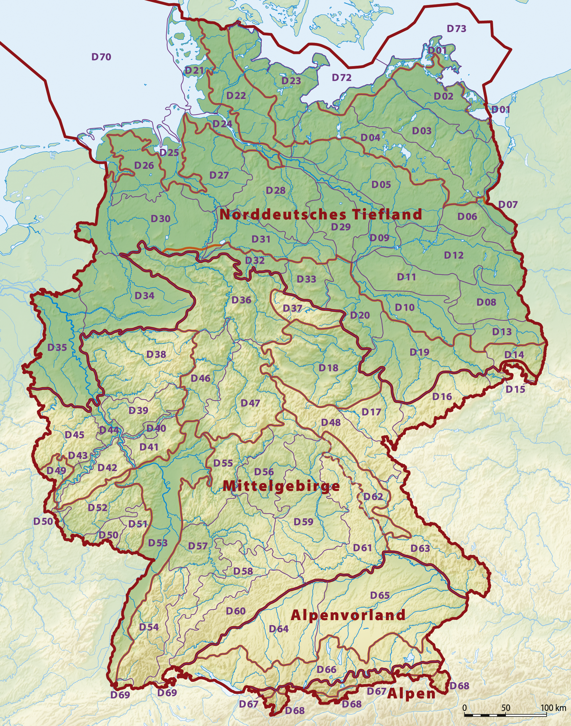
Deutsch: Karte der Naturräumlichen Großregionen Deutschlands; Großregionen 3. Ordnung nach dem System des Bundesamtes für Naturschutz (BfN).
|
| Date | 11-06-2008 |
| Source |
self-made, using
|
| Author | NordNordWest, shading by Lencer |
| Other versions |
Derivative works of this file: Relief Map of Germany, Black Forest.png
|


|
This map has been made or improved in the German Kartenwerkstatt (Map Lab). You can propose maps to improve as well.
|
Licensing
I, the copyright holder of this work, hereby publish it under the following licenses:

|
Permission is granted to copy, distribute and/or modify this document under the terms of the GNU Free Documentation License, Version 1.2 or any later version published by the Free Software Foundation; with no Invariant Sections, no Front-Cover Texts, and no Back-Cover Texts. A copy of the license is included in the section entitled GNU Free Documentation License. |
This file is licensed under the Creative Commons Attribution-Share Alike 3.0 Unported license.
- You are free:
- to share – to copy, distribute and transmit the work
- to remix – to adapt the work
- Under the following conditions:
- attribution – You must give appropriate credit, provide a link to the license, and indicate if changes were made. You may do so in any reasonable manner, but not in any way that suggests the licensor endorses you or your use.
- share alike – If you remix, transform, or build upon the material, you must distribute your contributions under the same or compatible license as the original.
You may select the license of your choice.
File history
Click on a date/time to view the file as it appeared at that time.
| Date/Time | Thumbnail | Dimensions | User | Comment | |
|---|---|---|---|---|---|
| current | 17:01, 29 September 2011 | | 1,826 × 2,318 (5.4 MB) | NordNordWest | upd |
| 18:51, 22 September 2011 |  | 1,826 × 2,318 (5.38 MB) | NordNordWest | ergänzt | |
| 18:57, 14 September 2011 |  | 1,826 × 2,318 (5.36 MB) | NordNordWest | update | |
| 10:16, 12 June 2008 |  | 1,980 × 2,322 (5.64 MB) | NordNordWest | ||
| 09:03, 12 June 2008 |  | 1,979 × 2,322 (5.49 MB) | NordNordWest | ||
| 19:04, 11 June 2008 |  | 1,979 × 2,321 (5.5 MB) | NordNordWest | == Beschreibung == {{Information |Description= {{de|Karte der Naturräumlichen Haupteinheiten Deutschlands nach dem System des Bundesamtes für Naturschutz (BfN)}} |So |
File usage
No pages on the English Wikipedia use this file (pages on other projects are not listed).
Global file usage
The following other wikis use this file:
- Usage on cs.wikipedia.org
- Usage on de.wikipedia.org
- Karte (Kartografie)
- Physische Karte
- Wikipedia:Kartenwerkstatt/Archiv/2008-06
- Diskussion:Naturräumliche Großregionen Deutschlands
- Benutzer Diskussion:Kjunix/Archiv 2009
- Benutzer:Frze
- Vorlage:Positionskarte Deutschland Naturräumliche Grossregionen
- Vorlage Diskussion:Positionskarte Deutschland Naturräumliche Grossregionen
- Usage on es.wikipedia.org
- Usage on hu.wikipedia.org
- Usage on nds.wikipedia.org