
File:East-West-Divide-peaks-20171121-014.jpg
Size of this preview: 799 × 600 pixels. Other resolutions: 320 × 240 pixels | 640 × 480 pixels | 1,023 × 768 pixels | 1,280 × 961 pixels | 2,560 × 1,921 pixels | 4,008 × 3,008 pixels.
Original file (4,008 × 3,008 pixels, file size: 3.66 MB, MIME type: image/jpeg)
| This is a file from the Wikimedia Commons. Information from its description page there is shown below. Commons is a freely licensed media file repository. You can help. |
Summary
| Description |
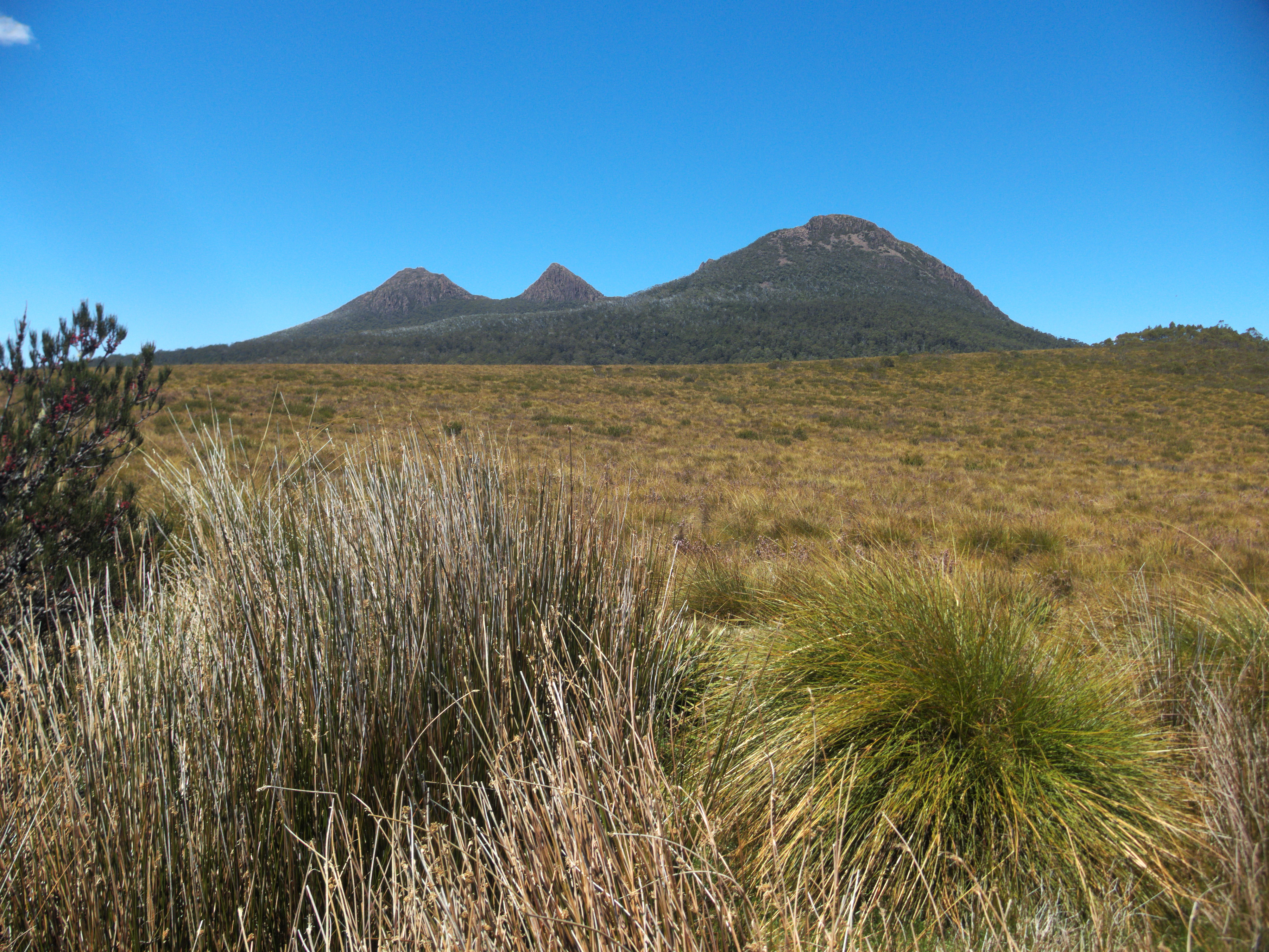
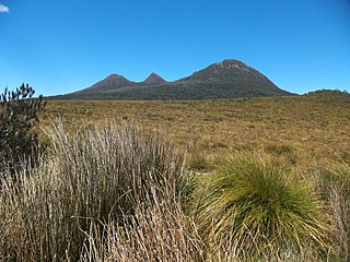
English: View south-east from the East-West Divide / King William Saddle parking area on the Lyell Highway, Tasmania. Buttongrass plain looking towards three mountain peaks of the King William Range, from left: Mount King William I, Milligans Peak, and Mount Pitt ([1] confirms the mountain identification). |
| Date | 21 November 2017, 13:01 +11:00 |
| Source | Own work |
| Author | Gary Houston |
| Camera location | | View this and other nearby images on: OpenStreetMap |
|---|
Licensing
I, the copyright holder of this work, hereby publish it under the following license:
| This file is made available under the Creative Commons CC0 1.0 Universal Public Domain Dedication. | |
| The person who associated a work with this deed has dedicated the work to the public domain by waiving all of their rights to the work worldwide under copyright law, including all related and neighboring rights, to the extent allowed by law. You can copy, modify, distribute and perform the work, even for commercial purposes, all without asking permission.
|
File history
Click on a date/time to view the file as it appeared at that time.
| Date/Time | Thumbnail | Dimensions | User | Comment | |
|---|---|---|---|---|---|
| current | 06:36, 13 December 2017 | | 4,008 × 3,008 (3.66 MB) | Ghouston | User created page with UploadWizard |
File usage
The following pages on the English Wikipedia use this file (pages on other projects are not listed):
Global file usage
The following other wikis use this file:
- Usage on arz.wikipedia.org
- Usage on ceb.wikipedia.org
- Usage on el.wikipedia.org
- Usage on www.wikidata.org