
File:East Washington Island, Wisconsin, aerial July 2, 2015.jpg
Size of this preview: 437 × 599 pixels. Other resolutions: 175 × 240 pixels | 350 × 480 pixels | 560 × 768 pixels | 747 × 1,024 pixels | 1,494 × 2,048 pixels | 5,512 × 7,555 pixels.
Original file (5,512 × 7,555 pixels, file size: 44.98 MB, MIME type: image/jpeg)
| This is a file from the Wikimedia Commons. Information from its description page there is shown below. Commons is a freely licensed media file repository. You can help. |
| Description |
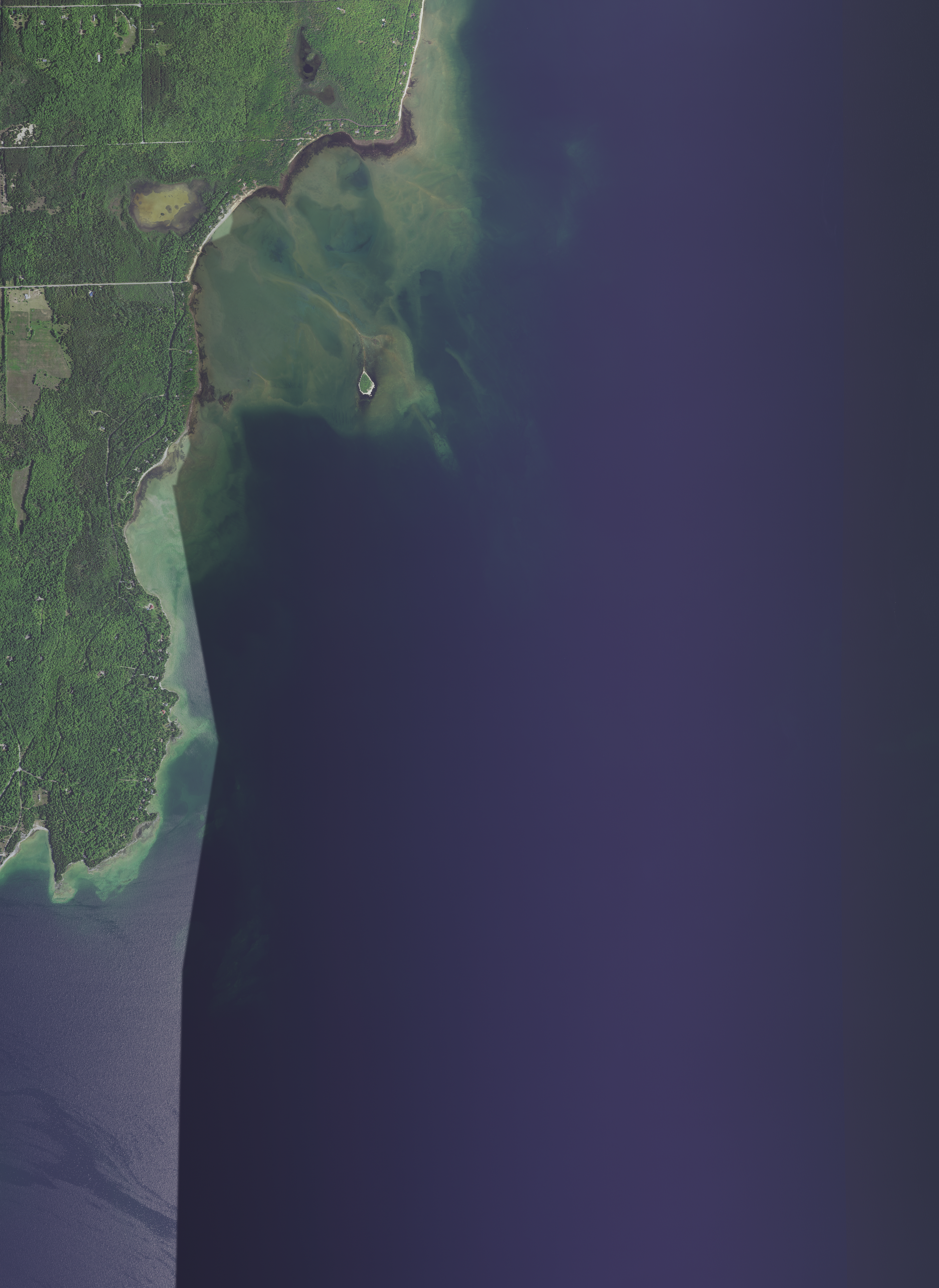
English: Hog Island, Wisconsin and part of the eastern shore of Washington Island, Wisconsin, taken July 2, 2015,
|
|||
| Date | ||||
| Source | converted to .jpg Epiphyllumlover from the original .tif available as item m_4508642_nw_16_1_20150702 on EarthExplorer | |||
| Author | Aerial Photography Field Office (APFO) for NAIP, USGS | |||
| Permission (Reusing this file) |
|
File history
Click on a date/time to view the file as it appeared at that time.
| Date/Time | Thumbnail | Dimensions | User | Comment | |
|---|---|---|---|---|---|
| current | 05:39, 29 November 2021 | | 5,512 × 7,555 (44.98 MB) | Epiphyllumlover | c:User:Rillke/bigChunkedUpload.js: {{Information | Description = {{en|Hog Island, Wisconsin and part of the eastern shore of Washington Island, Wisconsin, taken July 2, 2015, *West_Bounding_Coordinate: -86.8750 *East_Bounding_Coordinate: -86.8125 *North_Bounding_Coordinate: 45.3750 *South_Bounding_Coordinate: 45.3125}} | Date = July 2, 2015 | Source = converted to .jpg Epiphyllumlover from the original .tif available as item m_45... |
File usage
The following pages on the English Wikipedia use this file (pages on other projects are not listed):