
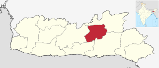
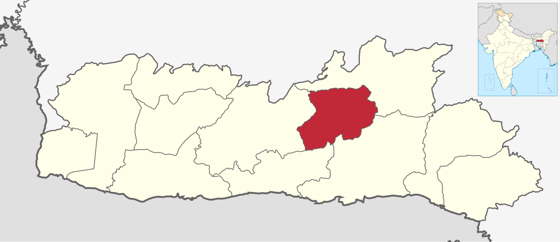
File:Eastern West Khasi Hills in Meghalaya (India).svg

Size of this PNG preview of this SVG file: 800 × 345 pixels. Other resolutions: 320 × 138 pixels | 640 × 276 pixels | 1,024 × 442 pixels | 1,280 × 552 pixels | 2,560 × 1,104 pixels | 1,152 × 497 pixels.
Original file (SVG file, nominally 1,152 × 497 pixels, file size: 418 KB)
| This is a file from the Wikimedia Commons. Information from its description page there is shown below. Commons is a freely licensed media file repository. You can help. |
.svg)
Summary
| Description |
English: Map of Eastern West Khasi Hills district of Meghalaya |
| Date | |
| Source | Derivative of File:India Meghalaya location map.svg |
| Author | Own work based on user:Milenioscuro |
Licensing
This file is licensed under the Creative Commons Attribution-Share Alike 3.0 Unported license.
- You are free:
- to share – to copy, distribute and transmit the work
- to remix – to adapt the work
- Under the following conditions:
- attribution – You must give appropriate credit, provide a link to the license, and indicate if changes were made. You may do so in any reasonable manner, but not in any way that suggests the licensor endorses you or your use.
- share alike – If you remix, transform, or build upon the material, you must distribute your contributions under the same or compatible license as the original.
File history
Click on a date/time to view the file as it appeared at that time.
| Date/Time | Thumbnail | Dimensions | User | Comment | |
|---|---|---|---|---|---|
| current | 04:40, 2 May 2022 | | 1,152 × 497 (418 KB) | C1MM | Uploaded a work by Own work based on user:Milenioscuro from Derivative of File:India Meghalaya location map.svg with UploadWizard |
File usage
The following pages on the English Wikipedia use this file (pages on other projects are not listed):
Global file usage
The following other wikis use this file:
- Usage on de.wikipedia.org
- Usage on te.wikipedia.org
- Usage on ur.wikipedia.org
.svg)