
File:Eng ttw all blue 300px labels.png
Size of this preview: 646 × 600 pixels. Other resolutions: 258 × 240 pixels | 517 × 480 pixels | 827 × 768 pixels | 1,103 × 1,024 pixels | 2,227 × 2,068 pixels.
Original file (2,227 × 2,068 pixels, file size: 1.79 MB, MIME type: image/png)
| This is a file from the Wikimedia Commons. Information from its description page there is shown below. Commons is a freely licensed media file repository. You can help. |
Summary
| Description |
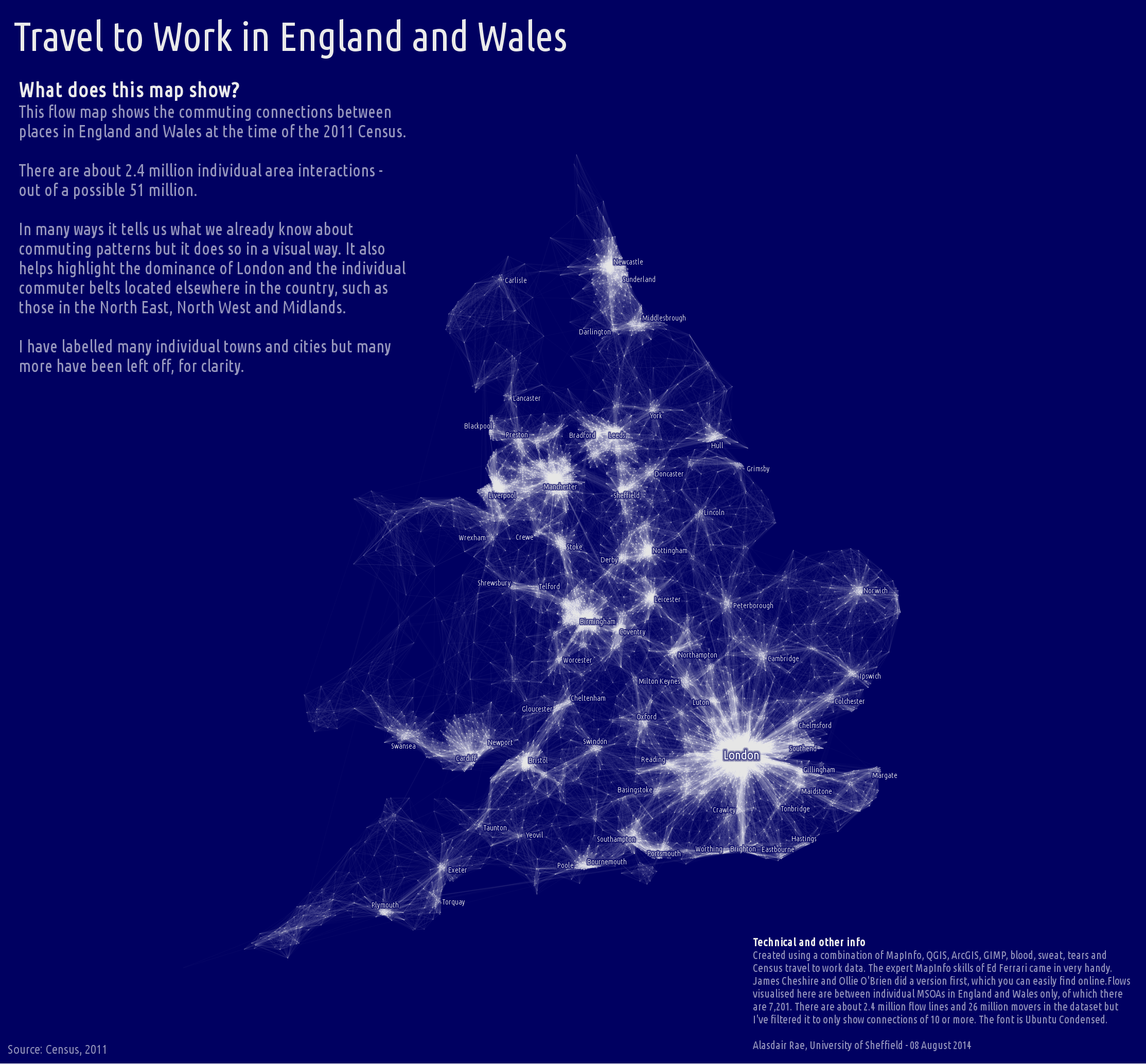
English: England & Wales Travel To Work flow map based on 2011 data
created by: Alasdair Rae with inputs from Ed Ferrari from: https://twitter.com/undertheraedar/status/497762570951200768 methodology: http://www.undertheraedar.com/2015/10/glowing-lines-in-qgis.html |
| Date | |
| Source | http://ajrae.staff.shef.ac.uk/img/eng_ttw_all_blue_300px_labels.png |
| Author | Alasdair Rae |
Licensing

|
Alasdair Rae, the copyright holder of this work, allows anyone to use it for any purpose including unrestricted redistribution, commercial use, and modification.
|
File history
Click on a date/time to view the file as it appeared at that time.
| Date/Time | Thumbnail | Dimensions | User | Comment | |
|---|---|---|---|---|---|
| current | 14:35, 30 August 2019 | | 2,227 × 2,068 (1.79 MB) | J mareeswaran | User created page with UploadWizard |
File usage
The following pages on the English Wikipedia use this file (pages on other projects are not listed):
Global file usage
The following other wikis use this file:
- Usage on de.wikipedia.org