
File:Evoluzione metropolitana di Milano (2022).gif
Size of this preview: 800 × 490 pixels. Other resolutions: 320 × 196 pixels | 640 × 392 pixels | 1,200 × 735 pixels.
Original file (1,200 × 735 pixels, file size: 773 KB, MIME type: image/gif, looped, 26 frames, 39 s)
| This is a file from the Wikimedia Commons. Information from its description page there is shown below. Commons is a freely licensed media file repository. You can help. |
.gif)
Summary
| Description |
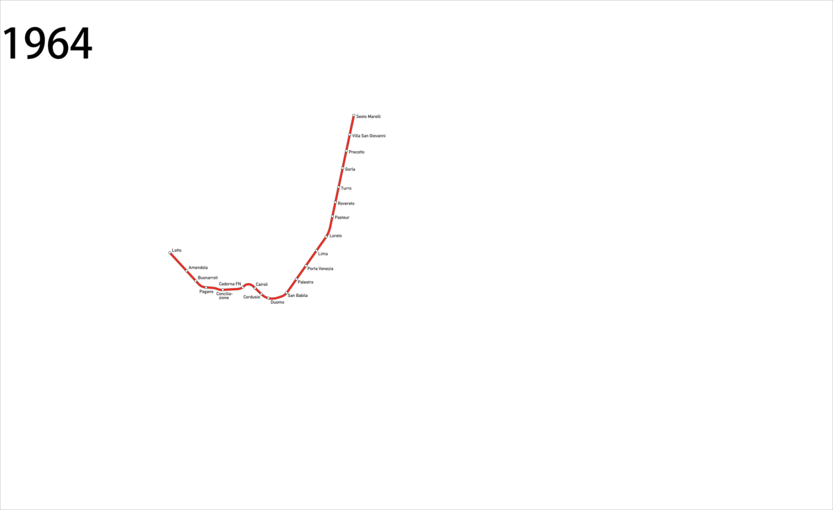
Italiano: Mappa geografica animata della metropolitana di Milano, dal 1964. Aggiornata al 26-11-2022 con l'apertura del tratto M4 Dateo-Linate |
| Date | |
| Source |
This file was derived from: Evoluzione metropolitana di Milano (2015).gif: This file was derived from: Milano - mappa rete metropolitana (geografica).svg: |
| Author |
.gif)
.svg)
| This is a retouched picture, which means that it has been digitally altered from its original version. Modifications: Aggiunta tratta Dateo-Linate (26-11-2022). The original can be viewed here: Evoluzione metropolitana di Milano (2015).gif:
|
Licensing
I, the copyright holder of this work, hereby publish it under the following license:
This file is licensed under the Creative Commons Attribution-Share Alike 4.0 International license.
- You are free:
- to share – to copy, distribute and transmit the work
- to remix – to adapt the work
- Under the following conditions:
- attribution – You must give appropriate credit, provide a link to the license, and indicate if changes were made. You may do so in any reasonable manner, but not in any way that suggests the licensor endorses you or your use.
- share alike – If you remix, transform, or build upon the material, you must distribute your contributions under the same or compatible license as the original.
Original upload log
This image is a derivative work of the following images:
- File:Evoluzione metropolitana di Milano.gif licensed with Cc-by-sa-4.0
- 2020-11-20T17:32:36Z Emanuele Lorenzo Corti 1200x735 (710962 Bytes) Uploaded own work with UploadWizard
Uploaded with derivativeFX
File history
Click on a date/time to view the file as it appeared at that time.
| Date/Time | Thumbnail | Dimensions | User | Comment | |
|---|---|---|---|---|---|
| current | 17:20, 8 September 2023 | | 1,200 × 735 (773 KB) | Arrow303 | Aggiornamento (Dateo-San Babila) |
| 19:22, 26 November 2022 |  | 1,200 × 735 (732 KB) | Arrow303 | conformazione tracciato | |
| 18:34, 26 November 2022 |  | 1,200 × 735 (731 KB) | Arrow303 | == {{int:filedesc}} == {{Information |Description={{it|1=Mappa geografica animata della metropolitana di Milano, dal 1964. Aggiornata al 26-11-2022 con l'apertura del tratto M4 Dateo-Linate}} |date=2022-11-26 |Source={{Derived from|Evoluzione metropolitana di Milano.gif|display=50}} |Date=2022-11-26 18:33 (UTC) |Author=* File:Evoluzione metropolitana di Milano.gif: Emanuele Lorenzo Corti * derivative work: [[User... |
File usage
The following pages on the English Wikipedia use this file (pages on other projects are not listed):
Global file usage
The following other wikis use this file:
- Usage on cs.wikipedia.org
- Usage on el.wikipedia.org
- Usage on es.wikipedia.org
- Usage on fi.wikipedia.org
- Usage on fr.wikipedia.org
- Usage on it.wikipedia.org
- Usage on ja.wikipedia.org
- Usage on ko.wikipedia.org
- Usage on lmo.wikipedia.org
- Usage on ru.wikipedia.org
- Usage on sk.wikipedia.org
- Usage on tr.wikipedia.org
- Usage on uk.wikipedia.org
- Usage on zh.wikipedia.org
.gif)