
File:Falk Oberdorf Vogler physisch.jpg
Size of this preview: 555 × 600 pixels. Other resolutions: 222 × 240 pixels | 444 × 480 pixels | 989 × 1,069 pixels.
Original file (989 × 1,069 pixels, file size: 283 KB, MIME type: image/jpeg)
| This is a file from the Wikimedia Commons. Information from its description page there is shown below. Commons is a freely licensed media file repository. You can help. |
Summary
| Description |
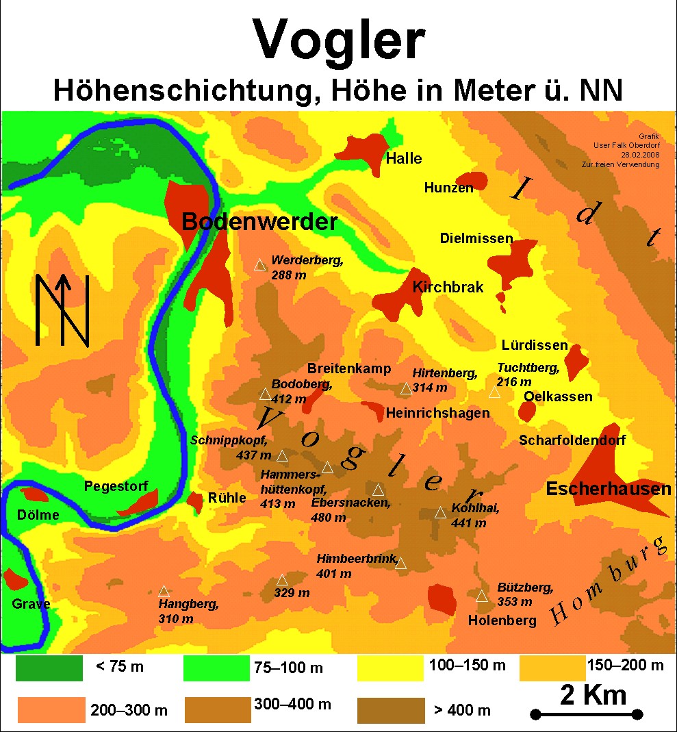
Deutsch: physische Karte des Vogler English: Relief map of the Vogler hills in Lower Saxony, Germany |
| Date | 04.03.2008 |
| Source | Own work (Original text: selbst erstellt) |
| Author | Falk Oberdorf, Osterstr. 8, 32312 Lübbecke |
| Permission (Reusing this file) |
=Original text : FalkOberdorf 01:39, 8. Mär. 2008 =CET=[User:FalkOberdorf]= |
Licensing
| I, the copyright holder of this work, release this work into the public domain. This applies worldwide. In some countries this may not be legally possible; if so: I grant anyone the right to use this work for any purpose, without any conditions, unless such conditions are required by law. |
Original upload log
The original description page was here. All following user names refer to de.wikipedia.
- 2008-03-08 00:39 FalkOberdorf 989×1069× (289676 bytes) {{Information |Beschreibung = physische Karte des Vogler |Quelle = selbst erstellt |Urheber = Falk Oberdorf, Osterstr. 8, 32312 Lübbecke |Datum = 04.03.2008 |Genehmigung = ~~~~[User:FalkOberdorf] |Andere Versionen = |Anmerkungen = }}
File history
Click on a date/time to view the file as it appeared at that time.
| Date/Time | Thumbnail | Dimensions | User | Comment | |
|---|---|---|---|---|---|
| current | 18:33, 9 September 2009 | | 989 × 1,069 (283 KB) | Bermicourt | {{Information |Description={{de|physische Karte des Vogler}} {{en|Relief map of the Vogler hills in Lower Saxony, Germany}} |Source=Transferred from [http://de.wikipedia.org de.wikipedia]<br/> (Original text : ''selbst erstellt'') |Date=04.03.2008<br/> ({ |
File usage
The following pages on the English Wikipedia use this file (pages on other projects are not listed):
Global file usage
The following other wikis use this file: