
File:Gambia Map.png

Size of this preview: 500 × 599 pixels. Other resolutions: 200 × 240 pixels | 400 × 480 pixels | 1,006 × 1,206 pixels.
Original file (1,006 × 1,206 pixels, file size: 228 KB, MIME type: image/png)
| This is a file from the Wikimedia Commons. Information from its description page there is shown below. Commons is a freely licensed media file repository. You can help. |
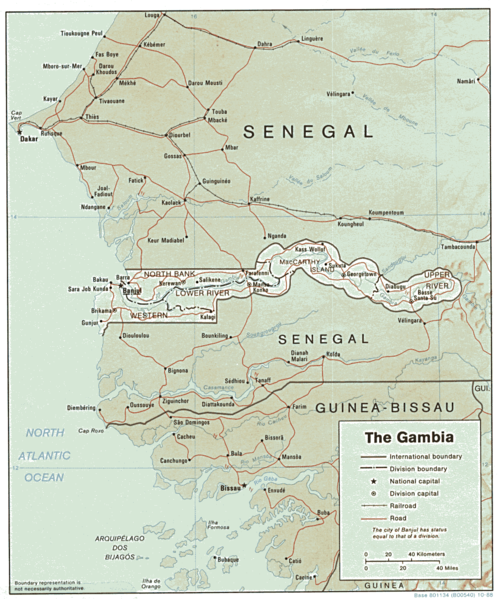
| Description | Shaded relief map of The Gambia. | |||
| Date | ||||
| Source | [1] from the Perry-Castañeda Library Map Collection. | |||
| Author | CIA | |||
| Permission (Reusing this file) |
|

![[1]](http://www.lib.utexas.edu/maps/africa/gambia.gif)
File history
Click on a date/time to view the file as it appeared at that time.
| Date/Time | Thumbnail | Dimensions | User | Comment | |
|---|---|---|---|---|---|
| current | 13:03, 22 February 2006 | | 1,006 × 1,206 (228 KB) | Lupo | Shaded relief map of The Gambia. Source: [http://www.lib.utexas.edu/maps/africa/gambia.gif] from the [http://www.lib.utexas.edu/maps/gambia.html Perry-Castañeda Library Map Collection]. {{PD-USGov-CIA}} Category:Maps of the Gambia |
File usage
The following pages on the English Wikipedia use this file (pages on other projects are not listed):
Global file usage
The following other wikis use this file:
- Usage on ast.wikipedia.org
- Usage on ca.wikipedia.org
- Usage on es.wikipedia.org
- Usage on fr.wikipedia.org
- Usage on hr.wiktionary.org
- Usage on mt.wikipedia.org
- Usage on tl.wikipedia.org
- Usage on uk.wikipedia.org
- Usage on vi.wikipedia.org