
File:Hannover 1807.png
Size of this preview: 783 × 600 pixels. Other resolutions: 314 × 240 pixels | 627 × 480 pixels | 991 × 759 pixels.
Original file (991 × 759 pixels, file size: 799 KB, MIME type: image/png)
| This is a file from the Wikimedia Commons. Information from its description page there is shown below. Commons is a freely licensed media file repository. You can help. |
Summary
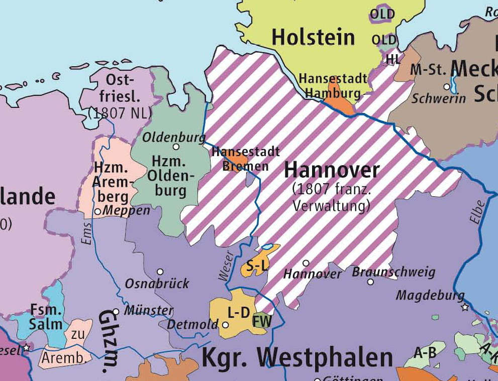
| Description | Karte des Kurfürstentum Hannover 1807 im Rheinbund |
| Source | Based on Karte des »Rheinbund 1807«/Source of Information: Putzger – Historischer Weltatlas, 89. Auflage, 1965 |
| Author | kgberger |
| Permission (Reusing this file) |
GNU FDL |
| Other versions | other_versions=unknown |
Licensing

|
Permission is granted to copy, distribute and/or modify this document under the terms of the GNU Free Documentation License, Version 1.2 or any later version published by the Free Software Foundation; with no Invariant Sections, no Front-Cover Texts, and no Back-Cover Texts. A copy of the license is included in the section entitled GNU Free Documentation License. |
| This file is licensed under the Creative Commons Attribution-Share Alike 3.0 Unported license. | ||
| ||
| This licensing tag was added to this file as part of the GFDL licensing update. |
File history
Click on a date/time to view the file as it appeared at that time.
| Date/Time | Thumbnail | Dimensions | User | Comment | |
|---|---|---|---|---|---|
| current | 16:29, 22 June 2007 | | 991 × 759 (799 KB) | Andi69 | {{Information |Description=Karte des Kurfürstentum Hannover 1808 im Rheinbund |Source= Based on Karte des »Rheinbund 1807«/Source of Information: Putzger – Historischer Weltatlas, 89. Auflage, 1965 |Date= |Author=kgberger |P |
File usage
The following pages on the English Wikipedia use this file (pages on other projects are not listed):
Global file usage
The following other wikis use this file:
- Usage on bg.wikipedia.org
- Usage on de.wikipedia.org
- Usage on el.wikipedia.org
- Usage on eo.wikipedia.org
- Usage on es.wikipedia.org
- Usage on et.wikipedia.org
- Usage on gd.wikipedia.org
- Usage on he.wikipedia.org
- Usage on id.wikipedia.org
- Usage on it.wikipedia.org
- Usage on ru.wikipedia.org
- Usage on www.wikidata.org