
File:Higher Kiln Quarry Caves - geograph.org.uk - 1097485.jpg
No higher resolution available.
Higher_Kiln_Quarry_Caves_-_geograph.org.uk_-_1097485.jpg (640 × 427 pixels, file size: 120 KB, MIME type: image/jpeg)
| This is a file from the Wikimedia Commons. Information from its description page there is shown below. Commons is a freely licensed media file repository. You can help. |
Summary
| Description |
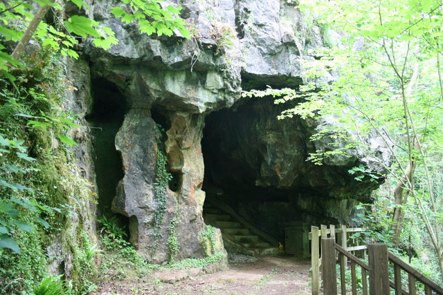
English: Higher Kiln Quarry Caves. These caves are in an outcrop of limestone on the edge of the granite aureole of Dartmoor. They were found as the limestone was quarried many years ago, and are now listed as SSSI because of their importance. This cave is called the Joint Mitnor cave after the local men who first explored it. Access can only be made through the William Pengelly Cave Studies Trust [1]. See 1097493. |
| Date | |
| Source | From geograph.org.uk |
| Author | Adrian Platt |
| Attribution (required by the license) | Adrian Platt / Higher Kiln Quarry Caves / |
| Camera location | | View this and other nearby images on: OpenStreetMap |
|---|
_heading:225.00&language=en)
| Object location | | View this and other nearby images on: OpenStreetMap |
|---|
_heading:225.00&language=en)
Licensing

|
This image was taken from the Geograph project collection. See this photograph's page on the Geograph website for the photographer's contact details. The copyright on this image is owned by Adrian Platt and is licensed for reuse under the Creative Commons Attribution-ShareAlike 2.0 license.
|
This file is licensed under the Creative Commons Attribution-Share Alike 2.0 Generic license.
Attribution: Adrian Platt
- You are free:
- to share – to copy, distribute and transmit the work
- to remix – to adapt the work
- Under the following conditions:
- attribution – You must give appropriate credit, provide a link to the license, and indicate if changes were made. You may do so in any reasonable manner, but not in any way that suggests the licensor endorses you or your use.
- share alike – If you remix, transform, or build upon the material, you must distribute your contributions under the same or compatible license as the original.
File history
Click on a date/time to view the file as it appeared at that time.
| Date/Time | Thumbnail | Dimensions | User | Comment | |
|---|---|---|---|---|---|
| current | 14:23, 24 February 2011 | | 640 × 427 (120 KB) | GeographBot | == {{int:filedesc}} == {{Information |description={{en|1=Higher Kiln Quarry Caves These caves are in an outcrop of limestone on the edge of the granite aureole of Dartmoor. They were found as the limestone was quarried many years ago, and are now listed a |
File usage
The following pages on the English Wikipedia use this file (pages on other projects are not listed):
Global file usage
The following other wikis use this file:
- Usage on la.wikipedia.org
- Usage on www.wikidata.org