
File:Hunsdon Mead - geograph.org.uk - 1317172.jpg
No higher resolution available.
Hunsdon_Mead_-_geograph.org.uk_-_1317172.jpg (640 × 428 pixels, file size: 64 KB, MIME type: image/jpeg)
| This is a file from the Wikimedia Commons. Information from its description page there is shown below. Commons is a freely licensed media file repository. You can help. |
Summary
| Description |
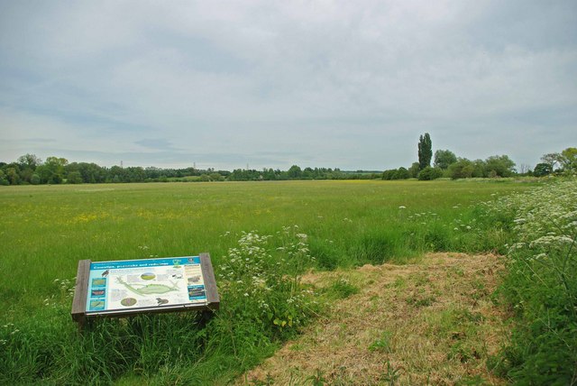
English: Hunsdon Mead. Hunsdon Mead is said to be one of the finest hay meadows left in southern England. It was purchased jointly by the Essex Wildlife Trust and the Hertfordshire & Middlesex Trust in the early 1980's. The Trusts continue a 600 year old tradition and manage the meadow on the ancient Lammas system http://www.floodplainmeadows.org.uk/p2_4.shtml that encourages the growth of wild flowers, the meadow is cut commercially for hay once a year. See http://www.essexwt.org.uk/visitor_centres__nature_reserves/hunsdon_mead/ for more information. Continue on a virtual tour of Wildlife Trust Reserves in Essex by visiting 1249815 |
| Date | |
| Source | From geograph.org.uk |
| Author | Glyn Baker |
| Attribution (required by the license) | Glyn Baker / Hunsdon Mead / |
| Camera location | | View this and other nearby images on: OpenStreetMap |
|---|
_heading:22.00&language=en)
| Object location | | View this and other nearby images on: OpenStreetMap |
|---|
_heading:22.00&language=en)
Licensing

|
This image was taken from the Geograph project collection. See this photograph's page on the Geograph website for the photographer's contact details. The copyright on this image is owned by Glyn Baker and is licensed for reuse under the Creative Commons Attribution-ShareAlike 2.0 license.
|
This file is licensed under the Creative Commons Attribution-Share Alike 2.0 Generic license.
Attribution: Glyn Baker
- You are free:
- to share – to copy, distribute and transmit the work
- to remix – to adapt the work
- Under the following conditions:
- attribution – You must give appropriate credit, provide a link to the license, and indicate if changes were made. You may do so in any reasonable manner, but not in any way that suggests the licensor endorses you or your use.
- share alike – If you remix, transform, or build upon the material, you must distribute your contributions under the same or compatible license as the original.
File history
Click on a date/time to view the file as it appeared at that time.
| Date/Time | Thumbnail | Dimensions | User | Comment | |
|---|---|---|---|---|---|
| current | 17:05, 27 February 2011 | | 640 × 428 (64 KB) | GeographBot | == {{int:filedesc}} == {{Information |description={{en|1=Hunsdon Mead Hunsdon Mead is said to be one of the finest hay meadows left in southern England. It was purchased jointly by the Essex Wildlife Trust and the Hertfordshire & Middlesex Trust in the ea |
File usage
The following pages on the English Wikipedia use this file (pages on other projects are not listed):
Global file usage
The following other wikis use this file:
- Usage on ru.wikipedia.org