
File:Indiana Whitewater Canal map.jpg
No higher resolution available.
Indiana_Whitewater_Canal_map.jpg (334 × 550 pixels, file size: 156 KB, MIME type: image/jpeg)
| This is a file from the Wikimedia Commons. Information from its description page there is shown below. Commons is a freely licensed media file repository. You can help. |
| Description |
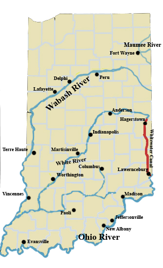
English: A map of Indiana showing the course of the Whitewater Canal. Lines are approximate. |
||
| Date | |||
| Source | Own work | ||
| Author | Charles Edward | ||
| Permission (Reusing this file) |
|
File history
Click on a date/time to view the file as it appeared at that time.
| Date/Time | Thumbnail | Dimensions | User | Comment | |
|---|---|---|---|---|---|
| current | 18:20, 14 October 2008 | | 334 × 550 (156 KB) | Charles Edward | {{Information |Description={{en|1=A map of Indiana showing the course of the Whitewater Canal. Lines are approximate.}} |Source=Own work by uploader |Author=Charles Edward |Date=10-14-08 |Permission={{pd=self}} |other_versions= }} |
File usage
The following pages on the English Wikipedia use this file (pages on other projects are not listed):