
File:Jumbuck Hill Park hillside from Brigadoon after 2021 wooroloo bushfire.jpg
Size of this preview: 800 × 426 pixels. Other resolutions: 320 × 170 pixels | 640 × 341 pixels | 1,024 × 545 pixels | 1,280 × 681 pixels | 3,553 × 1,891 pixels.
Original file (3,553 × 1,891 pixels, file size: 2.44 MB, MIME type: image/jpeg)
| This is a file from the Wikimedia Commons. Information from its description page there is shown below. Commons is a freely licensed media file repository. You can help. |
Summary
| Description |
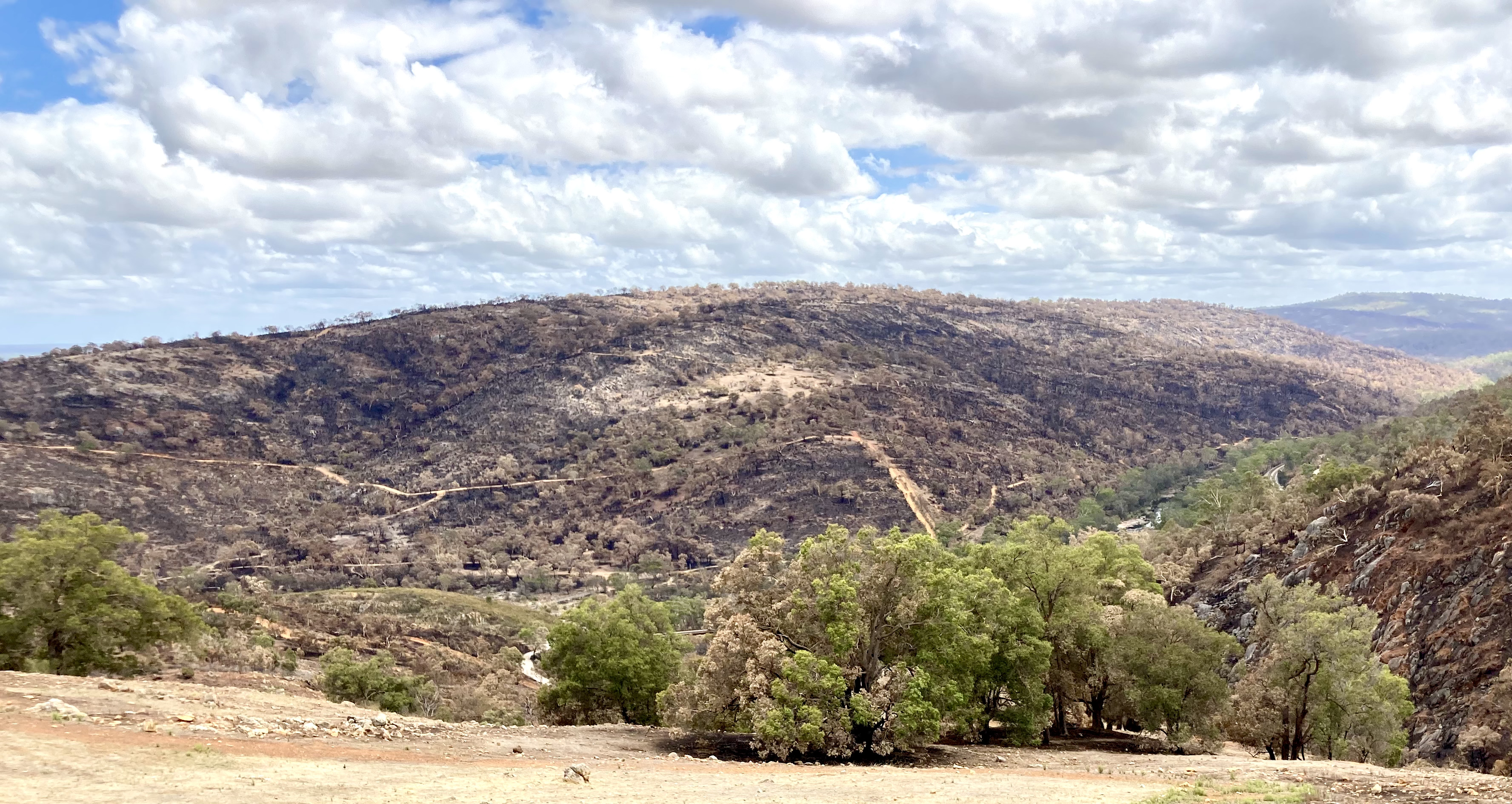
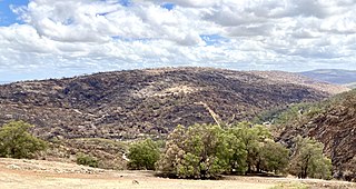
English: Jumbuck Hill Park hillside from Brigadoon, Western Australia after the 2021 Wooroloo Bushfire.
The Hill is known as Jumbuck Hill. Walyunga National Park to the right - north. |
| Date | |
| Source | Own work |
| Author | JarrahTree |
| Camera location | | View this and other nearby images on: OpenStreetMap |
|---|
Licensing
I User:JarrahTree hereby publish Jumbuck Hill Park hillside from Brigadoon after 2021 wooroloo bushfire.jpg under Creative Commons Attribution 2.5 Australia License
Attribution requirement;
Photographs by JarrahTree...commons.wikimedia.org
| process functionality required template |
|---|
| process functionality requires a generic template that best reflected image licensing as prescribed above on the 13 September 2012, where there is any difference/conflict/decrepency between what is described above as the image license and this template the above license as indicated takes precedence
JarrahTree, the copyright holder of this work, hereby publishes it under the following license: This file is licensed under the Creative Commons Attribution 2.5 Australia license. Attribution: Photographs by JarrahTree...commons.wikimedia.org
 |
File history
Click on a date/time to view the file as it appeared at that time.
| Date/Time | Thumbnail | Dimensions | User | Comment | |
|---|---|---|---|---|---|
| current | 10:30, 10 February 2021 | | 3,553 × 1,891 (2.44 MB) | JarrahTree | Uploaded own work with UploadWizard |
File usage
The following pages on the English Wikipedia use this file (pages on other projects are not listed):
Global file usage
The following other wikis use this file:
- Usage on ca.wikipedia.org