
File:KamiKuishikiVil-YamanashiPref.png
No higher resolution available.
KamiKuishikiVil-YamanashiPref.png (600 × 500 pixels, file size: 97 KB, MIME type: image/png)
| This is a file from the Wikimedia Commons. Information from its description page there is shown below. Commons is a freely licensed media file repository. You can help. |
Summary
| Description | |
| Date | |
| Source | 「国土数値情報(行政区域データ、湖沼データおよび海岸線データ) 国土交通省」を使用して作成。 |
| Author | 椰子之樹 at Japanese Wikipedia |
| Permission (Reusing this file) |
下記参照 |

|
This locator map image could be re-created using vector graphics as an SVG file. This has several advantages; see Commons:Media for cleanup for more information. If an SVG form of this image is available, please upload it and afterwards replace this template with
{{vector version available|new image name}}.
It is recommended to name the SVG file “KamiKuishikiVil-YamanashiPref.svg”—then the template Vector version available (or Vva) does not need the new image name parameter. |
Licensing
椰子之樹, the copyright holder of this work, hereby publishes it under the following licenses:

|
Permission is granted to copy, distribute and/or modify this document under the terms of the GNU Free Documentation License, Version 1.2 or any later version published by the Free Software Foundation; with no Invariant Sections, no Front-Cover Texts, and no Back-Cover Texts. A copy of the license is included in the section entitled GNU Free Documentation License. Subject to disclaimers. |
This file is licensed under the Creative Commons Attribution 3.0 Unported license.
Attribution: 椰子之樹
- You are free:
- to share – to copy, distribute and transmit the work
- to remix – to adapt the work
- Under the following conditions:
- attribution – You must give appropriate credit, provide a link to the license, and indicate if changes were made. You may do so in any reasonable manner, but not in any way that suggests the licensor endorses you or your use.
You may select the license of your choice.
Original upload log
| This file was moved from Japanese Wikipedia.
See below for original file information. | ||||||||||||||||||||||||
| ||||||||||||||||||||||||
|
| ||||||||||||||||||||||||
File history
Click on a date/time to view the file as it appeared at that time.
| Date/Time | Thumbnail | Dimensions | User | Comment | |
|---|---|---|---|---|---|
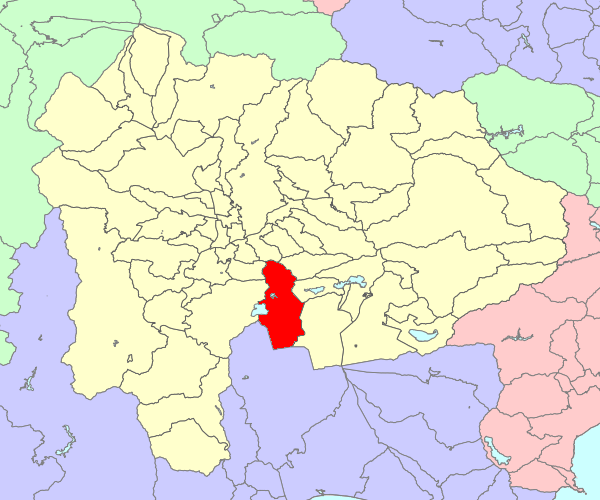
| current | 09:43, 2 December 2009 | | 600 × 500 (97 KB) | LERK | {{convert to SVG}} {{User:LERK/Information-other-user-image |language-code=ja |language-name=Japanese |wikimedia-project=Wikipedia |des={{ja| 山梨県西八代郡上九一色村の位置画像。}} |file-name=KamiKuishikiVil-Yaman |
| 14:39, 29 October 2009 |  | 600 × 500 (97 KB) | 椰子之樹 | {{Information |Description=山梨県西八代郡上九一色村の位置画像。 |Source=「国土数値情報(行政区域データ、湖沼データおよび海岸線データ) 国土交通省」を使用して作成。 |Date=2009年1 |
File usage
The following pages on the English Wikipedia use this file (pages on other projects are not listed):
Global file usage
The following other wikis use this file:
- Usage on de.wikipedia.org
- Usage on ja.wikipedia.org
- Usage on ja.wikiquote.org
- Usage on ko.wikipedia.org