
File:Kilauea - Landsat mosaic.jpg

Size of this preview: 800 × 592 pixels. Other resolutions: 320 × 237 pixels | 640 × 474 pixels | 1,024 × 758 pixels | 1,280 × 948 pixels | 2,563 × 1,898 pixels.
Original file (2,563 × 1,898 pixels, file size: 1.48 MB, MIME type: image/jpeg)
| This is a file from the Wikimedia Commons. Information from its description page there is shown below. Commons is a freely licensed media file repository. You can help. |
Summary
| Description |
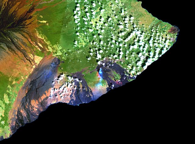
English: This simulated true-color image of the Kilauea was derived from data gathered by the Enhanced Thematic Mapper plus (ETM+) on the Landsat 7 satellite between 1999 and 2001. Français : Cette image en fausses couleurs du Kilauea est issue de données recueillies entre 1999 et 2001 par le capteur Enhanced Thematic Mapper plus (ETM+) situé sur le satellite Landsat 7. |
| Date | between 1999 and 2001 |
| Source | Cropped version of File:Island of Hawai'i - Landsat mosaic.jpg (Image and its description) |
| Author | Hawaii Land Cover Analysis project, NOAA Coastal Services Center |
| Other versions | Entire picture : File:Island of Hawai'i - Landsat mosaic.jpg |
Licensing
This image is in the public domain because it contains materials that originally came from the U.S. National Oceanic and Atmospheric Administration, taken or made as part of an employee's official duties.
|
File history
Click on a date/time to view the file as it appeared at that time.
| Date/Time | Thumbnail | Dimensions | User | Comment | |
|---|---|---|---|---|---|
| current | 11:11, 9 March 2012 | | 2,563 × 1,898 (1.48 MB) | Rémih |
File usage
The following pages on the English Wikipedia use this file (pages on other projects are not listed):
Global file usage
The following other wikis use this file:
- Usage on ar.wikipedia.org
- Usage on ast.wikipedia.org
- Usage on ca.wikipedia.org
- Usage on en.wikivoyage.org
- Usage on es.wikipedia.org
- Usage on es.wikivoyage.org
- Usage on fr.wikipedia.org
- Usage on hu.wikipedia.org
- Usage on hy.wikipedia.org
- Usage on it.wikivoyage.org
- Usage on ja.wikipedia.org
- Usage on mk.wikipedia.org
- Usage on ru.wikipedia.org
- Usage on www.wikidata.org
- Usage on zh.wikipedia.org