
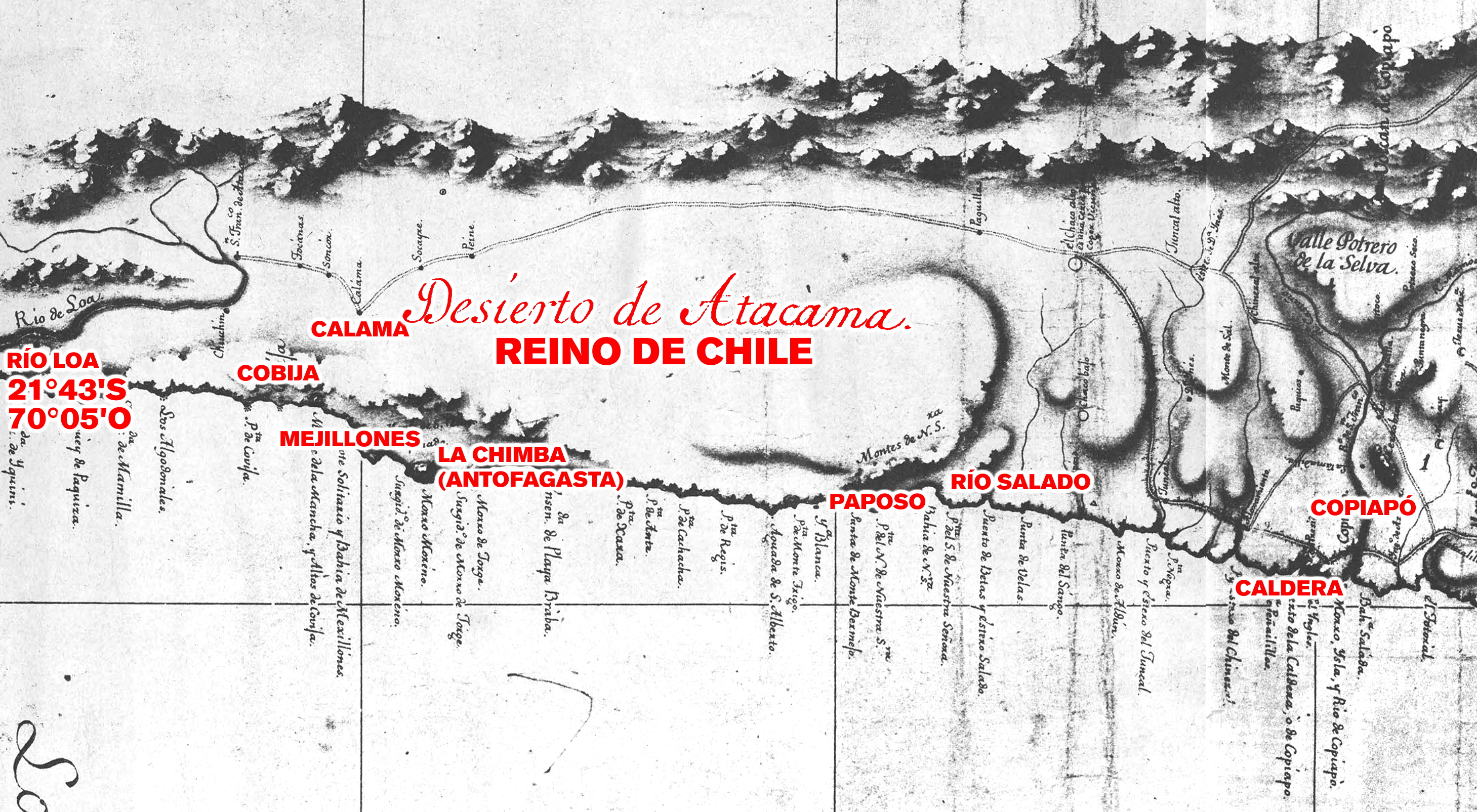
File:Límite entre Chile y Perú en el río Loa, Plano General del Reyno de Chile en la América Meridional de Andrés Baleato (1793) (Editado).jpg
Size of this preview: 800 × 440 pixels. Other resolutions: 320 × 176 pixels | 640 × 352 pixels | 1,024 × 563 pixels | 1,280 × 704 pixels | 2,918 × 1,605 pixels.
Original file (2,918 × 1,605 pixels, file size: 3.18 MB, MIME type: image/jpeg)
| This is a file from the Wikimedia Commons. Information from its description page there is shown below. Commons is a freely licensed media file repository. You can help. |
_(Editado).jpg)
Summary
| Description |
Español: Plano General del Reyno de Chile en la América Meridional de Andrés Baleato (1793) |
| Date | |
| Source | http://www.bibliotecanacionaldigital.gob.cl/bnd/631/w3-article-156657.html |
| Author | Andrés Baleato |
| Other versions | *File:Map border Chile Peru fr.jpg |
.jpg)
Licensing
This file is part of the common cultural heritage (public domain) according to the Intellectual Property Law of Chile (Law No. 17336 and its amendments). Nevertheless, its author and source must be acknowledged.
See here for the type of material that is part of the common cultural heritage (public domain).
|

|
File history
Click on a date/time to view the file as it appeared at that time.
| Date/Time | Thumbnail | Dimensions | User | Comment | |
|---|---|---|---|---|---|
| current | 03:52, 8 July 2022 | | 2,918 × 1,605 (3.18 MB) | Janitoalevic | Uploaded own work with UploadWizard |
File usage
The following pages on the English Wikipedia use this file (pages on other projects are not listed):
Global file usage
The following other wikis use this file:
- Usage on cs.wikipedia.org
- Usage on es.wikipedia.org
_(Editado).jpg)