
File:Location map Washington, D.C. central.png
No higher resolution available.
Location_map_Washington,_D.C._central.png (627 × 599 pixels, file size: 218 KB, MIME type: image/png)
| This is a file from the Wikimedia Commons. Information from its description page there is shown below. Commons is a freely licensed media file repository. You can help. |

|
This city map image could be re-created using vector graphics as an SVG file. This has several advantages; see Commons:Media for cleanup for more information. If an SVG form of this image is available, please upload it and afterwards replace this template with
{{vector version available|new image name}}.
It is recommended to name the SVG file “Location map Washington, D.C. central.svg”—then the template Vector version available (or Vva) does not need the new image name parameter. |
| Description |
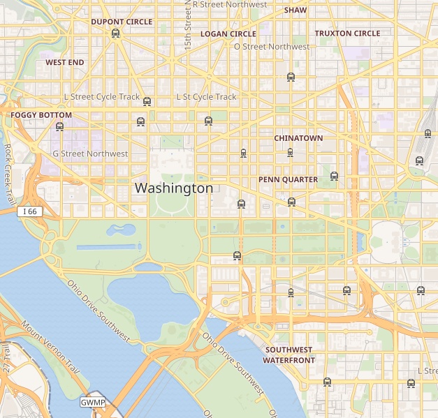
This map of Washington D.C. was created from OpenStreetMap project data, collected by the community. This map may be incomplete, and may contain errors. Don't rely solely on it for navigation. |
|||||||||
| Date | (see file history) | |||||||||
| Source | openstreetmap.org | |||||||||
| Creator |
OpenStreetMap contributors |
|||||||||
| Permission (Reusing this file) |
OpenStreetMap data and maps are licensed under the Creative Commons Attribution-ShareAlike 2.0 license (CC-BY-SA 2.0). This file is licensed under the Creative Commons Attribution-Share Alike 2.0 Generic license.
|
|||||||||
| Geotemporal data | ||||||||||
| Bounding box |
|
|||||||||
| Georeferencing | If inappropriate please set warp_status = skip to hide. | |||||||||
File history
Click on a date/time to view the file as it appeared at that time.
| Date/Time | Thumbnail | Dimensions | User | Comment | |
|---|---|---|---|---|---|
| current | 20:41, 8 September 2018 | | 627 × 599 (218 KB) | LinkTiger | Get same image from Wikimedia's map server: https://maps.wikimedia.org/img/osm-intl,14,38.893,-77.03075,627x599.png It's still bad, but maybe not quite as bad? |
| 13:23, 21 April 2016 |  | 796 × 761 (713 KB) | LinkTiger | Use latest OpenStreetMap style, which includes GSoC road visibility updates | |
| 08:33, 6 November 2013 |  | 796 × 761 (662 KB) | Ebywan | Update to current OpenStreetMap data | |
| 18:34, 26 May 2010 |  | 796 × 761 (579 KB) | Dr. Blofeld~commonswiki | {{Information |Description={{en|1=j}} |Source=j |Author=j |Date=j |Permission= |other_versions= }} |
File usage
More than 100 pages use this file. The following list shows the first 100 pages that use this file only. A full list is available.
- 2000 Pennsylvania Avenue
- 2225 N Street Apartment Building
- American Peace Society house
- American Red Cross National Headquarters
- Armenian Genocide Museum of America
- Art Museum of the Americas
- Arts Club of Washington
- Arts and Industries Building
- Ashburton House
- Cannon House Office Building
- Cathedral of St. Matthew the Apostle (Washington, D.C.)
- Central Heating Plant
- Church of the Ascension and Saint Agnes
- Church of the Epiphany (Washington, D.C.)
- Cleveland Abbe House
- Columbus Fountain
- Corcoran Gallery of Art
- DAR Constitution Hall
- Decatur House
- Dirksen Senate Office Building
- District of Columbia City Hall
- District of Columbia War Memorial
- Dwight D. Eisenhower Memorial
- Eisenhower Executive Office Building
- Elliott Coues House
- F Street House
- Ford's Theatre
- Ford House Office Building
- Franklin Delano Roosevelt Memorial
- Franklin School (Washington, D.C.)
- Friendship Baptist Church (Washington, D.C.)
- Garfinckel's
- General Post Office (Washington, D.C.)
- George Mason Memorial
- Hart Senate Office Building
- Heurich House Museum
- International Spy Museum
- J. Edgar Hoover Building
- Jamie L. Whitten Building
- Japanese American Memorial to Patriotism During World War II
- Jefferson Memorial
- John F. Kennedy Center for the Performing Arts
- Korean War Veterans Memorial
- Lillian & Albert Small Capital Jewish Museum
- Lincoln Memorial
- Longworth House Office Building
- Marian Koshland Science Museum
- Mary McLeod Bethune Council House National Historic Site
- Mayflower Hotel
- Memorial Continental Hall
- Munsey Trust Building
- National Academies of Sciences, Engineering, and Medicine
- National Air and Space Museum
- National Children's Museum
- National Museum of African American History and Culture
- National Museum of African Art
- National Museum of Catholic Art and History
- National Museum of Women in the Arts
- National Postal Museum
- National Savings and Trust Company
- National Sylvan Theater
- National World War I Memorial (Washington, D.C.)
- Old Naval Observatory
- Oscar W. Underwood House
- Peter Parker House
- President's Park
- Renwick Gallery
- Riggs National Bank
- Ringgold–Carroll House
- Ronald Reagan Building and International Trade Center
- Russell Senate Office Building
- S. Dillon Ripley Center
- Sixth & I Historic Synagogue
- St. Aloysius Church (Washington, D.C.)
- St. John's Episcopal Church, Lafayette Square
- St. Mary's Episcopal Church (Washington, D.C.)
- Stead Park
- Temperance Fountain (Washington, D.C.)
- The Octagon House
- Tower Building (Washington, D.C.)
- Treasury Building (Washington, D.C.)
- U.S. Capitol Gatehouses and Gateposts
- United Mine Workers of America Building
- United States Capitol
- United States Capitol Visitor Center
- United States Court of Military Appeals (building)
- United States Department of Agriculture South Building
- United States Holocaust Memorial Museum
- United States Navy Memorial
- United States Supreme Court Building
- Vietnam Veterans Memorial
- Walsh Stable
- Wardman Row
- Washington Circle
- Washington Gallery of Modern Art
- Washington Monument
- Watergate complex
- White House
- Willard InterContinental Washington
- World War II Memorial
View more links to this file.
Global file usage
The following other wikis use this file:
- Usage on ar.wikipedia.org
- Usage on bh.wikipedia.org
- Usage on bn.wikipedia.org
- Usage on ceb.wikipedia.org
- Usage on ce.wikipedia.org
- Usage on es.wikipedia.org
- Usage on fa.wikipedia.org
- کاخ سفید
- موزه ملی سرخپوستان ایالات متحده آمریکا
- بنای یادبود واشنگتن
- نگارخانه هنر فریر
- کاخ کنگره آمریکا
- موزه ملی هنر آفریقا (آمریکا)
- نگارخانه آرتور سکلر
- موزه ملی هوافضای اسمیتسونین
- موزه ملی تاریخ آمریکا
- موزه ملی تاریخ طبیعی (آمریکا)
- موزه ملی پستی (آمریکا)
- موزه یادبود هولوکاست
- شورای ملی پژوهش ایالات متحده آمریکا
- الگو:Location map United States Washington, D.C. central
- آکادمی ملی علوم
- موزه ملی زنان هنرمند
- ساختمان جی. ادگار هوور
- موزه ساختمان ملی
- موزه بینالمللی جاسوسی
- ساختمان دفتر اجرایی آیزنهاور
- حمله آوریل ۲۰۲۱ به کاخ کنگره ایالات متحده
- Usage on fr.wikipedia.org
- Usage on fy.wikipedia.org
- Usage on he.wikipedia.org
View more global usage of this file.