
File:LouisvilleMSA-Census04.jpg
No higher resolution available.
LouisvilleMSA-Census04.jpg (480 × 450 pixels, file size: 82 KB, MIME type: image/jpeg)
| This is a file from the Wikimedia Commons. Information from its description page there is shown below. Commons is a freely licensed media file repository. You can help. |
Summary
| Description |
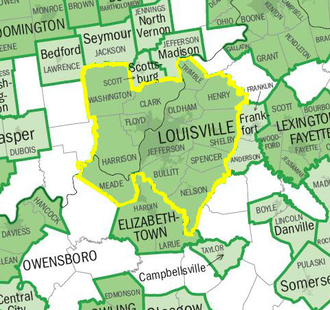
English: This is a representation of the en:Louisville-Jefferson County, KY-IN Metropolitan Statistical Area.
I created this image using a U.S. Census Bureau map image from Metropolitan and Micropolitan Statistical Areas Wall Maps: November 2004. As this image was originally generated by the U.S. federal government, it is considered to be public domain. |
| Source | |
| Author |
Licensing
This work is in the public domain in the United States because it is a work prepared by an officer or employee of the United States Government as part of that person’s official duties under the terms of Title 17, Chapter 1, Section 105 of the US Code.
Note: This only applies to original works of the Federal Government and not to the work of any individual U.S. state, territory, commonwealth, county, municipality, or any other subdivision. This template also does not apply to postage stamp designs published by the United States Postal Service since 1978. (See § 313.6(C)(1) of Compendium of U.S. Copyright Office Practices). It also does not apply to certain US coins; see The US Mint Terms of Use.
|
 | |
| This file has been identified as being free of known restrictions under copyright law, including all related and neighboring rights. | ||
Original upload log
The original description page was here. All following user names refer to en.wikipedia.
- 2006-07-29 04:51 Stevietheman 480×450×8 (83715 bytes) This is a representation of the [[Louisville-Jefferson County, KY-IN Metropolitan Statistical Area]]. I created this image using a U.S. Census Bureau map image from [http://www.census.gov/geo/www/maps/msa_maps2004/us_wall_1104.htm Metropolitan and Microp
File history
Click on a date/time to view the file as it appeared at that time.
| Date/Time | Thumbnail | Dimensions | User | Comment | |
|---|---|---|---|---|---|
| current | 14:16, 19 April 2008 | | 480 × 450 (82 KB) | File Upload Bot (Magnus Manske) | {{BotMoveToCommons|en.wikipedia}} {{Information |Description={{en|This is a representation of the en:Louisville-Jefferson County, KY-IN Metropolitan Statistical Area. I created this image using a U.S. Census Bureau map image from [http://www.census |
File usage
No pages on the English Wikipedia use this file (pages on other projects are not listed).
Global file usage
The following other wikis use this file:
- Usage on fr.wikipedia.org
- Usage on www.wikidata.org