
File:MSP Mass NOAA.jpg

Size of this preview: 800 × 430 pixels. Other resolutions: 320 × 172 pixels | 640 × 344 pixels | 1,419 × 762 pixels.
Original file (1,419 × 762 pixels, file size: 358 KB, MIME type: image/jpeg)
| This is a file from the Wikimedia Commons. Information from its description page there is shown below. Commons is a freely licensed media file repository. You can help. |
Summary
| Description |
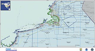
English: Example of Marine Spatial Planning |
| Date | 1 December 2009 |
| Source | U.S. Marine Cadastre - NOAA |
| Author | NOAA |
| Permission (Reusing this file) |
Public |
Licensing
This image is in the public domain because it contains materials that originally came from the U.S. National Oceanic and Atmospheric Administration, taken or made as part of an employee's official duties.
|
File history
Click on a date/time to view the file as it appeared at that time.
| Date/Time | Thumbnail | Dimensions | User | Comment | |
|---|---|---|---|---|---|
| current | 17:19, 1 December 2009 | | 1,419 × 762 (358 KB) | Hurricaneg | {{Information |Description = Example of Marine Spatial Planning |Source = U.S. Marine Cadastre - NOAA |Date = 1 December 2009 |Author = NOAA |Permission = Public |other_versions = }} |
File usage
The following pages on the English Wikipedia use this file (pages on other projects are not listed):