
File:Map Staten Island Railway en.png
Size of this preview: 651 × 600 pixels. Other resolutions: 260 × 240 pixels | 521 × 480 pixels | 833 × 768 pixels | 1,111 × 1,024 pixels | 1,885 × 1,737 pixels.
Original file (1,885 × 1,737 pixels, file size: 2.4 MB, MIME type: image/png)
| This is a file from the Wikimedia Commons. Information from its description page there is shown below. Commons is a freely licensed media file repository. You can help. |
| Description |
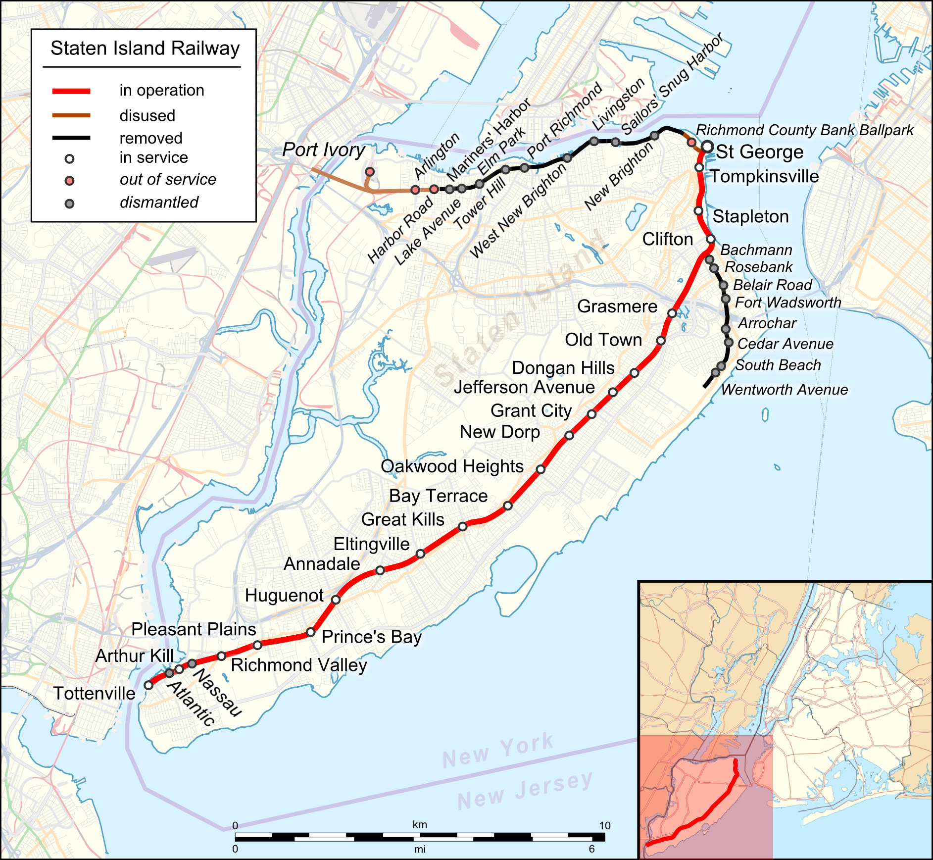
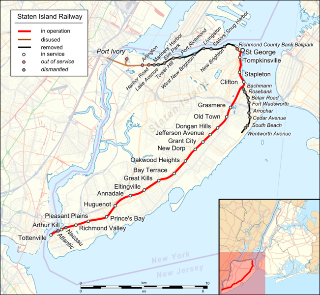
English: Location map of Staten Island Railway. English Index |
|||||||||
| Date | ||||||||||
| Source |
|
|||||||||
| Creator |
|
|||||||||
| Geotemporal data | ||||||||||
| Bounding box |
|
|||||||||
| Georeferencing | ||||||||||
| Other versions |
 |
|||||||||
I, the copyright holder of this work, hereby publish it under the following license:
This file is licensed under the Creative Commons Attribution 3.0 Unported license.
- You are free:
- to share – to copy, distribute and transmit the work
- to remix – to adapt the work
- Under the following conditions:
- attribution – You must give appropriate credit, provide a link to the license, and indicate if changes were made. You may do so in any reasonable manner, but not in any way that suggests the licensor endorses you or your use.
| This work is licensed under the Open Database License (summary). |
File history
Click on a date/time to view the file as it appeared at that time.
| Date/Time | Thumbnail | Dimensions | User | Comment | |
|---|---|---|---|---|---|
| current | 19:22, 17 August 2023 | | 1,885 × 1,737 (2.4 MB) | DinoSoupCanada | Connected into NJ |
| 02:11, 29 April 2018 |  | 1,885 × 1,737 (2.25 MB) | Pechristener | korr: Atlantic and Nassau stops were demolished | |
| 01:55, 29 April 2018 |  | 1,885 × 1,737 (2.25 MB) | Pechristener | typos / Arthur Kill station | |
| 08:09, 22 November 2016 |  | 1,885 × 1,737 (1.57 MB) | Kopiersperre | optipng | |
| 03:41, 22 November 2016 |  | 1,885 × 1,737 (2.27 MB) | Pechristener | {{Map |Description={{en|1=Location map of {{w|Staten Island Railway}}. English Index}} |Source= * [http://www.openstreetmap.org/ Open Street Map] Data * {{f|USA_New_York_City_location_map.svg}} (for location map) |Author= * rendering with Maperitive,... |
File usage
The following pages on the English Wikipedia use this file (pages on other projects are not listed):
Global file usage
The following other wikis use this file:
- Usage on de.wikipedia.org
- Usage on eo.wikipedia.org
- Usage on ja.wikipedia.org
- Usage on nl.wikipedia.org
- Usage on uz.wikipedia.org