
File:Map of Chwarel Ddu in 1888.png
Size of this preview: 800 × 592 pixels. Other resolutions: 320 × 237 pixels | 640 × 474 pixels | 1,024 × 758 pixels | 1,280 × 948 pixels | 1,502 × 1,112 pixels.
Original file (1,502 × 1,112 pixels, file size: 2.92 MB, MIME type: image/png)
| This is a file from the Wikimedia Commons. Information from its description page there is shown below. Commons is a freely licensed media file repository. You can help. |
Summary
| Description |
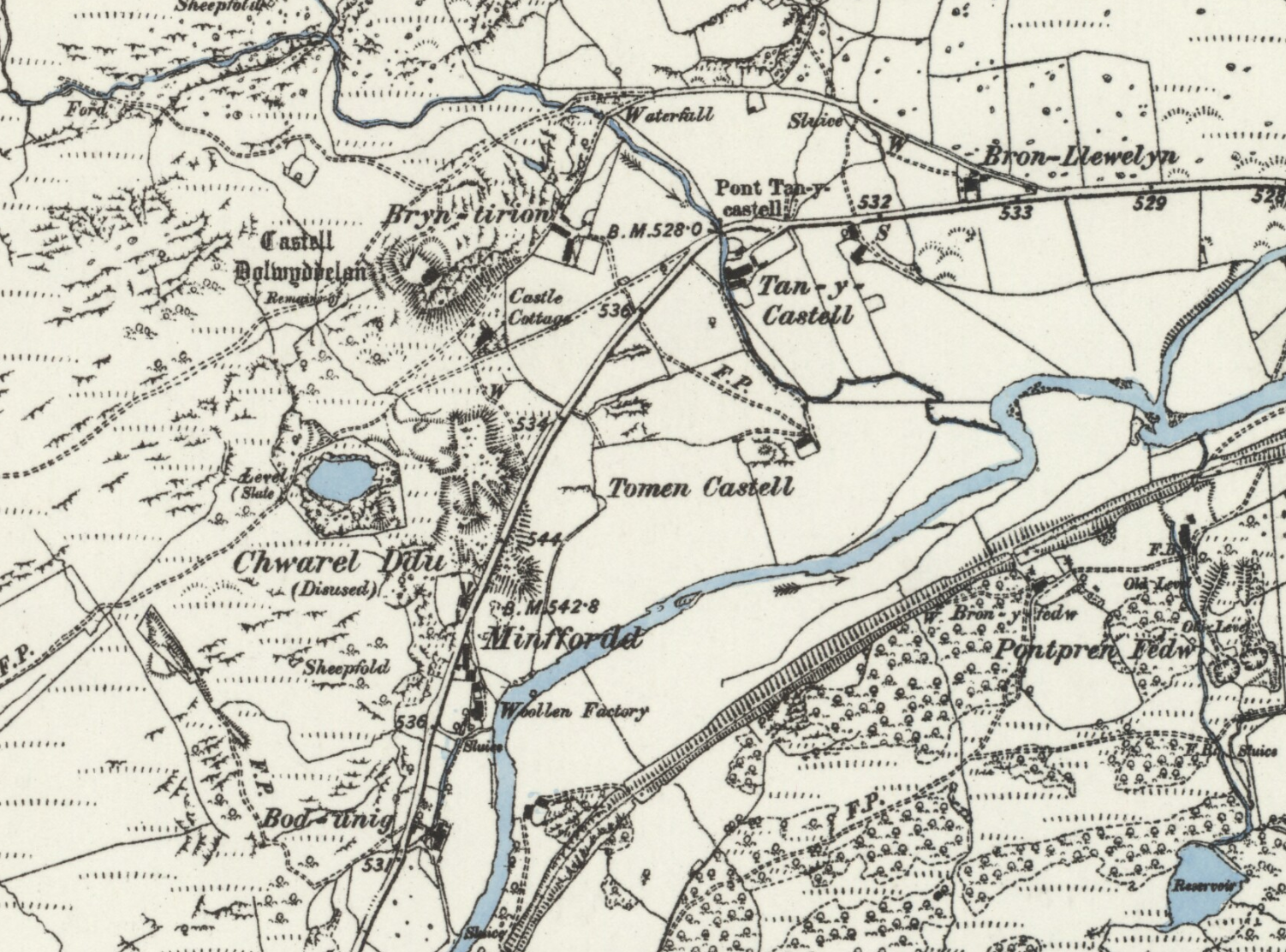
English: An extract of the 1888 Ordnance Survey map Caernarvonshire XXIII.SW, showing Dolwyddelan Castle and Chwarel Ddu |
| Date | |
| Source | https://maps.nls.uk/view/101606769 |
| Author | Ordnance Survey |
Licensing
This work is in the public domain in the United States because it was published (or registered with the U.S. Copyright Office) before January 1, 1929.
Public domain works must be out of copyright in both the United States and in the source country of the work in order to be hosted on the Commons. If the work is not a U.S. work, the file must have an additional copyright tag indicating the copyright status in the source country.
Note: This tag should not be used for sound recordings. |
File history
Click on a date/time to view the file as it appeared at that time.
| Date/Time | Thumbnail | Dimensions | User | Comment | |
|---|---|---|---|---|---|
| current | 04:28, 15 September 2019 | | 1,502 × 1,112 (2.92 MB) | The Mirror Cracked | User created page with UploadWizard |
File usage
The following pages on the English Wikipedia use this file (pages on other projects are not listed):