
File:Map of the Kushan Empire.png
Size of this preview: 648 × 600 pixels. Other resolutions: 259 × 240 pixels | 519 × 480 pixels | 830 × 768 pixels | 1,106 × 1,024 pixels | 2,324 × 2,151 pixels.
Original file (2,324 × 2,151 pixels, file size: 6.46 MB, MIME type: image/png)
| This is a file from the Wikimedia Commons. Information from its description page there is shown below. Commons is a freely licensed media file repository. You can help. |
Summary
| Description |
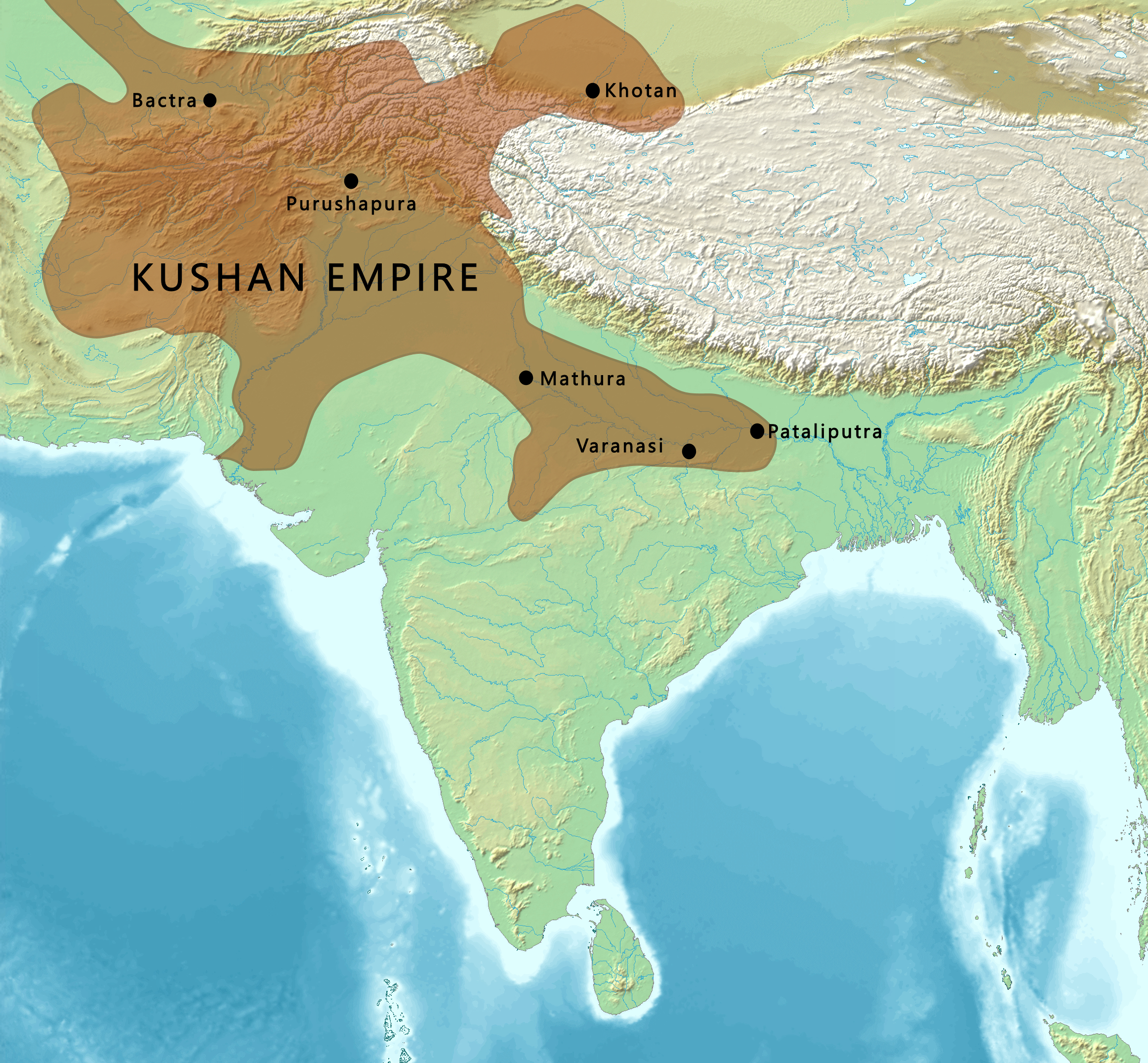
English: Map of the Kushan Empire |
| Date | |
| Source | |
| Author |
Map created from DEMIS Mapserver, which are public domain. Koba-chan. |

Licensing

|
Permission is granted to copy, distribute and/or modify this document under the terms of the GNU Free Documentation License, Version 1.2 or any later version published by the Free Software Foundation; with no Invariant Sections, no Front-Cover Texts, and no Back-Cover Texts. A copy of the license is included in the section entitled GNU Free Documentation License. |
| This file is licensed under the Creative Commons Attribution-Share Alike 3.0 Unported license. | ||
| ||
| This licensing tag was added to this file as part of the GFDL licensing update. |
File history
Click on a date/time to view the file as it appeared at that time.
| Date/Time | Thumbnail | Dimensions | User | Comment | |
|---|---|---|---|---|---|
| current | 12:20, 18 February 2023 | | 2,324 × 2,151 (6.46 MB) | पाटलिपुत्र | sat -10% |
| 10:13, 4 March 2022 |  | 2,324 × 2,151 (6.76 MB) | पाटलिपुत्र | locations | |
| 10:06, 4 March 2022 |  | 2,324 × 2,151 (6.75 MB) | पाटलिपुत्र | Khotan | |
| 09:29, 23 February 2022 |  | 2,324 × 2,151 (6.66 MB) | पाटलिपुत्र | Uploaded a work by Map created from [http://www2.demis.nl/mapserver/mapper.asp DEMIS Mapserver], which are public domain. Koba-chan.<br> Reference: [https://dsal.uchicago.edu/reference/schwartzberg/pager.html?object=182 Schwartzberg Atlas, v. , p. 145. Map g] from {{extracted from|File:South Asia non political, with rivers.jpg}} with UploadWizard |
File usage
The following pages on the English Wikipedia use this file (pages on other projects are not listed):
- Central Asians in ancient Indian literature
- Gandharan Buddhism
- History of Afghanistan
- History of Buddhism
- History of India
- Kabul
- Kushan Empire
- Mahameghavahana dynasty
- Nomadic empire
- Northern Satraps
- Rabatak inscription
- User:Falcaorib
- User:Northamerica1000/Portals of the world
- User:Կիմա34/sandbox
- Portal:Afghanistan
Global file usage
The following other wikis use this file:
- Usage on el.wikipedia.org
- Usage on es.wikipedia.org
- Usage on fa.wikipedia.org
- Usage on fr.wikipedia.org
- Usage on gu.wikipedia.org
- Usage on he.wikipedia.org
- Usage on hi.wikipedia.org
- Usage on hy.wikipedia.org
- Usage on it.wikipedia.org
- Usage on ja.wikipedia.org
- Usage on ko.wikipedia.org
- Usage on lld.wikipedia.org
- Usage on ne.wikipedia.org
- Usage on sl.wikipedia.org
- Usage on ta.wikipedia.org
- Usage on tr.wikipedia.org
- Usage on vi.wikipedia.org
- Usage on zh.wikipedia.org